Step 1/3: Approximate choice of a site
There are different ways to locate your observation (see image Step 1/3: Approximate choice of a site).

By typing text
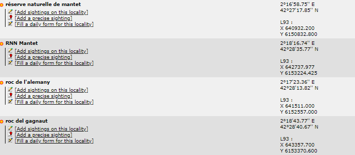
Search for a place by typing its name. You will be taken to wiki section Web inerface > Submitting records > Step 2/3: Precise site choice. If you typed a very general name (ex. Mantet), you will access a list with all possible precise locations (see image Step 2/3: Precise site choice); but if you typed a predetermined precise location (ex. Roc de l’Alemany), you will only access options for that location.
By geographic coordinates
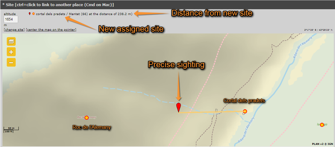
Coordinates should follow the WGS 84 datum, either in degrees, minutes and second (example 2°17'23.36 E 42°28'13.82'N) or in decimal degrees (exemple E002.28982° N42.47051°). The system will automatically detect if you are using degrees, minutes and seconds or decimal degrees. Use negative coordinates for Western longitudes. You will be taken to wiki section Web interface > Submitting records > Step 3/3: Transmit my sighting with the format as if you added a precise sighting (see wiki section Web inerface > Submitting records > Step 2/3: Precise site choice > Add a precise sighting). On next section, your location will be marked on a map and listed under the closest pre-determined site (see image Add a precise site on the map, the yelow line indicates under which re-determined location your sighting is listed)), but your coordinates will only be visible to you and to administrators.
By choosing a municipality
It is also possible to enter a municipality. Type the beginning of the municipality name and select from the panel. If clicking Display, you will go to a form asking for a more precise location (see wiki section Web inerface > Submitting records > Step 2/3: Precise site choice). If choosing Zoom on the municipality you can select from the map below a more precise location (see By clicking on the map below).
Choosing from
Choose from the proposed sites based on your previous records. You can see up to 5 of the most visited sites during the last 6 months. Click on any of these sites to access an expandable menu as in image Choose location by clicking on the map. In Choosing from you have the option to Attach to map. This will display in the map below the area you are looking for, and it is especially useful to approach a site you know is nearby.
By clicking on the map
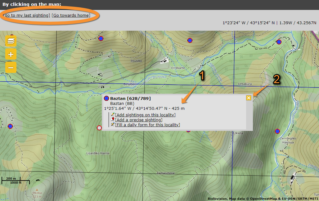
One can also select from the map below. Locations are represented with a dot. Click on a dot to see options for this location (see image Choose location by clicking on the map, and wiki section Web inerface > Submitting records > Step 2/3: Precise site choice). By clicking at any other point of the map, you can only add a precise sighting (see wiki section Web inerface > Submitting records > Step 2/3: Precise site choice). You can centre on your last location by clicking on go to my last sighting at the top left corner; or centre at your location by going to go towards home (see image Choose location by clicking on the map encircled). You can change your location at My account > Website customisation (see wiki section Web interface > Getting started > My account > Website customisation).

Note: images and examples are drawn from the French portal Faune-France. The design and position of some tools may vary slightly from portal to portal. To see a list of portals go to wiki section Local portals and partners. |