CBBS (Admin): Difference between revisions
| (16 intermediate revisions by the same user not shown) | |||
| Line 16: | Line 16: | ||
<div class="toc" style="width:300px;"> <!-- La llargada s'ha de canviar aquí --> | <div class="toc" style="width:300px;"> <!-- La llargada s'ha de canviar aquí --> | ||
<div class="mw-collapsible mw-collapsed" data-expandtext="Show" data-collapsetext="Hide" style="width:250px;margin-bottom:0px;margin-top:0px;background-color:#f7f7f7;"> | <div class="mw-collapsible mw-collapsed" data-expandtext="Show" data-collapsetext="Hide" style="width:250px;margin-bottom:0px;margin-top:0px;background-color:#f7f7f7;"> | ||
''' | '''25 CBBS in Protected areas''' | ||
<div class="mw-collapsible-content" style="width:300px;background-color:#f7f7f7;"> <!-- I també cal canviar la llargada aquí --> | <div class="mw-collapsible-content" style="width:300px;background-color:#f7f7f7;"> <!-- I també cal canviar la llargada aquí --> | ||
<ol> | <ol> | ||
25.1[[CBBS (Admin)#Preparation_and_data| Preparation and data]] <br /> | |||
25.2[[CBBS (Admin)#Sites| Sites]]<br /> | |||
25.3[[CBBS (Admin)#User/Site| User/Site]]<br /> | |||
25.4[[CBBS (Admin)#Settings| Settings]] <br /> | |||
25.5[[CBBS (Admin)#Import a shapefile| Import a shapefile]]<br /> | |||
25.6[[CBBS (Admin)#Check_data| Check Data]]<br /> | |||
25.7[[CBBS (Admin)#Report| Report]]<br /> | |||
25.8[[CBBS (Admin)#Map| Map]]<br /> </ol> | |||
</div> | </div> | ||
</div> | </div> | ||
| Line 47: | Line 48: | ||
<br/> | <br/> | ||
Identical section to the one available to registered users with rights to the | Identical section to the one available to registered users with rights to the CBBS in Protected areas. See wiki section Web interface > Protocols > CBBS in Protected areas > [[CCBS#Preparation_and_data|Preparation and data]] for more information. <br/> | ||
<br/> | <br/> | ||
[[CBBS_(Admin)#Preparation and data|[Top to Preparation and data]]] <br/> | |||
[[#top|[Back to CBBS protocol]]] | |||
<span id="Sites"></span> | <span id="Sites"></span> | ||
==CBBM_PROTECTED_AREAS Sites== | ==CBBM_PROTECTED_AREAS Sites== | ||
<br/> | <br/> | ||
<center> | <center> | ||
< | <div class="toc" style="border-radius: 5px; padding: 25px; text-align: left; font-family: sans-serif; color: black; width: 600px; background-color: #ffffdb"> | ||
<!-- GREEN BOX (Tips): hsl(157, 74%, 80%) | |||
YELLOW BOX (Summaries): #ffffdb" | |||
BLUE BOX (Information): hsl(201, 100%, 89%) | |||
RED BOX (Warnings): hsl(0, 77%, 78%) --> | |||
<p><b> CREATE A NEW SITE:</b><br /> | <p><b> CREATE A NEW SITE:</b><br /> | ||
1. Directly by <b>Transmit my sightings</b> map <br/>or <br/>through Menu > Administration > Protocol administration > CBBS in Protected areas > [[Media:CBBS sites.png|Sites]]> +NEW button <br /> | 1. Directly by <b>Transmit my sightings</b> map <br/>or <br/>through Menu > Administration > Protocol administration > CBBS in Protected areas > [[Media:CBBS sites.png|Sites]]> +NEW button <br /> | ||
2. Select new site as if [[Submitting_records|Submitting records]]<br/> | 2. Select new site as if [[Submitting_records|Submitting records]]<br/> | ||
3. Choose [[Media:Draw waterbird polygon.png|'''Create a protocoled census -CBBS in Protected areas''']]<br/> | 3. Choose [[Media:Draw waterbird polygon.png|'''Create a protocoled census -CBBS in Protected areas''']]<br/> | ||
4. [[Media:Name a new WBC site.png|Name the new site]]<br/> | 4. [[Media:Name a new WBC site.png|Name the new site]]<br/> | ||
5. [[Geometry_editor#Drawing_a_polygon|Draw a polygon]] or [[Media:2023-03-14 Importing a | 5. [[Geometry_editor#Drawing_a_polygon|Draw a polygon]] or [[Media:2023-03-14 Importing a plygon shapefile.png|import shapefile]]<br/> | ||
6. '''SAVE''' | 6. '''SAVE''' | ||
</p> | </p> | ||
</ | </div> | ||
</center> | </center> | ||
<br/> | <br/> | ||
| Line 85: | Line 90: | ||
<br/> | <br/> | ||
List of all existing sites allowing a | List of all existing sites allowing a CBBS in Protected areas. <br/> | ||
<br/> | <br/> | ||
Visit wiki section Administration > Protocol management > [[Protocol_management#Sites|Sites]] for more information.<br/> | Visit wiki section Administration > Protocol management > [[Protocol_management#Sites|Sites]] for more information.<br/> | ||
<br/> | <br/> | ||
[[CBBS_(Admin)#Sites|[Top to Sites]]] <br/> | |||
[[#top|[Back to CBBS protocol]]] | |||
<span id="User/Site"></span> | <span id="User/Site"></span> | ||
== | |||
==CBBM_PROTECTED_AREAS User/Site== | |||
<br/> | <br/> | ||
| Line 111: | Line 120: | ||
Visit wiki section Administration > Protocol management > [[Protocol_management#User/Site|User/Site]] for more information.<br/> | Visit wiki section Administration > Protocol management > [[Protocol_management#User/Site|User/Site]] for more information.<br/> | ||
<br/> | <br/> | ||
[[CBBS_(Admin)#User/Site|[Top to User/Site]]] <br/> | |||
[[#top|[Back to CBBS protocol]]] | |||
<span id="Settings"></span> | <span id="Settings"></span> | ||
==CBBM_PROTECTED_AREAS Settings== | ==CBBM_PROTECTED_AREAS Settings== | ||
<br/> | <br/> | ||
| Line 145: | Line 158: | ||
<th width="20%">Options</th> | <th width="20%">Options</th> | ||
</tr> | </tr> | ||
<tr style="padding: 25px; text-align: center; font-size: 16px; font-family: sans serif; color: black"> | <tr style="padding: 25px; text-align: center; font-size: 16px; font-family: sans serif; color: black"> | ||
<td style="text-align: center">'''Additional observer/s'''</td> | <td style="text-align: center">'''Additional observer/s'''</td> | ||
<td style="text-align: center">Space to indicate if the observer has been accompanied by someone whose observations were also recorded.</td> | <td style="text-align: center">Space to indicate if the observer has been accompanied by someone whose observations were also recorded.</td> | ||
<td style="text-align: center">empty field</td> | <td style="text-align: center">empty field</td> | ||
</tr> | </tr> | ||
| Line 258: | Line 174: | ||
</center> | </center> | ||
<br/><br/> | <br/><br/> | ||
[[CBBS_(Admin)#Settings|[Top to Settings]]] <br/> | |||
[[#top|[Back to CBBS protocol]]] | |||
<span id="Import a shapefile"></span> | |||
==CBBM_PROTECTED_AREAS Import a shapefile== | |||
<br/> | |||
<center> | |||
<div class="toc" style="border-radius:5px;background-color:#ffffff;padding-left:8px;padding-right:8px;padding-bottom:8px;width:300px;"> | |||
[[File:CBBS_Admin_Import_shapefile.png|300px]] | |||
<div class="toc" style="border-radius:5px;padding-left:15px;text-align:left; font-size:12px;width:285px;"> | |||
'''CBBS. Import a shapefile.''' | |||
</div> | |||
</div> | |||
</center> | |||
<br/> | |||
<br/> | |||
Import a shapefile with the study site and/or see all imports. <br/> | |||
Visit wiki section Administration > Protocol management > Settings > [[Protocol_management#Import_a_shapefile_settings|Import a shapefile]]. <br/> | |||
<br/> | |||
[[CBBS_(Admin)#Import a shapefile|[Top to Import a shapefile]]] <br/> | |||
[[#top|[Back to CBBS protocol]]] | |||
<span id="Check data"></span> | <span id="Check data"></span> | ||
==CBBM_PROTECTED_AREAS Check data== | ==CBBM_PROTECTED_AREAS Check data== | ||
<br/> | <br/> | ||
| Line 279: | Line 223: | ||
Visit wiki section Administration > Protocol management > [[Protocol_management#Check_data|Check data]] for more information. <br/> | Visit wiki section Administration > Protocol management > [[Protocol_management#Check_data|Check data]] for more information. <br/> | ||
<br/> | <br/> | ||
[[CBBS_(Admin)#Check data|[Top to Check data]]] <br/> | |||
[[#top|[Back to CBBS protocol]]] | |||
<span id="Report"></span> | <span id="Report"></span> | ||
| Line 301: | Line 248: | ||
Visit wiki section Administration > Protocol management > [[Protocol_management#Report|Report]] for more information.<br/> | Visit wiki section Administration > Protocol management > [[Protocol_management#Report|Report]] for more information.<br/> | ||
<br/> | <br/> | ||
[[CBBS_(Admin)#Report|[Top to Report]]] <br/> | |||
[[#top|[Back to CBBS protocol]]] | |||
<span id="Map"></span> | <span id="Map"></span> | ||
==CBBM_PROTECTED_AREAS Map== | ==CBBM_PROTECTED_AREAS Map== | ||
<br/> | <br/> | ||
| Line 323: | Line 274: | ||
<br/> | <br/> | ||
[[CBBS_(Admin)#Map|[Top to Map]]] <br/> | |||
[[#top|[Top to CBBS in Protected areas]]]<br/> | [[#top|[Top to CBBS in Protected areas]]]<br/> | ||
[[Protocol_management|[Back to Protocols management]]]<br/> | [[Protocol_management|[Back to Protocols management]]]<br/> | ||
<br/> | <br/> | ||
Latest revision as of 18:59, 18 September 2024
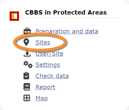
CBBM_PROTECTED_AREAS

CBBS in Protected areas. Admin menu.
25 CBBS in Protected areas
CBBM_PROTECTED_AREAS Preparation and data

CBBS in Protected areas. Preparation and data.
Identical section to the one available to registered users with rights to the CBBS in Protected areas. See wiki section Web interface > Protocols > CBBS in Protected areas > Preparation and data for more information.
[Top to Preparation and data]
[Back to CBBS protocol]
CBBM_PROTECTED_AREAS Sites
CREATE A NEW SITE:
1. Directly by Transmit my sightings map
or
through Menu > Administration > Protocol administration > CBBS in Protected areas > Sites> +NEW button
2. Select new site as if Submitting records
3. Choose Create a protocoled census -CBBS in Protected areas
4. Name the new site
5. Draw a polygon or import shapefile
6. SAVE

CBBS in Protected areas. Sites.
List of all existing sites allowing a CBBS in Protected areas.
Visit wiki section Administration > Protocol management > Sites for more information.
[Top to Sites]
[Back to CBBS protocol]
CBBM_PROTECTED_AREAS User/Site

CBBS in Protected areas. User/Site.
From the menu, select User / Site to assign users to study sites.
Visit wiki section Administration > Protocol management > User/Site for more information.
[Top to User/Site]
[Back to CBBS protocol]
CBBM_PROTECTED_AREAS Settings

CBBS in Protected areas. Settings.
Set protocol parameters.
Visit wiki section Administration > Protocol management > Settings for details.
Parameters describing the protocol
Expand the table below to see all posible parameters and options available for the CBBS in Protected areas. Use arrows on headers to alternate between ascending and descending alphabetical order.
| ExpandCBBS in Protected areas. Parameters. | ||||||||||
|---|---|---|---|---|---|---|---|---|---|---|
| Name | Description | Options | ||||||||
[Top to Settings]
[Back to CBBS protocol]
CBBM_PROTECTED_AREAS Import a shapefile

CBBS. Import a shapefile.
Import a shapefile with the study site and/or see all imports.
Visit wiki section Administration > Protocol management > Settings > Import a shapefile.
[Top to Import a shapefile]
[Back to CBBS protocol]
CBBM_PROTECTED_AREAS Check data

CBBS in Protected areas. Check data.
Visualise a summary of survey data.
Visit wiki section Administration > Protocol management > Check data for more information.
[Top to Check data]
[Back to CBBS protocol]
CBBM_PROTECTED_AREAS Report

CBBS in Protected areas. Report.
Visualise pooled results from surveys.
Visit wiki section Administration > Protocol management > Report for more information.
[Top to Report]
[Back to CBBS protocol]
CBBM_PROTECTED_AREAS Map

CBBS in Protected areas. Map.
Display the area map by polygon, and see its statistics.
Visit wiki section Administration > Protocol management > Map for more information.
[Top to Map]
[Top to CBBS in Protected areas]
[Back to Protocols management]