Other territory mapping: Difference between revisions
| Line 252: | Line 252: | ||
<br/> | <br/> | ||
[[Other territory mapping#Map|[Top to Map]]] <br/> | |||
[[#top|[Top to Other territory mapping]]]<br/> | [[#top|[Top to Other territory mapping]]]<br/> | ||
[[Protocols_web|[Back to Protocols]]]<br/> | [[Protocols_web|[Back to Protocols]]]<br/> | ||
<br/> | <br/> | ||
Latest revision as of 18:01, 3 December 2025
OTHER_MAPPING
The interface to enter data in the context of Other territory mapping exists only for NaturaList, but it can be edited and viewed through the web (after synchronisation). Go to Mobile interface > Protocols > Other territory mapping to see how to enter data.
Access your protocol from Menu > Take part > All my protocol > Other territory mapping.
For other options, visit wiki section Web interface > Local portal > Protocols > Accessing protocols.
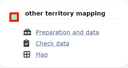
Other territory mapping. Menu.
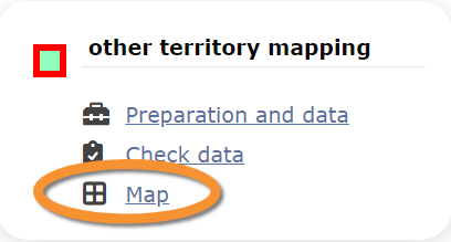
Other territory mapping
-
1 Preparation and data
- 1.1 Add observations (in NaturaList)
1.2 Results
1.3 Display on map
1.4 Modify the protocol
1.5 Census results
1.6 Download map
- 2 Check data
3 Map
OTHER_MAPPING Preparation and data
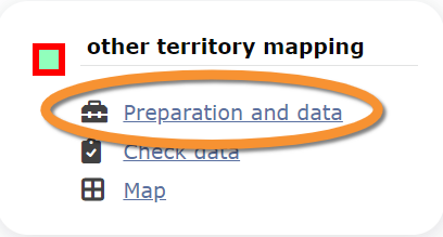
Other territory mapping. Preparation and data.
Lists all sites available to the current profile and allows entering observations, downloading printable maps and seeing results. Visit wiki section Mobile interface > Protocols > Other territory mapping to know how to enter data in the Other territory mapping protocol.
1 Preparation and data
-
1.1 Add observations (in NaturaList)
1.2 Results
1.3 Display on map
1.4 Modify the protocol
1.5 Census results
1.6 Download map
OTHER_MAPPING Results

Other territory mapping. Results.
See some statistics about your surveys results.
Visit wiki section Web interface > Protocols > Preparation and data > Results for details.
[Top to Preparation and data]
[Top to Other territory mapping protocols]
OTHER_MAPPING Display on map
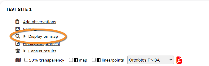
Other territory mapping. Display on map.
For the selected site, see the area to survey on a map. To know how to navigate the map, refer to wiki section Web interface > Navigating the map.
Visit wiki section Web interface > Protocols > Preparation and data > Display on map for details.
[Top to Preparation and data]
[Top to Other territory mapping protocols]
OTHER_MAPPING Modify the protocol

Other territory mapping. Modify the protocol.
Modify the site to survey.
Visit wiki section Web interface > Protocols > Preparation and data > Modify the protocol for details.
[Top to Preparation and data]
[Top to Other territory mapping protocols]
OTHER_MAPPING Census results

Other territory mapping. Census results.
Click on Census results to see all available years with data for this site (see image Protocol. Selecting year to visualise). Select the one to visualise.
Visit wiki section Web interface > Protocols > Preparation and data > Census protocol for details.
[Top to Preparation and data]
[Top to Other territory mapping protocols]
OTHER_MAPPING Download map

Other territory mapping. Download map.
Download maps ready to print.
Visit wiki section Web interface > Protocols > Preparation and data > Download map for details.
[Top to Preparation and data]
[Top to Other territory mapping protocols]
OTHER_MAPPING Check data
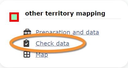
Other territory mapping. Check data.
Calendar showing visits to different sites and number of species detected.
Visit wiki section Web interface > Protocols > Preparation and data > Check data for details.
[Top to Check data]
[Top to Other territory mapping protocols]
OTHER_MAPPING Map
Other territory mapping. Map.
Map and statistics for site.
Visit wiki section Web interface > Protocols > Preparation and data > Map for details.
[Top to Map]
[Top to Other territory mapping]
[Back to Protocols]