Jackdaw (Admin): Difference between revisions
| (One intermediate revision by the same user not shown) | |||
| Line 47: | Line 47: | ||
<br/> | <br/> | ||
Identical section to the one available to registered users with rights to the | Identical section to the one available to registered users with rights to the Jackdaw protocol. See wiki section Web interface > Protocols > Jackdaw > [[Sand Martin#Preparation_and_data|Preparation and data]] for more information. <br/> | ||
<br/> | <br/> | ||
<span id="Sites"></span> | <span id="Sites"></span> | ||
==JACKDAW Sites== | ==JACKDAW Sites== | ||
<br/> | <br/> | ||
Revision as of 16:51, 19 April 2024
JACKDAW

Jackdaw. Admin menu.
19 Jackdaw
-
19.1 Preparation and data
19.2 Sites
19.3 User/Site
19.4 Settings
19.5 Check Data
19.6 Report
19.7 Map
JACKDAW Preparation and data

Jackdaw. Preparation and data.
Identical section to the one available to registered users with rights to the Jackdaw protocol. See wiki section Web interface > Protocols > Jackdaw > Preparation and data for more information.
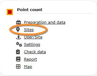
JACKDAW Sites
|
CREATE A NEW SITE:
or through Menu > Administration > Protocol administration > Jackdaw > Sites> +NEW button 2. Select new site as if Submitting records 3. Choose Create a protocoled census -Jackdaw 4. Name the new site 5. Draw polygons or import shapefile 6. SAVE |

Jackdaw. Sites.
List of all existing sites allowing a Point count.
Visit wiki section Administration > Protocol management > Sites for more information.
JACKDAW User/Site

Jackdaw. User/Site.
From the menu, select User / Site to assign users to study sites.
Visit wiki section Administration > Protocol management > User/Site for more information.
JACKDAW Settings

Jackdaw. Settings.
Set protocol parameters.
Visit wiki section Administration > Protocol management > Settings for details.
Parameters describing the protocol
Expand the table below to see all posible parameters and options available for the Jackdaw protocol. Use arrows on headers to alternate between ascending and descending alphabetical order.
| Jackdaw. Parameters. | ||||||||||
|---|---|---|---|---|---|---|---|---|---|---|
| Name | Description | Options | ||||||||
| Conditions in general | The user estimates how are surveying conditions overall regarding weather and disturbances, and indicate on next section the reason if surveying conditions are not good. | Good / normal Moderate Bad / heavily influenced Unknown |
||||||||
| Additional observer | Space to indicate if the observer has been accompanied by someone whose observations were also recorded. | empty field | ||||||||
| Important changes since last count ? | Allows indicating if there have been major changes since last visit. | empty field | ||||||||
| Conditions | The user can leave a note about general surveying conditions. | empty field | ||||||||
| Potential breeding pairs | To enter the number of breeding pairs. This information will be asked when entering data. |
empty field | ||||||||
| Occupied nests | To enter the number of occupied nests. This information will be asked when entering data. |
empty field | ||||||||
| Nest location | To select the location of the nest. | Rock cliff Building Nesting aids (nest box, raft) Tree Others |
||||||||
JACKDAW Check data

Jackdaw. Check data.
Visualise a summary of survey data.
Visit wiki section Administration > Protocol management > Check data for more information.
JACKDAW Report

Jackdaw. Report.
Visualise pooled results from surveys.
Visit wiki section Administration > Protocol management > Report for more information.
JACKDAW Map

Jackdaw. Map.
Display the area map by polygon, and see its statistics.
Visit wiki section Administration > Protocol management > Map for more information.