Waterbird census (NL)
WATERBIRD
Waterbird census
· Enter Waterbird census protocol.
· Choose the site to survey, if more than one.
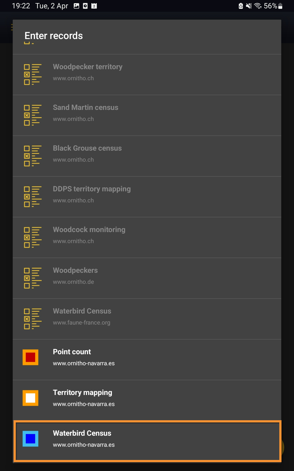
Open the menu as for Submitting records and choose Waterbird census (see image below).

Waterbird census protocol.
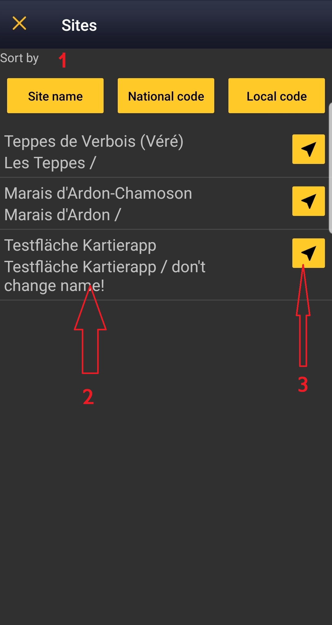
Choose the site you want to count at as explained in wiki section Mobile interface > Protocols > Enter data.
WATERBIRD Start of list
Enter general information before starting the count. Fields are protocol dependent and may change from country to country.
Visit wiki section Mobile interface > Protocols > Enter data > Start of list for details.
Click Next when done.
WATERBIRD Entering records
Enter observations as if Enter a list of precise observations.
- Place
Place your observation within the study area.
See wiki section Mobile interface > Protocols > Enter data > Entering observations > Place on how to interpret the map and place your observation.
- Species
Enter species 'by search' or using protocol shortcuts when available.
See wiki section Mobile interface > Protocols > Enter data > Entering observations > Species on how to enter the species name.
See wiki section Mobile interface > Shortcuts to learn more about shortcuts and how to create them.
- Number of individuals
- Number of individuals
Enter number of individuals and precision count. Using the counter function may easy collecting your data.
Visit Mobile interface > Entering records > Directly in the field > Number of individuals if necessary.
- Plus
Enter additional information as if it where a Enter a list of precise observations.
See wiki section Mobile interface > Submitting records > Enter a list of precise observations > Step 4: Additional information on how to do it, if necessary.
When done, click Save. It will take you to the Place screen to continue entering observations.
[Top to Entering records]
[Back to Waterbird census]
WATERBIRD Ending the list
To finish the survey,
1. Stop recording,
2. Adjust time, if necessary,
3. Fill in/modify details, and
4. Choose type of list.
- Which species list did you count?:
- Restricted list: You counted only the species of interest to the protocol (i.e. ducks).
- Extended list: You counted other water-related species besides those required by the protocol (i.e. ducks, herons and kingfishers).
- All species where reported (=complete list): You counted all species seen within the polygon (i.e. ducks, herons, kingfishers and passerines).
- Restricted list: You counted only the species of interest to the protocol (i.e. ducks).
Visit wiki section Mobile interface > Enter data > Ending the list for details, if necessary.
Remember to synchronise your data as soon as possible after entering to avoid loosing it.
WATERBIRD Editing records and/or protocols
To edit records within a protocol, or to edit the protocol's general parameters, visit wiki section Mobile interface > Editing records > Editing protocols.
WATERBIRD Deleting records and/or protocols
To delete records within a protocol, or to delete the whole protocol, visit wiki section Mobile interface > Editing records > Deleting protocols.
WATERBIRD Browsing records
See your protocoled records:
- Before synchronisation
- In the phone. See more details in wiki section Accessing records' details.
- Before synchronisation
- After synchronisation
- In Mine. See more details in wiki section Accesssing records' details.
- After synchronisation
- In Under verification (only if any data of the protocol needs more information)
- In Under verification (only if any data of the protocol needs more information)
- In the local portal. Go to the corresponding local portal, Menu > Explore > All my observations.
- In the local portal. Go to the corresponding local portal, Menu > Explore > All my observations.