Private territory mapping (Admin): Difference between revisions
| (21 intermediate revisions by the same user not shown) | |||
| Line 4: | Line 4: | ||
Private territory mapping records breeding birds within a pre-determined area. Data can only be entered through NaturaList. <br/> | Private territory mapping records breeding birds within a pre-determined area. Data can only be entered through NaturaList. <br/> | ||
<br/> | |||
Access your protocol from Menu > Take part > All my protocol > Private territory mapping. <br/> | |||
For other options, visit wiki section Administrators > Protocols > [[Protocols_web#Accessing_protocols|Accessing protocols]]. <br/> | |||
<br/> | <br/> | ||
| Line 19: | Line 23: | ||
<div class="toc" style="width:300px;"> <!-- La llargada s'ha de canviar aquí --> | <div class="toc" style="width:300px;"> <!-- La llargada s'ha de canviar aquí --> | ||
<div class="mw-collapsible mw-collapsed" data-expandtext="Show" data-collapsetext="Hide" style="width:250px;margin-bottom:0px;margin-top:0px;background-color:#f7f7f7;"> | <div class="mw-collapsible mw-collapsed" data-expandtext="Show" data-collapsetext="Hide" style="width:250px;margin-bottom:0px;margin-top:0px;background-color:#f7f7f7;"> | ||
''' | '''Private territory mapping''' | ||
<div class="mw-collapsible-content" style="width:300px;background-color:#f7f7f7;"> <!-- I també cal canviar la llargada aquí --> | <div class="mw-collapsible-content" style="width:300px;background-color:#f7f7f7;"> <!-- I també cal canviar la llargada aquí --> | ||
<ol> | <ol> | ||
1 [[Private territory mapping (Admin)#Preparation_and_data| Preparation and data]] <br /> | |||
2 [[Private territory mapping (Admin)#Sites| Sites]]<br /> | |||
3 [[Private territory mapping (Admin)#User/Site| User/Site]]<br /> | |||
4 [[Private territory mapping (Admin)#Settings| Settings]] <br /> | |||
5 [[Private territory mapping (Admin)#Import a shapefile| Import a shapefile]]<br /> | |||
6 [[Private territory mapping (Admin)#Check_data| Check Data]]<br /> | |||
7 [[Private territory mapping (Admin)#Report| Report]]<br /> | |||
8 [[Private territory mapping (Admin)#Map| Map]]<br /> </ol> | |||
</div> | </div> | ||
</div> | </div> | ||
| Line 37: | Line 41: | ||
<span id="Preparation and data"></span> | <span id="Preparation and data"></span> | ||
== | ==TERRITORY_MAPPING Preparation and data== | ||
<br/> | <br/> | ||
| Line 59: | Line 63: | ||
<span id="Sites"></span> | <span id="Sites"></span> | ||
== | ==TERRITORY_MAPPING Sites== | ||
<br/> | <br/> | ||
< | <br/> | ||
<div class=" | <div class="contenesummary" style="width:700px"> <!-- ajustar la mida --> | ||
< | <div class="contenesummaryima" style="min-width: 43px;max-width: 43px;"> <!-- no canviar les mides --> | ||
< | </div> | ||
<div class="contenesummarytext"> | |||
<hr class="contenesummarylinia"> | |||
<b> CREATE A NEW SITE:</b><br /> | |||
1. Directly by <b>Transmit my sightings</b> map > Protocols > Private territory mapping<br/>or <br/>through Menu > Administration > Protocol administration > Private territory mapping > [[Media:2023-05-22 PTM Sites.png|Sites]] > +NEW button<br /> | |||
2. Select new site as if [[Submitting_records|Submitting records]]<br/> | 2. Select new site as if [[Submitting_records|Submitting records]]<br/> | ||
3. Choose [[Media:Draw waterbird polygon.png|'''Create a protocoled census -Private territory mapping''']]<br/> | 3. Choose [[Media:Draw waterbird polygon.png|'''Create a protocoled census -Private territory mapping''']]<br/> | ||
| Line 72: | Line 79: | ||
5. [[Geometry_editor#Drawing_a_transect|Draw transects]] or [[Media:2023-03-14 Importing a plygon shapefile.png|import shapefile]]<br/> | 5. [[Geometry_editor#Drawing_a_transect|Draw transects]] or [[Media:2023-03-14 Importing a plygon shapefile.png|import shapefile]]<br/> | ||
6. '''SAVE''' | 6. '''SAVE''' | ||
</div> | </div> | ||
</ | </div> | ||
<br/> | <br /> | ||
<br/> | <br/> | ||
| Line 101: | Line 106: | ||
<span id="User/Site"></span> | <span id="User/Site"></span> | ||
== | ==TERRITORY_MAPPING User/Site== | ||
<br/> | <br/> | ||
| Line 126: | Line 131: | ||
<span id="Settings"></span> | <span id="Settings"></span> | ||
== | ==TERRITORY_MAPPING Settings== | ||
<br/> | <br/> | ||
| Line 150: | Line 155: | ||
<br/> | <br/> | ||
[[Private_territory_mapping_(Admin)# | [[Private_territory_mapping_(Admin)#Settings|[Top to Settings]]] <br/> | ||
[[#top|[Back to Private territory mapping]]] | [[#top|[Back to Private territory mapping]]] | ||
<span id="Import a shapefile"></span> | <span id="Import a shapefile"></span> | ||
==Import a shapefile== | ==TERRITORY_MAPPING Import a shapefile== | ||
<br/> | <br/> | ||
| Line 167: | Line 172: | ||
</center> | </center> | ||
<br/> | <br/> | ||
<br/> | |||
Import a shapefile with the study site and/or see all imports. <br/> | |||
Visit wiki section Administration > Protocol management > Settings > [[Protocol_management#Import_a_shapefile_settings|Import a shapefile]]. <br/> | |||
<br/> | <br/> | ||
| Line 174: | Line 183: | ||
<span id="Check data"></span> | <span id="Check data"></span> | ||
== | ==TERRITORY_MAPPING Check data== | ||
<br/> | <br/> | ||
| Line 199: | Line 208: | ||
<span id="Report"></span> | <span id="Report"></span> | ||
== | ==TERRITORY_MAPPING Report== | ||
<br/> | <br/> | ||
| Line 224: | Line 233: | ||
<span id="Map"></span> | <span id="Map"></span> | ||
== | ==TERRITORY_MAPPING Map== | ||
<br/> | <br/> | ||
Latest revision as of 20:26, 28 August 2026
TERRITORY_MAPPING
Private territory mapping records breeding birds within a pre-determined area. Data can only be entered through NaturaList.
Access your protocol from Menu > Take part > All my protocol > Private territory mapping.
For other options, visit wiki section Administrators > Protocols > Accessing protocols.

Private territory mapping. Admin menu.
Private territory mapping
-
1 Preparation and data
2 Sites
3 User/Site
4 Settings
5 Import a shapefile
6 Check Data
7 Report
8 Map
TERRITORY_MAPPING Preparation and data

Private territory mapping. Preparation and data.
Identical section to the one available to registered users with rights to the Private territory mapping. See wiki section Web interface > Protocols > Private territory mapping > Preparation and data for more information.
[Top to Preparation and data]
[Back to Private territory mapping]
TERRITORY_MAPPING Sites
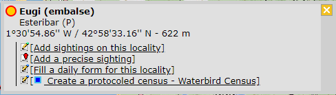
CREATE A NEW SITE:
1. Directly by Transmit my sightings map > Protocols > Private territory mapping
or
through Menu > Administration > Protocol administration > Private territory mapping > Sites > +NEW button
2. Select new site as if Submitting records
3. Choose Create a protocoled census -Private territory mapping
4. Name the new site
5. Draw transects or import shapefile
6. SAVE



Private territory mapping. Sites.
List of all existing sites allowing a protocoled data entry.
Visit wiki section Administration > Protocol management > Sites for more information.
[Top to Sites]
[Back to Private territory maping]
TERRITORY_MAPPING User/Site

Private territory mapping. User/Site.
From the Private territory mapping menu, select User / Site to assign users to study sites.
Visit wiki section Administration > Protocol management > User/Site for more information.
[Top to User/Site]
[Back to Private territory mapping]
TERRITORY_MAPPING Settings

Private territory mapping. Settings.
Set protocol parameters.
Visit wiki section Administration > Protocol management > Settings for details.
Parameters describing the protocol
There are no special parameters describing the protocol available for Private territory mapping protocols.
[Top to Settings]
[Back to Private territory mapping]
TERRITORY_MAPPING Import a shapefile

Private territory mapping. Import a shapefile.
Import a shapefile with the study site and/or see all imports.
Visit wiki section Administration > Protocol management > Settings > Import a shapefile.
[Top to Import a shapefile]
[Back to Import a shapefile]
TERRITORY_MAPPING Check data

Private territory mapping. Check data.
Visualise a summary of survey data.
Visit wiki section Administration > Protocol management > Check data for more information.
[Top to Check data]
[Back to Check data]
TERRITORY_MAPPING Report

Private territory mapping. Report.
Visualise pooled results from surveys.
Visit wiki section Administration > Protocol management > Report for more information.
[Top to Report]
[Back to Report]
TERRITORY_MAPPING Map

Private territory mapping. Map.
Display the area map by polygon, and see its statistics.
Visit wiki section Administration > Protocol management > Map for more information.
[Top to Settings]
[Back to Private territory mapping]
[Back to Protocols management]