|
|
| Line 135: |
Line 135: |
|
| |
|
| ====Parameters describing the protocol==== | | ====Parameters describing the protocol==== |
| Expand the table below to see all posible parameters and options available for Other territory mapping. Use arrows on headers to alternate between ascending and descending alphabetical order.<br/>
| | There are no special parameters describing the protocol available for Other territory mapping protocol. <br/> |
| <br/> | | <br/> |
|
| |
|
| <center> | | <span id="Check data"></span> |
| <table class="wikitable sortable mw-collapsible mw-collapsed" style="border:1px solid black;" width="95%" align="center" ;>
| |
| <th colspan="11" style="background-color:white; border=0px">''' Other territory mapping. Parameters.'''</th>
| |
| <tr style="padding: 25px; text-align: center; font-size: 16px; font-family: sans serif; color: black; background-color: LightGray">
| |
| <th width="25%" >Name</th>
| |
| <th width="55%">Description</th>
| |
| <th width="20%">Options</th>
| |
| </tr> | |
|
| |
|
| <tr style="padding: 25px; text-align: center; font-size: 16px; font-family: sans serif; color: black">
| |
| <td style="text-align: center">'''Count type'''</td>
| |
| <td style="text-align: center">User should choose one of the options.</td>
| |
| <td style="text-align: center">roost count <br/>
| |
| during day</td>
| |
| </tr>
| |
|
| |
| <tr style="padding: 25px; text-align: center; font-size: 16px; font-family: sans serif; color: black">
| |
| <td style="text-align: center">'''Optical equipment'''</td>
| |
| <td style="text-align: center">The user should indicate the equipment used for the survey. Only one option is possible.</td>
| |
| <td style="text-align: center">None <br/>
| |
| Telescope <br/>
| |
| Binoculars <br/>
| |
| Unknown</td>
| |
| </tr>
| |
|
| |
| <tr style="padding: 25px; text-align: center; font-size: 16px; font-family: sans serif; color: black">
| |
| <td style="text-align: center">'''Coverage'''</td>
| |
| <td style="text-align: center">Serves to indicate how much of the designated study area is covered in the survey.</td>
| |
| <td style="text-align: center">Partly <br/>
| |
| Complete <br/>
| |
| Unknown</td>
| |
| </tr>
| |
|
| |
| <tr style="padding: 25px; text-align: center; font-size: 16px; font-family: sans serif; color: black">
| |
| <td style="text-align: center">'''Coverage'''</td>
| |
| <td style="text-align: center">Serves to indicate how much of the designated study area is covered in the survey.</td>
| |
| <td style="text-align: center">Empty field</td>
| |
| </tr>
| |
|
| |
| <tr style="padding: 25px; text-align: center; font-size: 16px; font-family: sans serif; color: black">
| |
| <td style="text-align: center">'''Water level'''</td>
| |
| <td style="text-align: center">Indicates the water level.</td>
| |
| <td style="text-align: center">Dry / Empty <br/>
| |
| Low <br/>
| |
| Normal <br/>
| |
| High <br/>
| |
| Unknown</td>
| |
| </tr>
| |
|
| |
| <tr style="padding: 25px; text-align: center; font-size: 16px; font-family: sans serif; color: black">
| |
| <td style="text-align: center">'''Reason(s) for moderate / bad conditions'''</td>
| |
| <td style="text-align: center">If general conditions indicated in "conditions" were not good, clicking the yellow field the user opens an expandable menu and chooses the reason. Only one option is possible.</td>
| |
| <td style="text-align: center">Fog <br/>
| |
| Rain <br/>
| |
| Wind <br/>
| |
| Hunting <br/>
| |
| Fishing <br/>
| |
| Sport <br/>
| |
| Mixed (weather) <br/>
| |
| Mixed (human) <br/>
| |
| Others</td>
| |
| </tr>
| |
|
| |
| <tr style="padding: 25px; text-align: center; font-size: 16px; font-family: sans serif; color: black">
| |
| <td style="text-align: center">'''Drone used'''</td>
| |
| <td style="text-align: center">To indicate if drones were used during the survey.</td>
| |
| <td style="text-align: center">No<br/>
| |
| Yes</td>
| |
| </tr>
| |
|
| |
| <tr style="padding: 25px; text-align: center; font-size: 16px; font-family: sans serif; color: black">
| |
| <td style="text-align: center">'''Intact nests'''</td>
| |
| <td style="text-align: center">Number of intact nests. <br/> This information will be asked when entering data.</td>
| |
| <td style="text-align: center">empty field</td>
| |
| </tr>
| |
|
| |
| <tr style="padding: 25px; text-align: center; font-size: 16px; font-family: sans serif; color: black">
| |
| <td style="text-align: center">'''Occupied nests'''</td>
| |
| <td style="text-align: center">Number of occupied nests. <br/> This information will be asked when entering data.</td>
| |
| <td style="text-align: center">empty field</td>
| |
| </tr>
| |
|
| |
| <tr style="padding: 25px; text-align: center; font-size: 16px; font-family: sans serif; color: black">
| |
| <td style="text-align: center">'''Number of nests occupied by other species'''</td>
| |
| <td style="text-align: center">Number nests occupied by species other than those counted in the current protocol. <br/> This information will be asked when entering data.</td>
| |
| <td style="text-align: center">empty field</td>
| |
| </tr>
| |
|
| |
| <tr style="padding: 25px; text-align: center; font-size: 16px; font-family: sans serif; color: black">
| |
| <td style="text-align: center">'''Suspected nests'''</td>
| |
| <td style="text-align: center">Number of suspected nests. <br/> This information will be asked when entering data.</td>
| |
| <td style="text-align: center">empty field</td>
| |
| </tr>
| |
|
| |
| <tr style="padding: 25px; text-align: center; font-size: 16px; font-family: sans serif; color: black">
| |
| <td style="text-align: center">'''Conditions in general'''</td>
| |
| <td style="text-align: center">The user estimates how are surveying conditions overall regarding weather and disturbances, and indicate on next section the reason if surveying conditions are not good.</td>
| |
| <td style="text-align: center">Good / normal<br/>Moderate<br/>Bad / heavily influenced<br/>Unknown</td>
| |
| </tr>
| |
|
| |
| <tr style="padding: 25px; text-align: center; font-size: 16px; font-family: sans serif; color: black">
| |
| <td style="text-align: center">'''Additional observer/s'''</td>
| |
| <td style="text-align: center">Space to indicate if the observer has been accompanied by someone whose observations were also recorded.</td>
| |
| <td style="text-align: center">empty field</td>
| |
| </tr>
| |
|
| |
| <tr style="padding: 25px; text-align: center; font-size: 16px; font-family: sans serif; color: black">
| |
| <td style="text-align: center">'''Important changes since last count ?'''</td>
| |
| <td style="text-align: center">Allows indicating if there have been major changes since last visit.</td>
| |
| <td style="text-align: center">empty field</td>
| |
| </tr>
| |
|
| |
| <tr style="padding: 25px; text-align: center; font-size: 16px; font-family: sans serif; color: black">
| |
| <td style="text-align: center">'''Conditions'''</td>
| |
| <td style="text-align: center">The user can leave a note about general surveying conditions.</td>
| |
| <td style="text-align: center">empty field</td>
| |
| </tr>
| |
|
| |
| </table>
| |
| </center>
| |
| <br/><br/>
| |
|
| |
| <span id="Check data"></span>
| |
| ==OTHER_MAPPING Check data== | | ==OTHER_MAPPING Check data== |
| <br/> | | <br/> |
OTHER_MAPPING
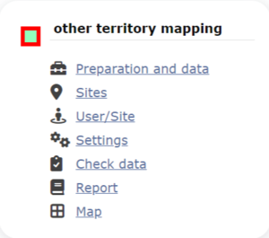
Other territory mapping. Admin menu.
23 Other territory mapping
OTHER_MAPPING Preparation and data
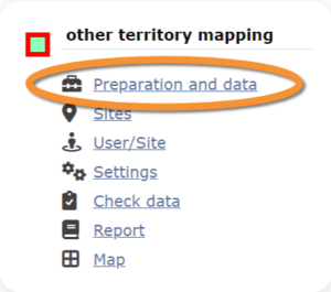
Other territory mapping. Preparation and data.
Identical section to the one available to registered users with rights to the Other territory mapping. See wiki section Web interface > Protocols > Other territory mapping > Preparation and data for more information.
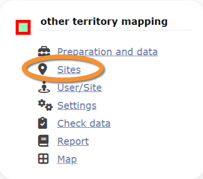
OTHER_MAPPING Sites

Other territory mapping. Sites.
List of all existing sites allowing a Point count.
Visit wiki section Administration > Protocol management > Sites for more information.
OTHER_MAPPING User/Site
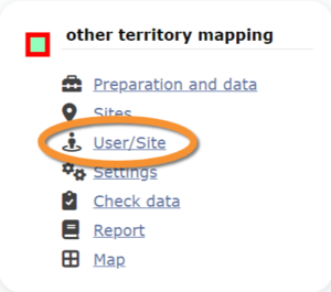
Other territory mapping. User/Site.
From the menu, select User / Site to assign users to study sites.
Visit wiki section Administration > Protocol management > User/Site for more information.
OTHER_MAPPING Settings
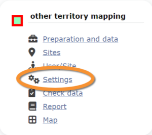
Other territory mapping. Settings.
Set protocol parameters.
Visit wiki section Administration > Protocol management > Settings for details.
Parameters describing the protocol
There are no special parameters describing the protocol available for Other territory mapping protocol.
OTHER_MAPPING Check data
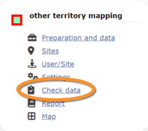
Other territory mapping. Check data.
Visualise a summary of survey data.
Visit wiki section Administration > Protocol management > Check data for more information.
OTHER_MAPPING Report
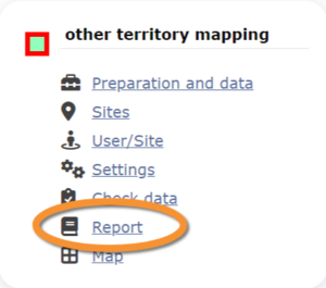
Other territory mapping. Report.
Visualise pooled results from surveys.
Visit wiki section Administration > Protocol management > Report for more information.
OTHER_MAPPING Map
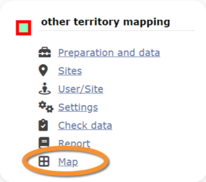
Other territory mapping. Map.
Display the area map by polygon, and see its statistics.
Visit wiki section Administration > Protocol management > Map for more information.
[Top to Other territory mapping]
[Back to Protocols management]


