Created page with "Lorsqu'un filtre est appliqué et que vous souhaitez le désactiver, cliquez sur '''AFFICHER TOUT''' pour voir la liste complète.<br />"
Pour accéder à l'administration d'un protocole, vous avez besoin de l'adresse suivante '''[[User_administration#Admin_users|Droit d'administrateur du protocole]]'''. Seul un administrateur du portail local peut vous donner cet accès, sous certaines conditions.<br/>
To access the adminstration of a protocol you need the '''[[User_administration#Admin_users|Protocol administrator right]]'''. Only an Admin of the Local portal can provide you such access, under certain conditions.<br/>
<br/>
<br/>
</div>
<div lang="en" dir="ltr" class="mw-content-ltr">
Il existe deux façons d'accéder à l'administration des protocoles : <br/>
There are two ways to access administration of protocols: <br/>
<br/>
<br/>
* From Main menu > Administration <br/>
* Depuis le menu principal > Administration <br/>
<br/>
<br/>
</div>
<div lang="en" dir="ltr" class="mw-content-ltr">
Si vous êtes un administrateur, accéder à la section administration dans la colonne de gauche. (voir l'image [[Media:Administration.png|Administration]]), et descendre jusqu'à '''Administration du protocole'''. Ouvrir le tableau de bord et sélectionner '''Administration du protocole''' (voir l'image [[Media:Protocol administration.png|Administration du protocole]]). <br />
If you are an administrator, go to the administration section on the left hand column (see image [[Media:Administration.png|Administration]]), and scroll down to '''Protocol administration'''. Open panel and select '''Protocol administration''' (see image [[Media:Protocol administration.png|Protocol administration]]). <br />
*Menu principal > Participer > Tout mon protocole <br/>
*From Main menu > Taking part > All my protocol <br/>
<br/>
<br/>
</div>
<div lang="en" dir="ltr" class="mw-content-ltr">
Menu principal > Participer > Tous mes protocoles. Vous verrez tous les protocoles auxquels vous avez accès, que ce soit en tant qu'administrateur ou non. Les utilisateurs qui n'ont pas de droits d'administration peuvent également suivre ce chemin pour accéder aux protocoles, mais ils n'ont pas accès à toutes les options d'un protocole. <br/>
Go to Main menu > Taking part > All my protocols. You will see all protocols you have access to, either as an administrator or otherwise. Users with no administration rights can also can also follow this path to access protocols but they are no given all options within a protocol. <br/>
<br/>
<br/>
</div>
<div lang="en" dir="ltr" class="mw-content-ltr">
[[File:Admin protocol through All my protocol.png|700px|thumb|center|Protocole d'administration par le biais de Tous mes protocoles.]] <br/>
[[File:Admin protocol through All my protocol.png|700px|thumb|center|Admin protocol through All my protocol.]] <br/>
Access protocols through the [[Media:Protocol panel.png|Protocol panel]] or as if [[Media:Enter_data_as_if_subitting_records.png|Submitting records]]. Visit wiki section Web interface > Local portal > Protocols > [[Protocols_web#Accessing_protocols|Accessing protocols]] for more details. <br/>
==Préparation et données==
<br/>
<br/>
</div>
<div lang="en" dir="ltr" class="mw-content-ltr">
<div lang="en" dir="ltr" class="mw-content-ltr">
[[File:Protocols. Preparation and data..png|700px|thumb|center|Protocols. Preparation and data.]]<br/>
Administrators and users with appropriate rights may have additional ways to access protocol functions: <br/>
<br/>
<br/>
</div>
</div>
<div lang="en" dir="ltr" class="mw-content-ltr">
<div lang="en" dir="ltr" class="mw-content-ltr">
Identical section to the one of Waterbird Census Protocol, we took as an example, available to registered users with rights. It allows printing maps and entering observations. See wiki section Web interface > Protocols > 'Protocol name' > [[Protocols_web#Preparation_and_data|Preparation and data]] for more information. <br/>
====Modify protocol====
</div>
<div lang="en" dir="ltr" class="mw-content-ltr">
Modify the protocol from <br/>
<br/>
<br/>
</div>
</div>
==Sites==
<div lang="en" dir="ltr" class="mw-content-ltr">
<br/>
* '''Submitting records''', as described in wiki section Web interface > Local portal > Protocols > Accessing protocols > [[Protocols_web#Modify protocol|Modify protocol]].<br/>
</div>
<div lang="en" dir="ltr" class="mw-content-ltr">
<div lang="en" dir="ltr" class="mw-content-ltr">
<center>
* '''Protocol panel > Preparation and data''', as described in Web interface > Local portal > Protocols > Accessing protocols > [[Protocols_web#Modify protocol|Modify protocol]].<br/>
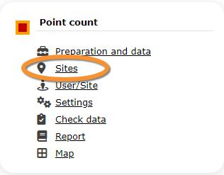
* '''Protocol panel > Sites'''. Only available to administrators. Go to wiki section Administration > Protocol management > [[Protocol_management#Sites|Sites]] > Edit for details. <br/>
<ul>
1. Directly by <b>Transmit my sightings</b> map <br/>or <br/>trought Menu > Administration > Protocol administration > 'Protocol name' > [[Media:Admin WBC Sites.png|Sites]]> +NEW button <br />
2. Select new site as if [[Submitting_records|Submitting records]]<br/>
3. Choose [[Media:Draw waterbird polygon.png|'''Create a protocoled census -Name of the protocol''']]<br/>
4. [[Media:Name a new WBC site.png|Name the new site]]<br/>
5. Draw geometry (polygon, dot, transect) or [[Media:2023-03-14 Importing a plygon shapefile.png|import shapefile]]<br/>
List of all existing sites allowing a protocoled data entry (here as an example the Waterbird census). Use arrows under titles to alternate between ascending and descending order (see [[Media:2023-03-27 example arrows.png|image as an example]]).<br/>
Create a new protocol from <br/>
<br/>
<br/>
</div>
</div>
<div lang="en" dir="ltr" class="mw-content-ltr">
<div lang="en" dir="ltr" class="mw-content-ltr">
[[File:WBC list of sites.png|700px|thumb|center|Protocols. Existing sites.]]
* '''Submitting records''', as described in wiki section Web interface > Local portal > Protocols > Accessing protocols > [[Protocols_web#Create protocol|Create protocol]].<br/>
</div>
</div>
<div lang="en" dir="ltr" class="mw-content-ltr">
<div lang="en" dir="ltr" class="mw-content-ltr">
<p style="margin-left:200px">
* '''Protocol panel > Sites'''. Only available to administrators. Go to wiki section Administration > Protocol management > [[Protocol_management#Sites|Sites]] > +NEW to see how to do it. <br/>
'''Reference name:''' Official name given to the study site. This is given by an administrator or user with special rights.<br/>
<br/>
'''Custom name:''' A different name under which the same place may be also known, or a name easier for the user. This can be set by the user allowed for that site himself.<br/>
'''Reference locality:''' Name of the location all observations from the protocol will be associated to. <br/>
'''Municipality:''' Municipality the locality belongs to.<br/>
'''Altitude:''' Altitude associated to the locality.<br/>
</p>
<br/>
<br/>
</div>
</div>
<div lang="en" dir="ltr" class="mw-content-ltr">
<div class="mw-translate-fuzzy">
:'''1. Search''' <br/>
Reduce list by typing the name of a site, Locality, Municipality , or part of it, and click '''SEARCH'''.
</div>
</div>
<div lang="en" dir="ltr" class="mw-content-ltr">
<div lang="en" dir="ltr" class="mw-content-ltr">
When a filter is applied and you want to desactivate it, click on
<p>
[[Media:2023-03-17 Diplay full list.png|'''DISPLAY ALL''']]. <br />
'''Access protocol panel:'''<br/>
- Through Menu > Take part > [[Media:Accessing protocols on the web (1).png|All my protocols]]. <br/>
- Through Menu > Administration > Protocol administration > [[Media:Protocol administration.png|Protocol administration]]. <br/>
<br/>
</div>
</div>
<div lang="en" dir="ltr" class="mw-content-ltr">
<div lang="en" dir="ltr" class="mw-content-ltr">
:'''2. Search''' <br/>
'''Enter data:''' <br/>
Select page number and/or number of items per page.<br/>
- Through [[Media:Protocol panel.png|Protocol panel]] > Preparation and data > [[Media:2023-05-09 WBC Add observations.png|Add observations]].<br/>
- Through [[Media:Add_data_to_protocol_scheme.png|Submitting records]]. See wiki section Web interface > Protocols > Accessing protocols > [[Protocols_web#|Entering data]] for details.<br/>
<br/>
</div>
</div>
<div lang="en" dir="ltr" class="mw-content-ltr">
<div lang="en" dir="ltr" class="mw-content-ltr">
:'''3. Details''' <br/>
'''Modify protocol:'''<br/>
Click to see details of selected site.<br/>
- Through [[Media:Protocol panel.png|Protocol panel]] > Preparation and data > [[Media:2023-05-09 WBC Modify the protocol.png|Modify the protocol]], or [[Media:Protocol panel.png|Protocol panel]] > [[Media:Protocols. Sites..png|Sites]] > Edit. <br/>
- Through [[Media:Modify protocol from the map.png|Submitting records]]. See wiki section Web interface > Protocols > Accessing protocols >[[Protocols_web#Modify protocol|Modify protocol]] for details.<br/>
<br/>
</div>
</div>
<div lang="en" dir="ltr" class="mw-content-ltr">
<div lang="en" dir="ltr" class="mw-content-ltr">
:'''4. Edit''' <br/>
'''Create protocol:''' <br/>
Click to edit details of selected site.<br/>
- Through Protocol panel > [[Media:Protocols. Sites..png|Sites]] > +NEW. <br/>
- Through [[Media:Create a new protocoled census.png|Submitting records]]. See wiki section Web interface > Protocols > Accessing protocols >[[Protocols_web#Create protocol|Create protocol]] for details.<br/><br/>
</p>
</div>
</div>
<div lang="en" dir="ltr" class="mw-content-ltr">
<div lang="en" dir="ltr" class="mw-content-ltr">
:'''5. New site''' <br/>
</td></tr></table>
Create a new site. <br/>
</center>
<br />
</div>
</div>
<div lang="en" dir="ltr" class="mw-content-ltr">
:::1. Click '''+ NEW''' under the list. Select the site as if entering an observation (see wiki section Web interface > [[Submitting_records|Submitting records]] if necessary) and choose the new option: '''Create a protocoled census - 'Name of the Protocol'''' (here Waterbird census, see image below). <br/>
<div class="mw-translate-fuzzy">
<br/>
==Préparation et données==
[[File:Draw waterbird polygon.png|700px|thumb|center|Creating a new site for Waterbird census protocol]]<br/>
<br/>
<br/>
</div>
</div>
<div lang="en" dir="ltr" class="mw-content-ltr">
<div lang="en" dir="ltr" class="mw-content-ltr">
:::2. Enter a name for the new site.<br/>
==Preparation and data==
<br/>
<br/>
</div>
</div>
<div lang="en" dir="ltr" class="mw-content-ltr">
<div class="mw-translate-fuzzy">
[[File:Name a new WBC site.png|700px|thumb|center|Naming a new Waterbird census site.]]
[[File:Protocols. Preparation and data..png|700px|thumb|center|Protocols. Préparation et données.]]<br/>
<br/>
</div>
</div>
<div lang="en" dir="ltr" class="mw-content-ltr">
Section identique à celle du Protocole de recensement des oiseaux d'eau, que nous avons pris comme exemple, disponible pour les utilisateurs enregistrés ayant des droits. Elle permet d'imprimer des cartes et de saisir des observations. Voir la section wiki Interface Web > Protocoles > 'Nom du protocole'> [[Protocols_web#Preparation_and_data|Préparation et données]] pour plus d'informations. <br/>
<p style="margin-left:220px">
<br/>
'''Name of reference locality:''' Location under which all observations of the protocol will be associated to. It is created by the administrator when creating a new protocol site and cannot be changed afterwards. <br/>
'''Reference name:''' Type a name for the new site. It can be a real name or a code, and consist on letters, numbers or a combination of both.<br/>
<div class="mw-translate-fuzzy">
'''Custom name:''' Type an additional name to the site if known. This name can be changed afterwards by the end user allocated to that site.<br/>
==Sites==
</p>
<br/>
<br/>
</div>
</div>
<div lang="en" dir="ltr" class="mw-content-ltr">
<div lang="en" dir="ltr" class="mw-content-ltr">
:::3. Either: <br/>
==Sites==
::::*Draw polygon as explained in wiki section Web interface > [[Geometry_editor|Geometry editor]] or,<br/>
[[File:2023-03-14 Importing a plygon shapefile.png|700px|thumb|center|Importing a plygon shapefile.]]
<ul>
<p style="margin-left:200px">
1. Directement par<b>Transmettre mes données</b> carte<br/>ou <br/>avec le menu > Administration > Administration du protocole > 'Nom du protocole' > [[Media:Protocols. Sites..png|Sites]] > +NOUVEAU bouton<br />
'''1.''' Choose datum and <br/>
2. Sélectionner un nouveau site comme si on[[Submitting_records|Transmettait ses données]]<br/>
'''2.''' upload the file.<br/>
3. Choisir[[Media:Draw waterbird polygon.png|'''Créer un recensement protocolé -Nom du protocole''''.]]<br/>
'''3.''' When done, click '''IMPORT'''.<br/>
4. [[Media:Name a new WBC site.png|Nom du nouveau site]]<br/>
5. Dessiner la géométrie (polygone, point, transect) ou [[Media:2023-03-14 Importing a plygon shapefile.png|importer un "shapefile"]]<br/>
6. '''ENREGISTRER'''
</ul>
</p>
</p>
</td></tr></table>
</center>
<br/>
<br/>
<br/>
</div>
<div lang="en" dir="ltr" class="mw-content-ltr">
<div class="mw-translate-fuzzy">
:::After a new polygon is created, it is possible to export it as a shapefile to use in the future or modify. Click on the file icon under the '''Polygon''' section (see image below, encircled). If necessary, modify it and '''IMPORT''' as explained above. <br/>
Liste de tous les sites existants permettant la saisie de données selon un protocole (ici, à titre d'exemple, le recensement des oiseaux d'eau). Utiliser les flèches sous les titres pour alterner entre l'ordre croissant et l'ordre décroissant. (see [[Media:2023-03-27 example arrows.png|image à titre d'exemple]]).<br/>
[[File:Save shapefile of new WBC site.png|700px|thumb|center|Saving the shapefile of a newly created site.]]<br/>
<br/>
<br/>
<div class="mw-translate-fuzzy">
[[File:WBC list of sites.png|700px|thumb|center|Protocoles. Sites existants.]]
</div>
</div>
<div lang="en" dir="ltr" class="mw-content-ltr">
<div class="mw-translate-fuzzy">
:::4. When the new site is ready you have three options: <br/>
<p style="margin-left:200px">
:::: '''SAVE AND STAY''' to save the site and continue making changes, or <br/>
'''Nom de référence:'' Nom officiel donné au site de l'étude. Il est donné par un administrateur ou un utilisateur ayant des droits particuliers.<br/>
:::: '''SAVE AND ADD A RECORD''' to save and start entering observations or
'''Nom personnalisé:''' Un nom différent sous lequel un même lieu peut être connu, ou un nom plus facile pour l'utilisateur. Ce nom peut être défini par l'utilisateur autorisé pour ce site lui-même.<br/>
::::
'''Localité de référence:''' Nom de l'emplacement auquel toutes les observations du protocole seront associées. <br/>
:::: '''DELETE SITE''' if needed. Note: That option is only available as long no data are linked to that site.<br />
'''Municipalité:''' Municipalité à laquelle appartient la localité.<br/>
'''Altitude:''' Altitude associée à la localité.<br/>
</p>
<br/>
</div>
:'''1. Chercher''' <br/>
Réduisez la liste en tapant le nom d'un site, d'une localité, d'une municipalité ou d'une partie de celle-ci, et cliquer sur'''CHERCHER'''.
Lorsqu'un filtre est appliqué, pour le désactiver, cliquer sur [[Media:2023-03-17 Diplay full list.png|'''MONTRER TOUT''']].<br />
:'''2. Chercher''' <br/>
Sélectionner le nombre de page et/ou le nombre d'éléments par page.<br/>
:'''3. Détails''' <br/>
Cliquer pour voir les détails du site sélectionné.<br/>
:'''4. Editer''' <br/>
Cliquer pour modifier les détails du site sélectionné.<br/>
:'''5. Nouveau site''' <br/>
Créer un nouveau site. <br/>
<div class="mw-translate-fuzzy">
:::1. Cliquer sur'''+ NOUVEAU''' sous la liste. Sélectionner le site comme lors de l'entrée d'une donnée (voir la section wiki Interface Web.> [[Submitting_records|Entrer une donnée]] si nécessaire) et choisir la nouvelle option : '''Créer un recensement protocolé - 'Nom du protocole'''' (ici recensement des oiseaux d'eau, voir l'image ci-dessous). <br/>
<br/>
[[File:Draw waterbird polygon.png|700px|thumb|center|Création d'un nouveau site pour le protocole de recensement des oiseaux d'eau]]<br/>
<br/>
<br/>
</div>
</div>
<div lang="en" dir="ltr" class="mw-content-ltr">
<div lang="en" dir="ltr" class="mw-content-ltr">
:::The new site is now created and saved (indicated at the top of the page). You have now the option to delete the newly created site if necessary (see image [[Media:Capture 2023-03-14 WBC delete new site.png|Deleting a newly created site]]). Otherwise, go anywhere in the page or start the whole process to create other sites without loosing the new one. <br/>
[[File:Name a new WBC site.png|700px|thumb|center|Nommer nouveau site de recensement des oiseaux d'eau.]]
<br/>
</div>
</div>
<div lang="en" dir="ltr" class="mw-content-ltr">
<div class="mw-translate-fuzzy">
From the "Name of the protocol (here Waterbird Census Protocol)" menu, select '''User / Site''' to assign users to study sites. <br/>
<p style="margin-left:220px">
'''Nom de la localité de référence:''' Emplacement sous lequel toutes les observations du protocole seront associées. Il est créé par l'administrateur lors de la création d'un nouveau site de protocole et ne peut plus être modifié par la suite. <br/>
'''Nom de référence:''' Choisir un nom pour le nouveau site. Il peut s'agir d'un nom réel ou d'un code, composé de lettres, de chiffres ou d'une combinaison des deux.<br/>
'''Nom personnalisé:''' Saisir un nom supplémentaire pour le site, s'il est connu. Ce nom peut être modifié ultérieurement par l'utilisateur final affecté à ce site.<br/>
</p>
<br/>
<br/>
</div>
</div>
<span id="Access_to_sites"></span>
:::3. Soit: <br/>
===Accès aux sites===
::::*Dessiner un polygone, un transect ou un point comme expliqué dans la section wiki Interface web > [[Geometry_editor|Editeur de géométrie]] ou,<br/>
<div lang="en" dir="ltr" class="mw-content-ltr">
::::*Importer un fichier de forme (shapefile):<br/>
List of observers allowed to conduct "Name of the protocol (here Waterbird Census Protocol)" and the site/s they are assigned to. Use arrows on columns to alternate between ascending and descending order (see [[Media:2023-03-27 example arrows.png|image as an example]]).<br/>
<br/>
<br/>
</div>
<div lang="en" dir="ltr" class="mw-content-ltr">
<div class="mw-translate-fuzzy">
[[File:WBC Access to sites.png|700px|thumb|center|Protocols. Access to sites.]]
[[File:2023-03-14 Importing a polygon shapefile.png|700px|thumb|center|Importation d'un fichier de forme polygonale.]]
<p style="margin-left:180px;margin-right:180px">
<p style="margin-left:200px">
'''User name:''' Name, email address and local site user number of observer.<br/>
'''1.''' Choisir le point de référence et <br/>
'''Reference name:''' Reference name of the "Name of the protocol (here Waterbird Census Protocol)" site (local official one).<br/>
'''2.''' télécharger le fichier.<br/>
'''3.''' Une fois terminé, cliquer sur '''IMPORT''''.<br/>
</p>
</p>
<br/>
<br/>
</div>
</div>
<div lang="en" dir="ltr" class="mw-content-ltr">
:::Après la création d'un nouveau polygone, il est possible de l'exporter sous forme de fichier de forme (shapefile) pour l'utiliser ultérieurement ou le modifier. Cliquer sur l'icône de fichier sous la section '''Polygone''' ('''Point''', '''Ligne''' or '''Boîte de délimitation'''), voir l'image ci-dessous, encerclée. Si nécessaire, modifier-la et '''IMPORTER''' comme expliqué ci-dessus. <br/>
:'''1. Search''' <br/>
<br/>
Reduce list by typing the name of a site, user, or part of it, and click '''SEARCH'''.
</div>
Lorsqu'un filtre est appliqué et que vous souhaitez le désactiver, cliquez sur [[Media:2023-03-17 Diplay full list.png|'''AFFICHER TOUT''']] pour voir la liste complète.<br />
<div class="mw-translate-fuzzy">
[[File:Save shapefile of new WBC site.png|700px|thumb|center|Sauvegarde du fichier de forme d'un site nouvellement créé.]]<br/>
<br/>
</div>
:'''2. Page et éléments'' <br/>
:::4. Lorsque le nouveau site est prêt, trois options s'offrent à vous: <br/>
Sélectionner le numéro de page et/ou le nombre d'éléments par page. Le chiffre montre le total des éléments trouvés pour la recherche.<br/> [[File:Capture 2023-09-14 at 15.50.31.png|center|thumb|600x600px|Détail pour choisir la page, l'élément/la page]]
:::: '''SAUVEGARDER ET RESTER" pour sauvegarder le site et continuer à faire des changements, ou <br/>
:''3. Détails''' <br/>
:::: '''ENREGISTRER ET AJOUTER UN ENREGISTREMENT''' pour enregistrer et commencer à saisir des observations ou
Voir les détails des observateurs et leur site assigné.<br/>
::::
:::: '''SUPPRIMER LE SITE''' si nécessaire. Remarque : cette option n'est disponible que si aucune donnée n'est liée à ce site.<br />
<br/>
<br/>
[[File:2023-03-17 WBC User-site details.png|700px|thumb|center|Protocoles. Détails de l'utilisateur/du site.]]
:::Le nouveau site est maintenant créé et sauvegardé (indiqué en haut de la page). Vous avez maintenant la possibilité de supprimer le site nouvellement créé si nécessaire (voir l'image [[Media:Capture 2023-03-14 WBC delete new site.png|Suppression d'un site nouvellement créé]]). Sinon, aller n'importe où dans la page ou commencer tout le processus pour créer d'autres sites sans perdre le nouveau. <br/>
<p style="margin-left:180px;margin-right:180px">
'''Nom de l'utilisateur:''' Nom de l'observateur, adresse électronique et numéro d'utilisateur du site local.<br/>
'''Nom de référence:''' Nom du site que l'observateur a le droit d'étudier pour le "Nom du protocole (ici Protocole de recensement des oiseaux d'eau)" . <br/>
'''Nom personnalisé:''' Nom supplémentaire sous lequel le site est également connu.<br/>
'''8. RETOUR:''' Retour à la liste principale.<br/>
'''4. EDITER:''' Voir la sous-section "Modifier" ci-dessous.<br/>
'''5. DELETE:''' Révoquer le droit de l'observateur de surveiller ce site pour le "Nom du protocole (ici Protocole de recensement des oiseaux d'eau)".<br/>
</p>
<br/>
<br/>
:'''4. Editer''' <br/>
<div class="mw-translate-fuzzy">
Modifier l'utilisateur assigné à ce site, ou le site assigné à cet utilisateur. <br/>
==Utilisateur/Site==
<br/>
<br/>
[[File:Capture 2023-05-25 at 9.10.26.png|center|thumb|700x700px|Protocoles. Modification de l'utilisateur/du site.]]
</div>
<p style="margin-left:180px;margin-right:180px">
'''10.''' Modifier l'observateur assigné à ce site. Commencez à taper le nom du nouvel observateur (a) et choisissez dans le panneau extensible(b).<br/>
'''11.''' Modifier le site assigné à l'observateur. Commencez à taper le nom du nouveau site (a) et choisissez dans le menu déroulant (b).<br/>
'''8. RETOUR:''' Retourner à l'écran précédent sans enregistrer les modifications.<br/>
'''9. MODIFIER:''' Enregistrer les modifications. </p><br/>
:'''5. Supprimer''' <br/>
<div lang="en" dir="ltr" class="mw-content-ltr">
Revoquer le droit de l'utilisateur de recenser ce site pour le "Nom du protocole (ici Protocole de recensement des oiseaux d'eau)" . <br/>
==User/Site==
<br/>
:'''6. EXPORTER''' <br/>
</div>
Exporter la liste sous la forme d'un fichier .txt. <br/>
:'''7. + NOUVEAU''' <br/>
<div class="mw-translate-fuzzy">
Accorder des droits à l'observateur pour effectuer le recensement "Nom du protocole (ici Protocole de recensement des oiseaux d'eau)" sur les sites désignés.<br/>
[[File:Capture 2023-03-22 .png|700px|thumb|center|Protocoles. Ajouter un nouvel utilisateur au site.]]
Dans le menu "Nom du protocole (ici Protocole de recensement des oiseaux d'eau)", sélectionner '''Utilisateur / Site''' pour assigner des utilisateurs aux sites d'étude. <br/>
<p style="margin-left:180px;margin-right:180px">
'''11.''' Sélectionner l'observateur pour lui accorder l'accès à un site donné. Commencez à taper le nom du nouvel observateur (a) et choisir dans le panneau déroulant(b).<br/>
'''12.''' Sélectionnez le site à attribuer à l'observateur. Commencer à taper le nom du nouveau site (a) et choisirdans le panneau déroulant(b).<br/>
'''13. RETOUR:''' Retourner à l'écran précédent sans enregistrer les modifications.<br/>
'''15. AJOUTER:''' Sauvegarder le nouvel ajout. </p><br/>
<br/>
<br/>
<span id="Administration_users_rights"></span>
<span id="Access_to_sites"></span>
===Droits des administrateurs===
===Accès aux sites===
Liste des utilisateurs et administrateurs ayant accès au "Nom du protocole (ici Protocole de recensement des oiseaux d'eau)" . Utilisez les flèches sur les colonnes pour alterner entre l'ordre croissant et l'ordre décroissant.(voir[[Media:2023-03-27 example arrows.png|image à titre d'exemple]]). <br/>
Liste des utilisateurs et administrateurs ayant accès au "Nom du protocole (ici Protocole de recensement des oiseaux d'eau)" et le ou les sites auxquels ils ont accès. Utiliser les flèches sur les colonnes pour alterner entre l'ordre croissant et l'ordre décroissant.(voir[[Media:2023-03-27 example arrows.png|image à titre d'exemple]]). <br/>
<br/>
<br/>
[[File:2023-03-20 Administration user's rights protocols.png|700px|thumb|center|Utilisateurs et administrateurs du protocole de recensement des oiseaux d'eau.]]<br/>
<div class="mw-translate-fuzzy">
[[File:WBC Access to sites.png|700px|thumb|center|Protocoles. Accès aux sites.]]
<p style="margin-left:180px;margin-right:180px">
'''Nom d'utilisateur:''' Nom, adresse électronique et numéro d'utilisateur du site local de l'observateur.<br/>
'''Nom de référence:''' Nom de référence du site "Nom du protocole (ici Protocole de recensement des oiseaux d'eau)" (le nom local officiel).<br/>
</p>
<br/>
<br/>
</div>
:'''1. Chercher''' <br/>
:'''1. Chercher''' <br/>
Réduisez la liste en tapant le nom d'un droit, d'un utilisateur ou d'une partie de ceux-ce, et cliquez sur '''CHERCHER'''.
Réduisez la liste en tapant le nom d'un site, d'un utilisateur ou d'une partie de celui-ci, puis cliquez sur'''Chercher'''.
Lorsqu'un filtre est appliqué, pour le désactiver, cliquez sur [[Media:2023-03-17 Diplay full list.png|'''MONTRER TOUT''']].<br />
Lorsqu'un filtre est appliqué et que vous souhaitez le désactiver, cliquez sur [[Media:2023-03-17 Diplay full list.png|'''AFFICHER TOUT''']] pour voir la liste complète.<br />
:'''2. Recherche''' <br/>
<div class="mw-translate-fuzzy">
Sélectionner le numéro de page et/ou le nombre d'éléments par page. <br/>
:'''2. Page et éléments'' <br/>
Sélectionner le numéro de page et/ou le nombre d'éléments par page. Le chiffre montre le total des éléments trouvés pour la recherche.<br/> [[File:Capture 2023-09-14 at 15.50.31.png|center|thumb|600x600px|Détail pour choisir la page, l'élément/la page]]
:''3. Détails''' <br/>
Voir les détails des observateurs et leur site assigné.<br/>
<br/>
</div>
:'''3. Détails''' <br/>
<div lang="en" dir="ltr" class="mw-content-ltr">
Voir les droits accordés à l'observateur sélectionné. <br/>
See details of observers and their assigned site.<br/>
<br/>
<br/>
</div>
[[File:2023-03-21 Sites-users, users rights, details.png|700px|thumb|center|Protocoles. Détails des droits.]]
<div class="mw-translate-fuzzy">
<p style="margin-left:170px;margin-right:170px">
[[File:2023-03-17 WBC User-site details.png|700px|thumb|center|Protocoles. Détails de l'utilisateur/du site.]]
'''Nombre:''' Ceci est destiné à l'usage interne de Biolovision.<br/>
<p style="margin-left:180px;margin-right:180px">
'''Nom de l'utilisateur:''' Nom, e-mail et numéro d'utilisateur du site local de l'utilisateur qui reçoit le droit. <br/>
'''Nom de l'utilisateur:''' Nom de l'observateur, adresse électronique et numéro d'utilisateur du site local.<br/>
'''Droit accordé:''' Droit accordé à l'utilisateur sélectionné.<br/>
'''Nom de référence:''' Nom du site que l'observateur a le droit d'étudier pour le "Nom du protocole (ici Protocole de recensement des oiseaux d'eau)" . <br/>
'''Nom personnalisé:''' Nom supplémentaire sous lequel le site est également connu.<br/>
'''8. RETOUR:''' Retour à la liste principale.<br/>
'''8. RETOUR:''' Retour à la liste principale.<br/>
'''9. MODIFIER:''' Voir la sous-section "Modifier" ci-dessous.<br/>
'''4. EDITER:''' Voir la sous-section "Modifier" ci-dessous.<br/>
'''10. DELETE:''' Révoquer le droit de l'observateur d'étudier ce site pour le "Nom du protocole (ici Protocole de recensement des oiseaux d'eau)" . <br/>
'''5. DELETE:''' Révoquer le droit de l'observateur de surveiller ce site pour le "Nom du protocole (ici Protocole de recensement des oiseaux d'eau)".<br/>
</p>
</p>
<br/>
<br/>
</div>
<div class="mw-translate-fuzzy">
:'''4. Editer''' <br/>
:'''4. Editer''' <br/>
Modifier les droits accordés à un observateur.<br/>
Modifier l'utilisateur assigné à ce site, ou le site assigné à cet utilisateur. <br/>
<br/>
<br/>
[[File:Capture 2023-05-25 at 9.10.26.png|center|thumb|700x700px|Protocoles. Modification de l'utilisateur/du site.]]
[[File:2023-03-21 user rights edit.png|700px|thumb|center|Protocoles. Droits d'édition.]]
<p style="margin-left:180px;margin-right:180px">
<p style="margin-left:170px;margin-right:170px">
'''10.''' Modifier l'observateur assigné à ce site. Commencez à taper le nom du nouvel observateur (a) et choisissez dans le panneau extensible(b).<br/>
'''11.''' Modifier l'observateur assigné à ce droit. Commencer à taper le nom du nouvel observateur (a) et choisir dans la liste déroulante (b).<br/>
'''11.''' Modifier le site assigné à l'observateur. Commencez à taper le nom du nouveau site (a) et choisissez dans le menu déroulant (b).<br/>
'''12.''' Modifier les droits attribués à l'observateur. Commencer à taper le nom du nouveau droit (a) et choisir ce droit dans le menu déroulant (b).<br/>
'''8. RETOUR:''' Retourner à l'écran précédent sans enregistrer les modifications.<br/>
'''13. RETOUR:''' Aller à l'écran précédent sans enregistrer les changements.<br/>
'''9. MODIFIER:''' Enregistrer les modifications. </p><br/>
'''14. MODIFIER:''' Enregistrer les modifications. </p><br/>
'''10.''' Modify observer assigned to this site. Start typing the name of the new observer (a) and choose from the expandable panel (b).<br/>
'''11.''' Modify site assigned to the observer. Start typing the name of the new site (a) and choose from the expandable panel (b).<br/>
'''8. BACK:''' Go to previous screen without saving changes.<br/>
'''9. MODIFY:''' Save changes.<br/>
</p>
</div>
</center>
<br/>
<br/>
</div>
:'''5. Supprimer''' <br/>
:'''5. Supprimer''' <br/>
Revoquer le droit de l'utilisateur de recenser ce site pour le "Nom du protocole (ici Protocole de recensement des oiseaux d'eau)" . <br/>
Revoquer le droit de l'utilisateur de recenser ce site pour le "Nom du protocole (ici Protocole de recensement des oiseaux d'eau)" . <br/>
:'''6. + NOUVEAU'''<br/>
:'''6. EXPORTER''' <br/>
Ajouter un nouveau droit à un observateur. <br/>
Exporter la liste sous la forme d'un fichier .txt. <br/>
<br/>
[[File:2023-03-21 user-sites new right.png|700px|thumb|center|Protocoles. Ajouter de nouveaux droits.]]
:'''7. + NOUVEAU''' <br/>
<p style="margin-left:170px;margin-right:170px">
Accorder des droits à l'observateur pour effectuer le recensement "Nom du protocole (ici Protocole de recensement des oiseaux d'eau)" sur les sites désignés.<br/>
'''11.''' Sélectionner l'observateur à qui vous accordez un droit. Commencer à taper le nom du nouvel observateur (a) et choisir le nom voulu dans la liste déroulante (b).<br/>
'''12.''' Sélectionner le droit à attribuer à l'observateur. Commencer à taper le nom du nouveau droit (a) et choisir dans le liste déroulant(b).<br/>
'''13. RETOUR:''' Retourner à l'écran précédent sans enregistrer les modifications.<br/>
'''15. AJOUTER:''' Sauvegarder le nouvel ajout. </p><br/>
<br/>
<br/>
:'''7. Administrateurs de protocole'''<br/>
<div class="mw-translate-fuzzy">
Liste des administrateurs du "Nom du protocole (ici Protocole de recensement des oiseaux d'eau)" et leurs adresses électroniques.<br/>
[[File:Capture 2023-03-22 .png|700px|thumb|center|Protocoles. Ajouter un nouvel utilisateur au site.]]
<p style="margin-left:180px;margin-right:180px">
'''10.''' Sélectionner l'observateur pour lui accorder l'accès à un site donné. Commencez à taper le nom du nouvel observateur (a) et choisir dans le panneau déroulant(b).<br/>
'''11.''' Sélectionnez le site à attribuer à l'observateur. Commencer à taper le nom du nouveau site (a) et choisirdans le panneau déroulant(b).<br/>
'''8. RETOUR:''' Retourner à l'écran précédent sans enregistrer les modifications.<br/>
'''12. AJOUTER:''' Sauvegarder le nouvel ajout. </p><br/>
Liste des utilisateurs et administrateurs ayant accès au "Nom du protocole (ici Protocole de recensement des oiseaux d'eau)" . Utilisez les flèches sur les colonnes pour alterner entre l'ordre croissant et l'ordre décroissant.(voir[[Media:2023-03-27 example arrows.png|image à titre d'exemple]]). <br/>
<br/>
<br/>
Définir les paramètres du protocole. <br/>
<div class="mw-translate-fuzzy">
[[File:2023-03-20 Administration user's rights protocols.png|700px|thumb|center|Utilisateurs et administrateurs du protocole de recensement des oiseaux d'eau.]]<br/>
<br/>
<br/>
</div>
:'''1. Chercher''' <br/>
Réduisez la liste en tapant le nom d'un droit, d'un utilisateur ou d'une partie de ceux-ce, et cliquez sur '''CHERCHER'''.
===Liste d'espèces===
Lorsqu'un filtre est appliqué, pour le désactiver, cliquez sur [[Media:2023-03-17 Diplay full list.png|'''MONTRER TOUT''']].<br />
<br/>
<center>
:'''2. Recherche''' <br/>
<table border="5" width="700px">
Sélectionner le numéro de page et/ou le nombre d'éléments par page. <br/>
Voir les droits accordés à l'observateur sélectionné. <br/>
Le paramétrage d'une liste d'espèces permet aux utilisateurs de déclarer toutes les espèces du protocole sans en oublier aucune. Il est plus rapide pour l'utilisateur de saisir des données sur le terrain car il n'a qu'à indiquer le nombre d'individus pour les espèces obligatoires. <br/>
En tant qu'administrateur, prenez le temps de remplir cette section avant le début de la saison de travail sur le terrain. <br/>
<br/>
<br/>
Une liste étendue est utile si vous souhaitez ajouter à votre rapport des espèces intéressantes, mais non obligatoires.<br/>
</ul></p>
</td></tr></table>
<div class="mw-translate-fuzzy">
</center>
[[File:2023-03-21 Sites-users, users rights, details.png|700px|thumb|center|Protocoles. Détails des droits.]]
<br />
<p style="margin-left:170px;margin-right:170px">
'''Nombre:''' Ceci est destiné à l'usage interne de Biolovision.<br/>
'''Nom de l'utilisateur:''' Nom, e-mail et numéro d'utilisateur du site local de l'utilisateur qui reçoit le droit. <br/>
'''Droit accordé:''' Droit accordé à l'utilisateur sélectionné.<br/>
'''8. RETOUR:''' Retour à la liste principale.<br/>
'''4. MODIFIER:''' Voir la sous-section "Modifier" ci-dessous.<br/>
'''5. DELETE:''' Révoquer le droit de l'observateur d'étudier ce site pour le "Nom du protocole (ici Protocole de recensement des oiseaux d'eau)" . <br/>
</p>
<br/>
</div>
:'''4. Editer''' <br/>
Liste des espèces désignées comme faisant partie d'une liste de base ou d'une liste étendue. Si aucune espèce n'est désignée comme faisant partie d'une liste, la section apparaît vide, mais les utilisateurs sont toujours invités à indiquer la liste qu'ils utilisent. Les flèches situées sous les titres permettent d'alterner entre l'ordre croissant et l'ordre décroissant. (voir[[Media:2023-03-27 example arrows.png|image comme exemple]]).<br/>
Modifier les droits accordés à un observateur.<br/>
<br/>
<br/>
[[File:2023-03-26 WBC lists.png|700px|thumb|center|Protocoles. Liste des espèces.]]
<div class="mw-translate-fuzzy">
[[File:2023-03-21 user rights edit.png|700px|thumb|center|Protocoles. Droits d'édition.]]
<p style="margin-left:170px;margin-right:170px">
<p style="margin-left:170px;margin-right:170px">
'''Espèces:''' liste des espèces sélectionnées pour l'enquête.<br/>
'''10.''' Modifier l'observateur assigné à ce droit. Commencer à taper le nom du nouvel observateur (a) et choisir dans la liste déroulante (b).<br/>
'''Liste d'espèces étendue :"'' espèces appartenant à une liste d'espèces étendue.<br/>
'''11.''' Modifier les droits attribués à l'observateur. Commencer à taper le nom du nouveau droit (a) et choisir ce droit dans le menu déroulant (b).<br/>
'''Ordre :"" ordre d'apparition.<br/></p>
'''8. RETOUR:''' Aller à l'écran précédent sans enregistrer les changements.<br/>
'''9. MODIFIER:''' Enregistrer les modifications. </p><br/>
<p style="margin-left:170px;margin-right:170px">
<i> Voir[[Protocols#Ending_the_list| Terminer une liste dans NaturaList]] pour connaître la différence entre une liste de base, une liste étendue et une liste complète.</i></p><br/>
<br/>
<br/>
</div>
:'''1. Chercher''' <br/>
:'''5. Supprimer''' <br/>
Réduire la liste en tapant le nom d'une espèce ou d'une partie de celle-ci, et cliquer sur '''CHERCHER'''.
Revoquer le droit de l'utilisateur de recenser ce site pour le "Nom du protocole (ici Protocole de recensement des oiseaux d'eau)" . <br/>
Lorsqu'un filtre est actif, pour le désactiver, cliquez sur [[Media:2023-03-17 Diplay full list.png|'''AFFICHER TOUT''']] pour voir la liste complète.<br />
:'''6. + NOUVEAU'''<br/>
Ajouter un nouveau droit à un observateur. <br/>
<br/>
:'''2.''' '''Page et éléments''' <br />
<div class="mw-translate-fuzzy">
Sélectionner le numéro de page et/ou le nombre d'éléments par page. Le nombre indique le total des éléments trouvés pour la recherche.[[File:Capture 2023-09-14 at 15.50.31.png|center|thumb|600x600px|Détail pour choisir une page, détails/page]]
[[File:2023-03-21 user-sites new right.png|700px|thumb|center|Protocoles. Ajouter de nouveaux droits.]]
:
<p style="margin-left:170px;margin-right:170px">
'''10.''' Sélectionner l'observateur à qui vous accordez un droit. Commencer à taper le nom du nouvel observateur (a) et choisir le nom voulu dans la liste déroulante (b).<br/>
'''11.''' Sélectionner le droit à attribuer à l'observateur. Commencer à taper le nom du nouveau droit (a) et choisir dans le liste déroulant(b).<br/>
'''8. RETOUR:''' Retourner à l'écran précédent sans enregistrer les modifications.<br/>
'''12. AJOUTER:''' Sauvegarder le nouvel ajout. </p><br/>
<br/>
<br/>
</div>
:'''3. Détails''' <br/>
:'''7. Administrateurs de protocole'''<br/>
Voir le nom des espèces, l'ordre qui leur est attribué dans la liste et le type de liste auquel elles appartiennent.<br/>
Liste des administrateurs du "Nom du protocole (ici Protocole de recensement des oiseaux d'eau)" et leurs adresses électroniques.<br/>
<br/>
<br/>
[[File:2023-03-26 WBC lists details.png|700px|thumb|center|Protocoles. Détails de la liste d'espèces.]]
<div class="mw-translate-fuzzy">
==Paramètres==
<br />
</div>
<br/> <p style="margin-left:170px">
<div lang="en" dir="ltr" class="mw-content-ltr">
<p style="margin-left:170px">
==Settings==
'''Espèce :''' espèce sélectionnée pour voir les détails ou faire des modifications.<br/>
<br />
'''Liste d'espèces étendue :''' Oui : l'espèce appartient à la liste d'espèces étendue / Non : l'espèce appartient à la liste de base.<br/>
</div>
<i>Voir [[Protocols#Ending_the_list|Terminer la liste]] pour faire la différence entre une liste de base, une liste étendue et une liste complète.</i><br/>
'''Ordre:''' ordre d'apparition.<br/>
'''7. RETOUR:''' Aller à l'écran précédent.<br/>
'''8. EDITER:''' Voir la sous-section sur l'édition ci-dessous. <br/>
'''9. SUPPRIMER:'' Supprimer l'espèce de la liste. <br/>
</p><br/>
:'''4. Editer'''<br/>
<div class="mw-translate-fuzzy">
Modifier les détails de l'espèce sélectionnée.<br/>
Le paramétrage d'une liste d'espèces permet aux utilisateurs de déclarer toutes les espèces du protocole sans en oublier aucune. Il est plus rapide pour l'utilisateur de saisir des données sur le terrain car il n'a qu'à indiquer le nombre d'individus pour les espèces obligatoires. <br/>
Même si aucune espèce n'est désignée comme une liste de base ou une liste étendue (cette section reste vide), les utilisateurs sont toujours invités à indiquer la liste qu'ils suivent. <br/>
En tant qu'administrateur, prenez le temps de remplir cette section avant le début de la saison de travail sur le terrain. <br/>
Nous recommandons de définir ces listes afin d'éviter toute confusion et tout malentendu parmi les utilisateurs.
<br/>
Une liste étendue est utile si vous souhaitez ajouter à votre rapport des espèces intéressantes, mais non obligatoires.<br/>
Liste de tous les paramètres décrivant le protocole et leur état actuel. Les paramètres dépendent du protocole. Veuillez vous référer à chaque protocole individuel pour plus de détails.<br/>
Liste des espèces désignées comme faisant partie d'une liste de base ou d'une liste étendue. Si aucune espèce n'est désignée comme faisant partie d'une liste, la section apparaît vide, mais les utilisateurs sont toujours invités à indiquer la liste qu'ils utilisent. Les flèches situées sous les titres permettent d'alterner entre l'ordre croissant et l'ordre décroissant. (voir[[Media:2023-03-27 example arrows.png|image comme exemple]]).<br/>
<br/>
<br/>
<!--Utilisez les flèches sous les titres pour alterner entre l'ordre croissant et l'ordre décroissant. (voir[[Media:2023-03-27 example arrows.png|image comme exemple]]).
<div class="mw-translate-fuzzy">
[[File:2023-03-26 WBC lists.png|700px|thumb|center|Protocoles. Liste des espèces.]]
<p style="margin-left:170px;margin-right:170px">
'''Espèces:''' liste des espèces sélectionnées pour l'enquête.<br/>
'''Liste d'espèces étendue :"'' espèces appartenant à une liste d'espèces étendue.<br/>
'''Ordre :"" ordre d'apparition.<br/></p>
</div>
Ces paramètres sont spécifiques à chaque protocole et sont énumérés et décrits séparément pour chacun d'entre eux.<br />
<p style="margin-left:170px;margin-right:170px">
<br />
<i> Voir[[Protocols#Ending_the_list| Terminer une liste dans NaturaList]] pour connaître la différence entre une liste de base, une liste étendue et une liste complète.</i></p><br/>
[[File:Waterbird census. Settings.png|700px|thumb|center|Paramètres du protocole. Paramètres.]] <br/>
<br/>
<br/>
:'''1. Chercher''' <br/>
:'''1. Chercher''' <br/>
Sélectionnez le numéro de page et/ou le nombre d'éléments par page. <br/>
Réduire la liste en tapant le nom d'une espèce ou d'une partie de celle-ci, et cliquer sur '''CHERCHER'''.
<br/>
:'''2. Actif?''' <br/>
Lorsqu'un filtre est actif, pour le désactiver, cliquez sur [[Media:2023-03-17 Diplay full list.png|'''AFFICHER TOUT''']] pour voir la liste complète.<br />
Indique si l'utilisateur sera invité à fournir des informations sur le paramètre correspondant. La question apparaîtra lors du remplissage du protocole mais n'est pas bloquante si l'utilisateur la laisse vide.<br/>
<br/>
:'''3. Obligatoire?''' <br/>
<div class="mw-translate-fuzzy">
Indique s'il est obligatoire de fournir des informations concernant ce paramètre. La question apparaîtra lors du remplissage du protocole et il faudra y répondre avant de passer à l'étape suivante. Un avertissement demandant de remplir la question apparaîtra si la réponse n'est pas donnée.<br/>
:'''2.''' '''Page et éléments''' <br />
Sélectionner le numéro de page et/ou le nombre d'éléments par page. Le nombre indique le total des éléments trouvés pour la recherche.[[File:Capture 2023-09-14 at 15.50.31.png|center|thumb|600x600px|Détail pour choisir une page, détails/page]]
:
<br/>
<br/>
</div>
:'''4. Ordre''' <br/>
<div lang="en" dir="ltr" class="mw-content-ltr">
Ordre dans lequel les différents paramètres apparaîtront au début du protocole. <br/>
Voir les détails associés au paramètre sélectionné. <br/>
Voir le nom des espèces, l'ordre qui leur est attribué dans la liste et le type de liste auquel elles appartiennent.<br/>
<br/>
<br/>
[[File:2023-03-22 WBC settings details.png|700px|thumb|center|Protocole de recensement des oiseaux d'eau. Affichage des paramètres.]]
<div class="mw-translate-fuzzy">
<p style="margin-left:170px;margin-right:170px">
[[File:2023-03-26 WBC lists details.png|700px|thumb|center|Protocoles. Détails de la liste d'espèces.]]
<b>RETOUR:</b> Aller à l'écran précédent.<br/>
</div>
<b>EDITER:</b> Editer. Voir la sous-section correspondante ci-dessous.<br/>
</p><br/>
:'''6. Editer'''<br/>
<div class="mw-translate-fuzzy">
Modifier les réglages du paramètre sélectionné. <br/>
<br/> <p style="margin-left:170px">
<br/>
<p style="margin-left:170px">
'''Espèce :''' espèce sélectionnée pour voir les détails ou faire des modifications.<br/>
[[File:2023-03-22 WBC Settings edit.png|700px|thumb|center|Protocole de recensement des oiseaux d'eau. Édition des paramètres.]]
'''Liste d'espèces étendue :''' Oui : l'espèce appartient à la liste d'espèces étendue / Non : l'espèce appartient à la liste de base.<br/>
<p style="margin-left:170px;margin-right:170px">
<i>Voir [[Protocols#Ending_the_list|Terminer la liste]] pour faire la différence entre une liste de base, une liste étendue et une liste complète.</i><br/>
'''8.''' Sélectionner si l'utilisateur sera invité à fournir des informations sur le paramètre correspondant.<br/>
'''Ordre:''' ordre d'apparition.<br/>
'''9.''' Indiquer s'il est obligatoire de fournir des informations concernant ce paramètre.<br/>
'''7. RETOUR:''' Aller à l'écran précédent.<br/>
'''10.''' Indiquer l'ordre dans lequel le paramètre apparaîtra au début du protocole.<br/>
'''4. EDITER:''' Voir la sous-section sur l'édition ci-dessous. <br/>
'''RETOUR:''' Retourner à l'écran précédent sans enregistrer les modifications.<br/>
'''5. SUPPRIMER:'' Supprimer l'espèce de la liste. <br/>
'''MODIFIER:''' Enregister les modifications apportées au paramètre.<br/>
</p><br/>
</p><br/>
</div>
:'''7. Paramètres'''<br/>
:'''4. Editer'''<br/>
Liste de tous les paramètres possibles : l'administrateur détermine si ces paramètres seront demandés ou non. La liste des paramètres est spécifique à chaque protocole et répertoriée dans chaque section spécifique du wiki pour ces protocoles.<br/>
Modifier les détails de l'espèce sélectionnée.<br/>
<br /><br />-->
<br/>
===Paramètres===
<div class="mw-translate-fuzzy">
<br/>
[[File:2023-03-26 WBC edit species list.png|700px|thumb|center|Protocoles. Édition des listes d'espèces.]]
</div>
Montre le statut des paramètres de[[l'outil zones libres]] pour le "Nom du protocole (ici le protocole de recensement des oiseaux d'eau )" :<br/>
<div class="mw-translate-fuzzy">
* '''OUI:''' [[l'outil zones non recensées]] est actif. <br/>
<p style="margin-left:170px;margin-right:170px">
* '''NON:''' [[l'outil zones non recensées]] est inactif. <br/>
'''8. Espèces:''' Modifier, si nécessaire, le nom de l'espèce (8a) and select from the expandable menu (8b).<br/>
'''9. Liste élargie des espèces?:''' Choisissez si l'espèce fera partie d'une liste étendue (OUI) ou d'une liste de base (NON).<br/>
'''10. Commande:''' Saisir l'ordre dans lequel les espèces sélectionnées apparaîtront dans la liste.<br/>
'''7. RETOUR:''' Retourner à l'écran précédent sans sauvegarder.<br/>
'''11. MODIFIER:''' Enregistrer les modifications.<br/></p>
<br/>
<br/>
</div>
Lorsqu'elle est active, elle permet aux utilisateurs et aux administrateurs de voir les polygones qui n'ont pas encore été assignés à un observateur. Les utilisateurs peuvent demander à être affectés à un site. Voir la section wiki Interface web > [[Free_area_tool|Outil de zones encore libres]] for details.<br/>
:'''5. Supprimer'''<br/>
Supprimer l'espèce de la liste.<br/>
<br/>
<br/>
[[File:2023-03-27 WBC free area tool.png|700px|thumb|center|Protocoles. Outil de zones libres.]]<br/>
:'''6. NOUVEAU'''<br/>
Ajouter une nouvelle espèce à la liste.<br/>
<br/>
<br/>
:'''1. Détails''' <br/>
<div class="mw-translate-fuzzy">
<br/>
[[File:2023-03-26 WBC add new species.png|700px|thumb|center|Protocols. Ajouter une nouvelle espèce à la liste.]]
</div>
[[File:2023-03-27 Free area tool details.png|700px|thumb|center|Protocoles. Détails de l'outil "Zones non attribuées" .]]
<div class="mw-translate-fuzzy">
<p style="margin-left:200px;margin-right:200px">
<p style="margin-left:170px;margin-right:170px">
'''RETOUR:''' Retourner à l'écran précédent.<br/>
'''8. Espèces:''' Commencez à taper le nom ou une partie du nom de l'espèce (8a) et sélectionnez dans le menu extensible (8b).<br/>
'''MODIFIER:''' Modifier les détails. Voir la sous-section Editer ci-dessous.<br/>
'''9. Liste d'espèces étendue?:''' Choisissez si l'espèce fera partie d'une liste étendue (OUI) ou d'une liste de base (NON).<br/>
</p><br/>
'''10. Ordre:''' Saisir l'ordre dans lequel les espèces sélectionnées apparaîtront dans la liste.<br/>
'''7. RETOUR:''' Retourner à l'écran précédent sans sauvegarder.<br/>
'''12. AJOUTER:''' Ajouter les espèces de la liste à la liste.<br/></p>
[[File:2023-03-27 WBC edit free area tool.png|700px|thumb|center|Protocoles. Outil d'édition de la zone libre.]]<br/>
<div class="mw-translate-fuzzy">
<p>
<ul>
<b>NB:</b><br />
Même si aucune espèce n'est désignée comme une liste de base ou une liste étendue (cette section reste vide), les utilisateurs sont toujours invités à indiquer la liste qu'ils suivent. <br/>
Nous recommandons de définir ces listes afin d'éviter toute confusion et tout malentendu parmi les utilisateurs.
</ul></p>
</div>
</td></tr></table>
</center>
<br/>
<br/>
<br/>
Modifiez le statut si nécessaire et cliquez : <br/>
* '''RETOUR''' pour revenir à l'écran précédent sans enregistrer les modifications, ou<br/>
===Paramètres décrivant le protocole===
* '''MODIFIER''' pour enregistrer les changements.<br/>
<div class="mw-translate-fuzzy">
Liste de tous les paramètres décrivant le protocole et leur état actuel. Les paramètres dépendent du protocole. Veuillez vous référer à chaque protocole individuel pour plus de détails.<br/>
<br/>
<br/>
</div>
Quand l'[[Outil "Zones non attribuées"]] est actif, les administrateurs ont plus d'options que les utilisateurs ordinaires lorsqu'ils accèdent à l'[[Outil "Zones non attribuées"]]:<br/>
<div class="mw-translate-fuzzy">
* '''[[Media:Free area tool, assigned census.png|Recensement assigné/zone d'échantillonnage]]''': liste des zones assignées. <br/>
<!--Utilisez les flèches sous les titres pour alterner entre l'ordre croissant et l'ordre décroissant. (voir[[Media:2023-03-27 example arrows.png|image comme exemple]]).
* '''[[Media:Free area tool, statistics.png| Statistiques sur demande]]''': liste des messages envoyés par les observateurs. <br/>
</div>
<br/>
===Groupe de raccourcis===
<div class="mw-translate-fuzzy">
<br/>
Ces paramètres sont spécifiques à chaque protocole et sont énumérés et décrits séparément pour chacun d'entre eux.<br />
<br />
</div>
Liste des groupes de raccourcis existants pour ce protocole. <br/>
<div class="mw-translate-fuzzy">
[[File:Waterbird census. Settings.png|700px|thumb|center|Paramètres du protocole. Paramètres.]] <br/>
<br/>
<br/>
</div>
:'''1. Chercher''' <br/>
:'''1. Chercher''' <br/>
Réduisez la liste en tapant le nom du groupe de raccourcis ou d'une partie de celui-ci, puis cliquez sur '''RECHERCHE'''. <br/>
Sélectionnez le numéro de page et/ou le nombre d'éléments par page. <br/>
<br/>
<br/>
:'''2.'''
:'''2. Actif?''' <br/>
::'''Page et éléments''' Sélectionner le numéro de page et/ou le nombre d'éléments par page. Le nombre indique le total des éléments trouvés pour la recherche.[[File:Capture 2023-09-14 at 15.50.31.png|center|thumb|600x600px|Détail pour choisir une page, détails/page]]
Indique si l'utilisateur sera invité à fournir des informations sur le paramètre correspondant. La question apparaîtra lors du remplissage du protocole mais n'est pas bloquante si l'utilisateur la laisse vide.<br/>
::
<br/>
<br/>
:'''3. Détails'''<br/>
:'''3. Obligatoire?''' <br/>
Voir les détails pour le groupe sélectionné.<br/>
Indique s'il est obligatoire de fournir des informations concernant ce paramètre. La question apparaîtra lors du remplissage du protocole et il faudra y répondre avant de passer à l'étape suivante. Un avertissement demandant de remplir la question apparaîtra si la réponse n'est pas donnée.<br/>
<br/>
<br/>
:'''4. Editer'''<br/>
:'''4. Ordre''' <br/>
Modifier le groupe de raccourcis sélectionné.<br/>
Ordre dans lequel les différents paramètres apparaîtront au début du protocole. <br/>
<br/>
<br/>
:'''5. Supprimer''' <br/>
:'''5. Détails''' <br/>
Supprimer un groupe de raccourcis. <br/>
Voir les détails associés au paramètre sélectionné. <br/>
<br/>
<br/>
:'''6. NEW'''<br/>
<div class="mw-translate-fuzzy">
Créez un nouveau groupe.<br/>
[[File:2023-03-22 WBC settings details.png|700px|thumb|center|Protocole de recensement des oiseaux d'eau. Affichage des paramètres.]]
<p style="margin-left:170px;margin-right:170px">
<b>RETOUR:</b> Aller à l'écran précédent.<br/>
<b>EDITER:</b> Editer. Voir la sous-section correspondante ci-dessous.<br/>
</p><br/>
</div>
:'''6. Editer'''<br/>
Modifier les réglages du paramètre sélectionné. <br/>
<br/>
<br/>
===Raccourcis===
<div class="mw-translate-fuzzy">
<br/>
[[File:2023-03-22 WBC Settings edit.png|700px|thumb|center|Protocole de recensement des oiseaux d'eau. Édition des paramètres.]]
[[File:Capture 2023-09-14 at 16.09.54.png|center|thumb|800x800px|Raccourcis dans la partie administration du protocole]]
<p style="margin-left:170px;margin-right:170px">
Liste des espèces pour lesquelles il existe un raccourci.<br/>
'''8.''' Sélectionner si l'utilisateur sera invité à fournir des informations sur le paramètre correspondant.<br/>
<br/>
'''9.''' Indiquer s'il est obligatoire de fournir des informations concernant ce paramètre.<br/>
'''10.''' Indiquer l'ordre dans lequel le paramètre apparaîtra au début du protocole.<br/>
'''RETOUR:''' Retourner à l'écran précédent sans enregistrer les modifications.<br/>
'''Espèce:''' Nom de l'espèce.<br/>
'''MODIFIER:''' Enregister les modifications apportées au paramètre.<br/>
'''Groupe de raccourcis:''' Nom du groupe de raccourcis.<br/>
'''Code couleur:''' Couleur associée à cette espèce. L'utilisateur peut [[Shortcuts|le changer dans NaturaList]] par la suite.<br/>
'''Ordre :''' Ordre dans lequel ce raccourci d'espèce apparaîtra par rapport aux autres raccourcis d'espèces du même groupe.<br/>
</p><br/>
</p><br/>
</div>
:'''1. Rechercher''''. <br/>
<div class="mw-translate-fuzzy">
Réduire la liste en tapant le nom du groupe, ou une partie de celui-ci, et cliquer sur '''RECHERCHE'''. <br/>
:'''7. Paramètres'''<br/>
<br/>
Liste de tous les paramètres possibles : l'administrateur détermine si ces paramètres seront demandés ou non. La liste des paramètres est spécifique à chaque protocole et répertoriée dans chaque section spécifique du wiki pour ces protocoles.<br/>
<br /><br />-->
</div>
:'''2.'''
<div lang="en" dir="ltr" class="mw-content-ltr">
::'''Page et éléments''' Sélectionnez le numéro de page et/ou le nombre d'éléments par page. Le nombre total d'éléments trouvés pour la recherche.[[File:Capture 2023-09-14 at 15.50.31.png|center|thumb|600x600px|Détail de la sélection de la page, nombre d'élément/page]]
:::'''Comment''' <br />
::
</div>
<br/>
<br/>
:'''3. Détails''<br/>
<div lang="en" dir="ltr" class="mw-content-ltr">
Voir les détails du groupe sélectionné.<br/>
::Allows user to enter a comment if necessary. <br />
<br/>
<br />
</div>
:'''4. Modifier'''<br/>
<div lang="en" dir="ltr" class="mw-content-ltr">
Modifier le groupe de raccourcis sélectionné.<br/>
:::'''Important changes''' <br />
<br/>
</div>
:'''5. Effacer''' <br/>
<div lang="en" dir="ltr" class="mw-content-ltr">
Supprimer le groupe raccourci. <br/>
::Allows indicating if there have been major changes since last visit.<br/>
<br/>
<br />
</div>
:'''6. NOUVEAU'''<br/>
<div lang="en" dir="ltr" class="mw-content-ltr">
Créez un nouveau groupe.<br/>
:::'''Additional observer''' <br />
<br/>
</div>
<p style="margin-right:220px;margin-let:220px">
<div lang="en" dir="ltr" class="mw-content-ltr">
'''BACK:''' Aller à l'écran précédent sans sauvegarder.<br/>
::Space to indicate if the observer has been accompanied by someone whose observations were also recorded.<br />
'''ADD:''' Ajouter la nouvelle espèce à la liste.<br/>
<br />
</p><br/>
</div>
:'''Espèces:''' Tapez le nom, ou une partie du nom, des nouvelles espèces dans le champ de gauche et sélectionnez-les dans le menu extensible de droite.<br/>
<div lang="en" dir="ltr" class="mw-content-ltr">
<br/>
:::'''Ice''' <br/>
</div>
:'''Groupe de raccourcis:''' Tapez le nom du groupe, ou une partie de celui-ci, dans le champ de droite, et sélectionnez-le dans le menu extensible du champ de gauche.<br/>
<div lang="en" dir="ltr" class="mw-content-ltr">
::Indicates the percentage of water surface that is frozen. Options are:<br/>
:::: no ice <br/>
:::: 0 - 10 % <br/>
:::: 10 - 50 % <br/>
:::: 50 - 90 % <br/>
:::: 90 - 100 % <br/>
:::: 100 % <br/>
:::: Unknown
<br/>
<br/>
</div>
:'''Code couleur:''' Sélectionnez une couleur à associer à ce raccourci. Les utilisateurs peuvent [[Shortcuts|changer cette couleur dans NaturaList]] par la suite.<br/>
<div lang="en" dir="ltr" class="mw-content-ltr">
<br/>
:::'''Snow coverage''' <br/>
</div>
:'''Ordre:''' Tapez un nombre pour indiquer la position dans laquelle ce raccourci apparaîtra par rapport aux autres raccourcis du même groupe de raccourcis.<br/>
<div lang="en" dir="ltr" class="mw-content-ltr">
::Indicates the proportion of snow cover. Options are:<br/>
:::: no snow <br/>
:::: partly covered <br/>
:::: completely covered <br/>
:::: Unknown
<br/>
<br/>
</div>
==Vérifier les données==
<div lang="en" dir="ltr" class="mw-content-ltr">
<br/>
:::'''Count type''' <br />
</div>
[[File:Protocoles. Données de contrôle.png|700px|thumb|center|Protocoles. Contrôle des données.]]<br/>
<div lang="en" dir="ltr" class="mw-content-ltr">
<br/>
::User should choose one the options:<br/>
:::: roost count <br/>
:::: during day <br />
<br />
</div>
Visualiser un résumé des données du recensement.<br/>
<div lang="en" dir="ltr" class="mw-content-ltr">
<br/>
:::'''Count method''' <br />
</div>
[[File:2023-03-30 WBC check data general.png|center|thumb|700x700px|Protocoles. Contrôle des données.]]<br/>
<div lang="en" dir="ltr" class="mw-content-ltr">
<br/>
::The user indicates how they conducted the survey. Only one option is possible. Options are:<br/>
:::: at ground <br/>
:::: on airplane <br/>
:::: on ship <br/>
:::: other <br/>
:::: unknown <br />
<br />
</div>
:'''1. Graphiques''' <br/>
<div lang="en" dir="ltr" class="mw-content-ltr">
:::'''Optical equipment''' <br />
</div>
Faites défiler vers le bas pour voir tous les graphiques : <br/>
<div lang="en" dir="ltr" class="mw-content-ltr">
<br/>
::The user should indicate the equipment used for the survey. Only one option is possible. Options are: <br />
:::: None <br/>
:::: Telescope <br/>
:::: Binoculars <br/>
:::: Unknown <br/>
<br />
</div>
:::'''Nombre de recensements''' : nombre de recensements par an, des dernières années à aujourd'hui.<br/>
<div lang="en" dir="ltr" class="mw-content-ltr">
:::'''Durée du recensement''' : nombre total d'heures d'enquête par an, des dernières années à aujourd'hui. <br/>
:::'''Coverage''' <br />
:::'''Durée moyenne du recensement''' : nombre moyen de minutes par enquête. <br/>
</div>
<br/>
:'''2. Site / Observateur'' <br/>
<div lang="en" dir="ltr" class="mw-content-ltr">
Sélectionnez un site et/ou un observateur dans le menu déroulant. Tapez le nom, ou une partie du nom, si nécessaire pour réduire la liste des options. Si seul un site est concerné, vous verrez les suivis de tous les observateurs ; si seul un observateur est sélectionné, vous verrez tous les sites auxquels l'observateur a accès. Voir l'image ci-dessous pour un exemple de résultats. <br/>
::Serves to indicate how much of the designated polygon is covered in the survey. The user chooses between:<br/>
<br/>
:::: Partly <br/>
:::: Complete <br/>
:::: Unknown <br/>
<br />
</div>
[[File:2023-03-30 WBC check data site-observer.png|700px|thumb|center|Protocoles. Vérifier les données en sélectionnant le site et/ou l'observateur.]] <br/>
<div lang="en" dir="ltr" class="mw-content-ltr">
<br/>
:::'''Water level''' <br />
</div>
Placez le pointeur sur un carré de couleur pour afficher la date de l'enquête et le nombre d'espèces enregistrées. Cliquez sur une date pour afficher une [[Media:Capture 2023-03-30 WBC display sp.png|liste des espèces enregistrées]] dans une nouvelle fenêtre.
<div lang="en" dir="ltr" class="mw-content-ltr">
::Indicates the water level. Options are:<br />
:::: Dry / Empty <br/>
:::: Low <br/>
:::: Normal <br/>
:::: High <br/>
:::: Unknown <br/>
<br />
</div>
La couleur est liée au nombre d'espèces recensées lors du recensement.
<div lang="en" dir="ltr" class="mw-content-ltr">
:::'''Visibility''' <br />
</div>
Blanc : = 0 espèce
<div lang="en" dir="ltr" class="mw-content-ltr">
::Approximate distance within which it is possible to identify species. Options are:<br />
:::: 0-100 m <br/>
:::: 100-300 m <br/>
:::: 300-1000 m <br/>
:::: ≥ 1000 m <br/>
:::: Unknown <br/>
<br />
</div>
Rouge : =1 espèce
<div lang="en" dir="ltr" class="mw-content-ltr">
:::'''Waves''' <br />
</div>
De l'orange au jaune en passant par le vert : 11 niveaux de couleurs selon le nombre d'espèces entre 1 et 20.
<div lang="en" dir="ltr" class="mw-content-ltr">
::Provides information about the waves. Options are: <br/>
Green: = or >20 espèces <br />
:::: None <br/>
<br />
:::: Small <br/>
:::: Moderate <br/>
:::: With crests <br/>
:::: Unknown <br/>
<br />
</div>
:'''3. Période / Site''' <br/>
<div lang="en" dir="ltr" class="mw-content-ltr">
Sélectionner une période de comptage et une région dans le menu extensible pour voir les enquêtes à la période et au site sélectionnés. Voir l'image [[Media:2023-03-30 WBC check data site-observer.png|Protocole de recensement des oiseaux d'eau. Vérifier les données en sélectionnant le site et/ou l'observateur]] comme exemple de résultats. <br/>
:::'''Conditions in general''' <br />
<br/>
</div>
:'''4. Sites sans données''' <br/>
<div lang="en" dir="ltr" class="mw-content-ltr">
Sélectionnez une période de comptage et une région dans le menu déroulant. Une liste montrera tous les sites sans données pour la période sélectionnée et les observateurs assignés à chacun des sites listés. Cliquez sur le nom d'un observateur pour accéder à sa fiche personnelle. Cochez la case '''e-mail''' (image ci-dessous, A) pour envoyer un message à l'observateur/aux observateurs du site ; ou cochez '''cochez tout''' en haut (image ci-dessous, B) pour envoyer un message général à tous les observateurs de tous les sites. <br/>
::The user estimates how are surveying conditions overall regarding weather and disturbances, and indicate on next section the reason if surveying <br/>
<br/>
::conditions are not good. Options are:<br />
:::: Good / Normal <br/>
:::: Moderate <br/>
:::: Bad / heavely influenced <br/>
:::: Unknown <br/>
<br />
</div>
[[File:2023-03-30 WBC send mail empty census.png|700px|thumb|center|Protocoles. Envoyer un courrier électronique aux observateurs du recensement vide.]]<br/>
<div lang="en" dir="ltr" class="mw-content-ltr">
:::'''Reason(s) for moderate / bad conditions''' <br />
</div>
Un modèle de message est affiché sous la liste, ainsi que les adresses électroniques qui reçoivent ce message (voir l'image ci-dessous). Changer le destinataire en sélectionnant un nouveau site d'étude dans la liste ci-dessus. Envoyez-le tel quel ou tapez un message dans la zone prévue à cet effet pour le personnaliser. Une fois terminé, cliquer sur '''ENVOYER LA DEMANDE''' pour envoyer le message. <br/>
<div lang="en" dir="ltr" class="mw-content-ltr">
<br/>
::If general conditions indicated above were noot good, <br/>
::clicking the yellow field the user opens an expandable menu and chooses the reason. Only one option is possible: <br />
:::: Fog <br/>
:::: Rain <br/>
:::: Wind <br/>
:::: Hunting <br/>
:::: Fishing <br/>
:::: Sport <br/>
:::: Mixed (weather) <br/>
:::: Mixed (human) <br/>
:::: Others <br/>
<br />
</div>
[[File:2023-03-30 WBC emails.png|700px|thumb|center|Protocoles. Envoi d'emails sur les sites vides.]] <p style="margin-left:180px;margin-right:180px">
<div lang="en" dir="ltr" class="mw-content-ltr">
'''5.''' Tapez un message pour personnaliser l'email. <br/>
:::'''Count payed''' <br/>
'''6.''' Destinataires du message.<br/> </p>
</div>
<br/>
==Rapport==
<div lang="en" dir="ltr" class="mw-content-ltr">
::The user can indicate if the count is payed for or not. Only options are <br/>
Visualiser les résultats groupés de recensements.<br/>
<div lang="en" dir="ltr" class="mw-content-ltr">
::The user can type the number of persons on shore.<br/>
<br/>
<br/>
</div>
<div lang="en" dir="ltr" class="mw-content-ltr">
:::'''Number of rowing boats''' <br/>
</div>
[[File:2023-03-27 WBC report, filters.png|700px|thumb|center|Protocoles. Filtrage des résultats.]]<br/>
<div lang="en" dir="ltr" class="mw-content-ltr">
::The user can type the number of rowing boats.<br/>
<br/>
<br/>
</div>
:'''1. Filtrer les dates''' <br/>
<div lang="en" dir="ltr" class="mw-content-ltr">
Sélectionner la date de début et de fin en utilisant le calendrier extensible à droite ou en tapant directement jj.mm.aaaa dans le champ correspondant.<br/>
:::'''Number of motor boats''' <br/>
<br/>
</div>
:'''2. Agrégation temporelle''' <br/>
<div lang="en" dir="ltr" class="mw-content-ltr">
Sélectionnez les critères d'agrégation dans le menu extensible à droite. Les options sont les suivantes : <br/>
::The user can type the number of motor boats. <br/>
::: '''Jour:''' Affiche les résultats par jour. Il s'agit de l'option par défaut. <br/>
::: '''Pentade:''' Affiche les résultats par groupes de cinq jours. <br/>
::: '''Semaine:''' Affiche les résultats par semaine. <br/>
::: '''Décade:''' Affiche les résultats par groupes de dix jours. <br/>
::: '''Mois:''' Affiche les résultats par mois.<br/>
::: '''Année:''' Affiche les résultats par année.<br>
<br/>
<br/>
</div>
:'''3. Agrégation spatiale''' <br/>
<div lang="en" dir="ltr" class="mw-content-ltr">
Sélectionnez les critères d'agrégation spatiale dans le menu extensible à droite. Les options sont les suivantes : <br/>
:::'''Number of sailing boats''' <br/>
::: '''Pays:''' Les résultats sont regroupés par zone couverte par le portail local. Si le portail ne couvre qu'une partie du pays, seule cette partie est prise en compte ; si le portail local couvre l'ensemble du pays, tout le pays est pris en compte. <br/>
</div>
::: '''Kanton:''' Les Cantons sont des zones administratives définies spécifiques à un pays. Leur nom officiel diffère d'un pays à l'autre : Kreis, province, commarca, comté, etc. <br/>
::: '''Commune:''' La commune, comme le canton, est une zone définie administrativement et spécifique à un pays. <br/>
<div lang="en" dir="ltr" class="mw-content-ltr">
::: '''Supersite:''' Un supersite est un lieu qui comprend de nombreuses autres localités, et ne peut être utilisé que s'il a été créé au préalable. <br/>
::The user can type the number of sailing boats. <br/>
::: '''Lieu:''' Un lieu est un groupe de localités (voir ci-dessous) liées entre elles dans le protocole. Il est soit représenté sur la carte par un point jaune, soit caché. Par exemple, dans le recensement STOC EPS, on peut avoir différents nombres de points dans un carré. Chacun des points représente une localité, mais le carré contenant tous les points est un lieu. Effectuez la recherche en conséquence. Notez que les termes "lieu" et "localité" sont parfois identiques. Par exemple, dans l'étude sur les oiseaux nicheurs communs, une localité représente un transect, et il n'y a qu'un seul transect par carré.
:::
::: '''Localité:''' Une localité est l'endroit exact où se déroule une enquête. Elle peut représenter un point, un transect ou un polygone, en fonction de l'étude, et elle est représentée sur la carte par un point.
<br/>
<br/>
</div>
<div lang="en" dir="ltr" class="mw-content-ltr">
:::'''Number of canoes/kayaks''' <br/>
</div>
:'''4. Visualisation'' <br/>
<div lang="en" dir="ltr" class="mw-content-ltr">
::: '''AFFICHER : '''Voir les résultats à l'écran, ou <br/>
::The user can type the number of canoes/kayaks.<br/>
::: '''EXPORTER:'''Télécharger les résultats sur un fichier excel.<br/>
'''2. Agrégation temporelle:''' Affiche le nombre total d'individus de l'espèce indiquée dans la première colonne (5) Dans cet exemple, l'agrégation se fait par semaine. Les semaines sans données restent vides. Utilisez la barre horizontale en bas pour faire défiler tous les résultats. <br/> '''3. Nom du site de l'étude:'''. Résultats agrégés par lieu. Dans cet exemple, par localité. Tous les sites d'étude de la localité sélectionnée apparaissent séparément. Utilisez la barre verticale à droite pour faire défiler tous les résultats. <br/>
:::'''Number of fishing boats''' <br/>
'''5. Liste des espèces:'''. Liste des espèces enregistrées sur chaque site. <br/>
</div>
</p><br/>
==Carte== <br/>
[[File:Protocols. Map..png|700px|thumb|center|Protocols. Map.]]Afficher la carte de la zone par polygone.<br/>
<div lang="en" dir="ltr" class="mw-content-ltr">
[[File:Capture 2023-09-14 at 16.45.45.png|center|thumb|900x900px|Map]]
::The user can type the number of fishing boats. <br/>
<br />Il affiche les statistiques et les informations relatives à la zone sélectionnée :
<br/>
</div>
1 : Sélectionner la zone
<div lang="en" dir="ltr" class="mw-content-ltr">
:::'''Number of sports divers''' <br/>
</div>
2 : Point affiché
<div lang="en" dir="ltr" class="mw-content-ltr">
::The user can type the number of sports divers.<br/>
<br/>
</div>
3 : point rose = zones où se trouvent les polygones
<div lang="en" dir="ltr" class="mw-content-ltr">
:::'''Number of surfers''' <br/>
</div>
4 : statistiques concernant la zone affichée.
<div lang="en" dir="ltr" class="mw-content-ltr">
::The user can type the number of surfers.<br/>
<br/>
</div>
Sélectionnez le site et voyez les détails comme expliqué dans la section wiki Interface Web > Protocoles > "Nom du protocole" (ici le protocole de recensement des oiseaux d'eau) > [[Protocoles_web#Map|carte]].<br /> <br />
<div lang="en" dir="ltr" class="mw-content-ltr">
:::'''Temperature''' <br/>
</div>
Les fonctions de la section 4 de l'image "[[:File:2023-05-17 WBC Map links.png|Protocoles. Liens pour les administrateurs]]" sont différentes de celles des non-administrateurs. <br/>
<div lang="en" dir="ltr" class="mw-content-ltr">
::Indicates the air temperature at the time of the count. Options are:<br/>
::Indicates the overall wind sensation. Options are:<br/>
::::Calm <br/>
::::Breeze <br/>
::::Moderate <br/>
<br/>
<br/>
</div>
:'''Liens pour le polygone''' <br/>
<div lang="en" dir="ltr" class="mw-content-ltr">
Placer le pointeur sur les icônes pour voir la signification de chacune d'entre elles.<br/>
:::'''Cloud cover''' <br/>
<br/>
</div>
::: [[File:Capture 2023-09-14 at 17.00.49.png|left|thumb]]'''Ajouter des observations:''' Ajouter d'autres observations sur ce site ou à tout autre comme décrit dans la section wiki Interface Web > Protocoles > Préparation et données > [[Protocoles_web#Add_observations|Ajouter des observations]].<br/>
<div lang="en" dir="ltr" class="mw-content-ltr">
::Indicates cloud cover during survey. Options are:<br/>
::::Clear <br/>
::::Cloudy <br/>
::::Very cloudy <br/>
<br/>
<br/>
</div>
:: : [[File:Capture 2023-09-14 at 17.01.58.png|left|thumb]]'''Toutes les données du site:''' Voir tous les enregistrements associés au site. À partir de cet écran (voir l'image ci-dessous), vous pouvez accéder à d'autres données comme dans l'[[Media:Search engine example.png|Outil moteur de recherche]].<br/>
<div lang="en" dir="ltr" class="mw-content-ltr">
<br/>
:::'''Rain''' <br/>
</div>
[[File:2023-03-29 WBC map add observations.png|700px|thumb|center|Protocoles. Ajout d'observations à un polygone.]]<br/>
<div lang="en" dir="ltr" class="mw-content-ltr">
::Indicates if there was any rain. Options are: <br/>
::::None <br/>
::::Drizzle <br/>
<br/>
<br/>
</div>
:: : [[File:Capture 2023-09-14 at 17.03.14.png|left|thumb]]'''Liste des enregistrements à vérifier:''' Voir tous les enregistrements associés au site nécessitant une vérification. <br/> <br/>
<div lang="en" dir="ltr" class="mw-content-ltr">
:::'''Visibility''' <br/>
</div>
:'''Liens pour le carré''' <br/>
<div lang="en" dir="ltr" class="mw-content-ltr">
Placer le pointeur sur les icônes pour voir la signification de chacune d'entre elles.<br/>
::Indicates the visibility. Options are:<br/>
::::Good <br/>
::::Regular <br/>
<br/>
<br/>
</div>
<div lang="en" dir="ltr" class="mw-content-ltr">
:::'''Counting mammals''' <br/>
</div>
::: [[File:Capture 2023-09-14 at 17.04.48.png|left|thumb]]'''Modifier le protocole:''' Modifier le protocole comme décrit dans la section wiki Web > Protocoles > Préparation et données > [[/Protocols_web#Modify_the_protocol|Modifier le protocole]].<br/> <br/>
<div lang="en" dir="ltr" class="mw-content-ltr">
::Indicates if the user is counter mammals they encounter. Options are: <br/>
::::No <br/>
::::Yes, but there were no sightings <br/>
::::Yes<br/>
<br/>
<br/>
</div>
:::[[File:Capture 2023-09-14 at 17.01.58.png|left|thumb]]'''Toutes les données du site:'' Voir tous les enregistrements associés au site. À partir de cet écran (voir l'image [[Media:2023-03-29 WBC map add observations.png|Protocole de recensement des oiseaux d'eau. Ajouter des observations à un polygone]]) vous pouvez accéder à d'autres données comme dans le [[Media:Search engine example.png|Exemple de moteur de recherche]].<br/>
<div lang="en" dir="ltr" class="mw-content-ltr">
<br/>
:::'''Neutralised time''' <br/>
</div>
:::[[File:Capture 2023-09-14 at 17.03.14.png|left|thumb]]'''Liste des enregistrements à vérifier:''' Voir tous les enregistrements associés au site qui ont besoin d'être contrôlés. <br/>
<div lang="en" dir="ltr" class="mw-content-ltr">
<br/>
<br/>
</div>
:: :[[File:Capture 2023-09-14 at 17.06.09.png|left|thumb]]'''Visualisation des données:''' Voir tous les protocoles associés à ce site comme dans Interface Web > Protocoles > "Nom du protocole" (ici un Protocole Oiseaux d'eau) [[Protocols_web#Browse_observations| Parcourir les données]]. <br/>
<div lang="en" dir="ltr" class="mw-content-ltr">
<br/>
:::'''Additional observers'''<br />
</div>
:::[[File:Capture 2023-09-14 at 17.06.55.png|left|thumb]]'''Résultats:''' Voir les résultats comme décrit dans la section wiki Interface web > Protocoles > Préparation et données >[[Protocols_web#Results|Résultats]]'''. <br/>
<div lang="en" dir="ltr" class="mw-content-ltr">
<br/>
::The user can indicate the name of other observers participating in the data collection. <br />
<br />
</div>
[[#top|[Top]]]<br/>
<div lang="en" dir="ltr" class="mw-content-ltr">
<br/>
:::'''Important changes since last count?''' <br />
</div>
=Waterbird census=
<div lang="en" dir="ltr" class="mw-content-ltr">
<br/>
::The user can indicate if there has been any major change since their previous count, for example, some disturbance like noise or construction. <br />
<br />
</div>
[[File:2023-05-09 WBC Admin Menu.png|700px|thumb|center|Waterbird census protocol. Administration menu.]]<br/>
<div lang="en" dir="ltr" class="mw-content-ltr">
:::'''Record the trace''' <br />
</div>
<div lang="en" dir="ltr" class="mw-content-ltr">
::By checking a cell, the user can have their track recorded. <br/>
::Allows the user to indicate if despite visiting the site and following the guidelines, there were no records. <br/>
==Preparation and data==
<br/>
<br/>
</div>
[[File:2023-05-09 WBC admin, prep and data.png|700px|thumb|center|Waterbird census protocol. Preparation and data.]]<br/>
<div class="mw-translate-fuzzy">
===Paramètres===
<br/>
<br/>
</div>
Identical section to the one available to registered users with rights to the Waterbird Census Protocol. It allows printing maps and entering observations. See wiki section Web interface > Protools > Waterbird protocol > [[Protocols_web#Preparation_and_data|Preparation and data]] for more information. <br/>
<div lang="en" dir="ltr" class="mw-content-ltr">
===Parameters===
<br/>
<br/>
</div>
==Sites==
Montre le statut des paramètres de[[l'outil zones libres]] pour le "Nom du protocole (ici le protocole de recensement des oiseaux d'eau )" :<br/>
* '''OUI:''' [[l'outil zones non recensées]] est actif. <br/>
* '''NON:''' [[l'outil zones non recensées]] est inactif. <br/>
<br/>
<br/>
<center>
Lorsqu'elle est active, elle permet aux utilisateurs et aux administrateurs de voir les polygones qui n'ont pas encore été assignés à un observateur. Les utilisateurs peuvent demander à être affectés à un site. Voir la section wiki Interface web > [[Free_area_tool|Outil de zones encore libres]] for details.<br/>
[[File:2023-03-27 WBC free area tool.png|700px|thumb|center|Protocoles. Outil de zones libres.]]<br/>
<br/>
<br/>
</div>
List of all existing sites allowing a Waterbird census. Use arrows under titles to alternate between ascending and descending order (see [[Media:2023-03-27 example arrows.png|image as an example]]).<br/>
:'''1. Détails''' <br/>
<br/>
<br/>
[[File:WBC list of sites.png|700px|thumb|center|Waterbird census. Existing sites.]]
<div class="mw-translate-fuzzy">
[[File:2023-03-27 Free area tool details.png|700px|thumb|center|Protocoles. Détails de l'outil "Zones non attribuées" .]]
<p style="margin-left:200px">
<p style="margin-left:200px;margin-right:200px">
'''Reference name:''' Official name given to the study site.<br/>
'''RETOUR:''' Retourner à l'écran précédent.<br/>
'''Custom name:''' A different name under which the same place may be also known.<br/>
'''MODIFIER:''' Modifier les détails. Voir la sous-section Editer ci-dessous.<br/>
'''Reference locality:''' Name of the location all observations from the protocol will be associated to. <br/>
</p><br/>
'''Municipality:''' Municipality the locality belongs to.<br/>
</div>
'''Altitude:''' Altitude associated to the locality.<br/>
</p>
:'''2. Editer''' <br/>
<br/>
<br/>
:'''1. Search''' <br/>
<div class="mw-translate-fuzzy">
Reduce list by typing the name of a site, locality, custom name, municipality or part of it, and click '''SEARCH'''.
[[File:2023-03-27 WBC edit free area tool.png|700px|thumb|center|Protocoles. Outil d'édition de la zone libre.]]<br/>
<br/>
</div>
When a filter is applied, to deactivate it, click on
Modifiez le statut si nécessaire et cliquez : <br/>
[[Media:2023-03-17 Diplay full list.png|'''DISPLAY ALL''']]. <br />
* '''RETOUR''' pour revenir à l'écran précédent sans enregistrer les modifications, ou<br/>
* '''MODIFIER''' pour enregistrer les changements.<br/>
<br/>
:'''2. Search''' <br/>
Quand l'[[Outil "Zones non attribuées"]] est actif, les administrateurs ont plus d'options que les utilisateurs ordinaires lorsqu'ils accèdent à l'[[Outil "Zones non attribuées"]]:<br/>
Select page number and/or number of items per page.<br/>
* '''[[Media:Free area tool, assigned census.png|Recensement assigné/zone d'échantillonnage]]''': liste des zones assignées. <br/>
* '''[[Media:Free area tool, statistics.png| Statistiques sur demande]]''': liste des messages envoyés par les observateurs. <br/>
<br/>
:'''3. Detail'''<br/>
<div class="mw-translate-fuzzy">
Click to see details of selected site.<br/>
===Groupe de raccourcis===
:'''4. Edit''' <br/>
Click to edit details of selected site.<br/>
:'''5. New site''' <br/>
Create a new site. <br/>
:::1. Click '''+ NEW''' under the list. Select the site as if entering an observation (see wiki section Web interface > [[Submitting_records|Submitting records]] if necessary) and choose the new option: '''Create a protocoled census - Waterbird census''' (see image below). <br/>
<br/>
[[File:Draw waterbird polygon.png|700px|thumb|center|Creating a new site for Waterbird census protocol]]<br/>
<br/>
<br/>
</div>
:::2. Enter a name for the new site.<br/>
<div lang="en" dir="ltr" class="mw-content-ltr">
===Shortcuts group===
<br/>
<br/>
</div>
[[File:Name a new WBC site.png|700px|thumb|center|Naming a new Waterbird census site.]]
Liste des groupes de raccourcis existants pour ce protocole. <br/>
<p style="margin-left:220px">
'''Name of reference locality:''' Location under which all observations of the protocol will be associated to. It is created by the administrator when creating a new protocol site and cannot be changed afterwards. <br/>
'''Reference name:''' Type a name for the new site. It can be a real name or a code, and consist on letters, numbers or a combination of both.<br/>
'''Custom name:''' Type an additional name to the site if known. This name can be changed afterwards by the end user.<br/>
</p>
<br/>
<br/>
:::3. Either: <br/>
:'''1. Chercher''' <br/>
::::*Draw polygon as explained in [[Geometry_editor| Geometry editor tool]] or,<br/>
Réduisez la liste en tapant le nom du groupe de raccourcis ou d'une partie de celui-ci, puis cliquez sur '''RECHERCHE'''. <br/>
::::*Import shapefile:<br/>
<br/>
<br/>
[[File:2023-03-14 Importing a plygon shapefile.png|700px|thumb|center|Importing a plygon shapefile.]]
<div class="mw-translate-fuzzy">
<p style="margin-left:200px">
:'''2.'''
'''1.''' Choose datum and <br/>
::'''Page et éléments''' Sélectionner le numéro de page et/ou le nombre d'éléments par page. Le nombre indique le total des éléments trouvés pour la recherche.[[File:Capture 2023-09-14 at 15.50.31.png|center|thumb|600x600px|Détail pour choisir une page, détails/page]]
'''2.''' upload the file.<br/>
::
'''3.''' When done, click '''IMPORT'''.<br/>
</p>
<br/>
<br/>
</div>
:::After a new polygon is created, it is possible to export it as a shapefile to use in the future or modify. Click on the file icon under the '''Polygon''' section (see image below, encircled). If necessary, modify it and '''IMPORT''' as explained above. <br/>
[[File:Save shapefile of new WBC site.png|700px|thumb|center|Saving the shapefile of a newly created Waterbird census site]]<br/>
:'''3. Détails'''<br/>
Voir les détails pour le groupe sélectionné.<br/>
<br/>
<br/>
:::4. When the new site is ready, <br/>
:'''4. Editer'''<br/>
:::: '''SAVE AND STAY''' to save the site and continue making changes, or <br/>
Modifier le groupe de raccourcis sélectionné.<br/>
:::: '''SAVE AND ADD A RECORD''' to save and start entering observations.
::::
:::: '''DELETE SITE''' if needed. Note: That option is only available as long no data are linked to that site.<br /><br />
<br/>
<br/>
:::The new site is now created and saved (indicated at the top of the page). You have now the option to delete the newly created site if necessary (see image [[Media:Capture 2023-03-14 WBC delete new site.png|Deleting a newly created site]]). Otherwise, go anywhere in the page or start the whole process to create other sites without loosing the new one. <br/>
:'''5. Supprimer''' <br/>
Supprimer un groupe de raccourcis. <br/>
<br/>
<br/>
==User/Site==
:'''6. NEW'''<br/>
Créez un nouveau groupe.<br/>
<br/>
<br/>
[[File:WBC User Site.png|700px|thumb|center|Waterbird census. User/Site]]<br/>
<div class="mw-translate-fuzzy">
===Raccourcis===
<br/>
[[File:Capture 2023-09-14 at 16.09.54.png|center|thumb|800x800px|Raccourcis dans la partie administration du protocole]]
Liste des espèces pour lesquelles il existe un raccourci.<br/>
<br/>
<br/>
</div>
From the Waterbird census menu, select '''User / Site''' to assign users to study sites. <br/>
'''Groupe de raccourcis:''' Nom du groupe de raccourcis.<br/>
'''Code couleur:''' Couleur associée à cette espèce. L'utilisateur peut [[Shortcuts|le changer dans NaturaList]] par la suite.<br/>
'''Ordre :''' Ordre dans lequel ce raccourci d'espèce apparaîtra par rapport aux autres raccourcis d'espèces du même groupe.<br/>
</p><br/>
</div>
List of observers allowed to conduct Waterbird census protocols and the site/s they are assigned to. Use arrows on columns to alternate between ascending and descending order (see [[Media:2023-03-27 example arrows.png|image as an example]]).<br/>
:'''1. Rechercher''''. <br/>
Réduire la liste en tapant le nom du groupe, ou une partie de celui-ci, et cliquer sur '''RECHERCHE'''. <br/>
<br/>
<br/>
[[File:WBC Access to sites.png|700px|thumb|center|Waterbird census protocol. Access to sites.]]
<div class="mw-translate-fuzzy">
<p style="margin-left:180px">
:'''2.'''
'''User name:''' Name and email address of observer.<br/>
::'''Page et éléments''' Sélectionnez le numéro de page et/ou le nombre d'éléments par page. Le nombre total d'éléments trouvés pour la recherche.[[File:Capture 2023-09-14 at 15.50.31.png|center|thumb|600x600px|Détail de la sélection de la page, nombre d'élément/page]]
'''Reference name:''' Name of the Waterbird census site.<br/>
::
</p>
<br/>
<br/>
<br/>
</div>
:'''1. Search''' <br/>
<div lang="en" dir="ltr" class="mw-content-ltr">
Reduce list by typing the name of a user, reference name site or part of it, and click '''SEARCH'''.
Select page number and/or number of items per page. <br/>
Voir les détails du groupe sélectionné.<br/>
<br/>
:'''3. Details''' <br/>
:'''4. Modifier'''<br/>
See details of observers and their assigned site.<br/>
Modifier le groupe de raccourcis sélectionné.<br/>
<br/>
<br/>
[[File:2023-03-17 WBC User-site details.png|700px|thumb|center|Waterbird census protocol. User/site Details.]]
:'''5. Effacer''' <br/>
<p style="margin-left:180px">
Supprimer le groupe raccourci. <br/>
'''User name:''' Observer name and email address.<br/>
'''Reference name:''' Name of site the observer has right to survey for the Waterbird census protocol. <br/>
'''Custom name:''' Additional name under which the site is also known.<br/>
'''8. BACK:''' Go back to main list.<br/>
'''9. EDIT:''' See Edit subsection below.<br/>
'''10. DELETE:''' Revoque observer's right to survey this site for the Waterbird census protocol. <br/>
</p>
<br/>
<br/>
:'''4. Edit''' <br/>
:'''6. NOUVEAU'''<br/>
Modify the user assigned to this site, or the site assigned to this user. <br/>
Créez un nouveau groupe.<br/>
<br/>
<br/>
[[File:WBC User Site edit (1).png|center|thumb|700x700px|Waterbird census protocol. Editing User/site.]]
<p style="margin-left:220px;margin-right:180px">
'''11.''' Modify observer assigned to this site. Start typing the name of the new observer (a) and choose from the expandable panel (b).<br/>
'''12.''' Modify site assigned to the observer. Start typing the name of the new site (a) and choose from the expandable panel (b).<br/>
'''13. BACK:''' Go to previous screen without saving changes.<br/>
'''14. MODIFY:''' Save changes. </p><br/>
:'''5. Delete''' <br/>
<p style="margin-right:220px;margin-let:220px">
Revoque the user's right to survey this site for the Waterbird census protocol. <br/>
'''BACK:''' Aller à l'écran précédent sans sauvegarder.<br/>
'''ADD:''' Ajouter la nouvelle espèce à la liste.<br/>
</p><br/>
:'''Espèces:''' Tapez le nom, ou une partie du nom, des nouvelles espèces dans le champ de gauche et sélectionnez-les dans le menu extensible de droite.<br/>
<br/>
:'''6. EXPORT''' <br/>
:'''Groupe de raccourcis:''' Tapez le nom du groupe, ou une partie de celui-ci, dans le champ de droite, et sélectionnez-le dans le menu extensible du champ de gauche.<br/>
Export list as a .txt file. <br/>
:'''7. + NEW''' <br/>
Grant rights to observer to conduct Waterbird census on dessignated sites.<br/>
<br/>
<br/>
[[File:Capture 2023-03-22 .png|700px|thumb|center|Waterbird census protocol. Adding new user to site.]]
:'''Code couleur:''' Sélectionnez une couleur à associer à ce raccourci. Les utilisateurs peuvent [[Shortcuts|changer cette couleur dans NaturaList]] par la suite.<br/>
<p style="margin-left:220px;margin-right:180px">
'''11.''' Select observer to grant access to a certain site. Start typing the name of the new observer (a) and choose from the expandable panel (b).<br/>
'''12.''' Select site to be assigned to the observer. Start typing the name of the new site (a) and choose from the expandable panel (b).<br/>
'''13. BACK:''' Go to preious screen without saving changes.<br/>
'''15. ADD:''' Save new addition. </p><br/>
<br/>
<br/>
===Administration users rights===
:'''Ordre:''' Tapez un nombre pour indiquer la position dans laquelle ce raccourci apparaîtra par rapport aux autres raccourcis du même groupe de raccourcis.<br/>
List of users and administrators with acces to the Waterbird census protocol. Use arrows on columns to alternate between ascending and descending order (see [[Media:2023-03-27 example arrows.png|image as an example]]). <br/>
<br/>
<br/>
[[File:2023-03-20 Administration user's rights protocols.png|700px|thumb|center|Users and administrators of Waterbird census protocol.]]<br/>
<div class="mw-translate-fuzzy">
==Vérifier les données==
<br/>
<br/>
</div>
:'''1. Search''' <br/>
<div lang="en" dir="ltr" class="mw-content-ltr">
Reduce list by typing the name of a user, of a right or part of it, and click '''SEARCH'''.
==Check data==
<br/>
</div>
When a filter is applied and you want to deactivate it, click on [[Media:2023-03-17 Diplay full list.png|'''DISPLAY ALL''']].<br />
<div class="mw-translate-fuzzy">
[[File:Protocoles. Données de contrôle.png|700px|thumb|center|Protocoles. Contrôle des données.]]<br/>
<br/>
</div>
:'''2. Search''' <br/>
Visualiser un résumé des données du recensement.<br/>
Select page number and/or number of items per page. <br/>
<br/>
:'''3. Details''' <br/>
<div class="mw-translate-fuzzy">
See the rights granted to the selected observer. <br/>
[[File:2023-03-30 WBC check data general.png|center|thumb|700x700px|Protocoles. Contrôle des données.]]<br/>
<br/>
<br/>
</div>
[[File:2023-03-21 Sites-users, users rights, details.png|700px|thumb|center|Waterbird census protocol. Rights details.]]
:'''1. Graphiques''' <br/>
<p style="margin-left:220px">
'''Number:''' File number.<br/>
'''User name:''' Name of the user receiving the right. <br/>
'''Right granted:''' Right the selected user is granted.<br/>
'''8. BACK:''' Go back to main list.<br/>
'''9. EDIT:''' See Edit subsection below.<br/>
'''10. DELETE:''' Revoque observer's right to survey this site for the Waterbird census protocol. <br/>
</p>
<br/>
:'''4. Edit''' <br/>
Faites défiler vers le bas pour voir tous les graphiques : <br/>
Modify the rights granted to an observer.<br/>
<br/>
<br/>
[[File:2023-03-21 user rights edit.png|700px|thumb|center|Waterbird census protocol. Editing rights.]]
:::'''Nombre de recensements''' : nombre de recensements par an, des dernières années à aujourd'hui.<br/>
<p style="margin-left:220px;margin-right:220px">
:::'''Durée du recensement''' : nombre total d'heures d'enquête par an, des dernières années à aujourd'hui. <br/>
'''11.''' Modify observer assigned to this site. Start typing the name of the new observer (a) and choose from the expandable panel (b).<br/>
:::'''Durée moyenne du recensement''' : nombre moyen de minutes par enquête. <br/>
'''12.''' Modify site assigned to the observer. Start typing the name of the new site (a) and choose from the expandable panel (b).<br/>
'''13. BACK:''' Go to previous screen without saving changes.<br/>
'''14. MODIFY:''' Save changes. </p><br/>
<br/>
<br/>
:'''5. Delete''' <br/>
:'''2. Site / Observateur'' <br/>
Revoque the user's right to survey this site for the Waterbird census protocol. <br/>
Sélectionnez un site et/ou un observateur dans le menu déroulant. Tapez le nom, ou une partie du nom, si nécessaire pour réduire la liste des options. Si seul un site est concerné, vous verrez les suivis de tous les observateurs ; si seul un observateur est sélectionné, vous verrez tous les sites auxquels l'observateur a accès. Voir l'image ci-dessous pour un exemple de résultats. <br/>
:'''6. + NEW'''<br/>
Add a new right to an observer. <br/>
<br/>
<br/>
[[File:2023-03-21 user-sites new right.png|700px|thumb|center|Waterbird census protocol. Adding new right.]]
<div class="mw-translate-fuzzy">
<p style="margin-left:220px;margin-right:220px">
[[File:2023-03-30 WBC check data site-observer.png|700px|thumb|center|Protocoles. Vérifier les données en sélectionnant le site et/ou l'observateur.]] <br/>
'''11.''' Select observer to grant access to a certain site. Start typing the name of the new observer (a) and choose from the expandable panel (b).<br/>
'''12.''' Select site to be assigned to the observer. Start typing the name of the new site (a) and choose from the expandable panel (b).<br/>
'''13. BACK:''' Go to preious screen without saving changes.<br/>
'''15. ADD:''' Save new addition. </p><br/>
<br/>
<br/>
</div>
:'''7. Protocol administrators'''<br/>
Placez le pointeur sur un carré de couleur pour afficher la date de l'enquête et le nombre d'espèces enregistrées. Cliquez sur une date pour afficher une [[Media:Capture 2023-03-30 WBC display sp.png|liste des espèces enregistrées]] dans une nouvelle fenêtre.
List of administrators of Waterbird census protocol and their email addresses.<br/>
<br/>
==Settings==
La couleur est liée au nombre d'espèces recensées lors du recensement.
De l'orange au jaune en passant par le vert : 11 niveaux de couleurs selon le nombre d'espèces entre 1 et 20.
Set protocol parameters. <br/>
Green: = or >20 espèces <br />
<br/>
<br />
===Species list===
:'''3. Période / Site''' <br/>
Sélectionner une période de comptage et une région dans le menu extensible pour voir les enquêtes à la période et au site sélectionnés. Voir l'image [[Media:2023-03-30 WBC check data site-observer.png|Protocole de recensement des oiseaux d'eau. Vérifier les données en sélectionnant le site et/ou l'observateur]] comme exemple de résultats. <br/>
<br/>
<br/>
List of species designated as part of a basic or an extended list. If no species are designated as part of any list, the section appears empty but users are still asked to indicate which list they are using. Use arrows under titles to alternate between ascending and descending order (see [[Media:2023-03-27 example arrows.png|image as an example]]).<br/>
:'''4. Sites sans données''' <br/>
Sélectionnez une période de comptage et une région dans le menu déroulant. Une liste montrera tous les sites sans données pour la période sélectionnée et les observateurs assignés à chacun des sites listés. Cliquez sur le nom d'un observateur pour accéder à sa fiche personnelle. Cochez la case '''e-mail''' (image ci-dessous, A) pour envoyer un message à l'observateur/aux observateurs du site ; ou cochez '''cochez tout''' en haut (image ci-dessous, B) pour envoyer un message général à tous les observateurs de tous les sites. <br/>
<br/>
<br/>
[[File:2023-03-26 WBC lists.png|700px|thumb|center|Waterbird census protocol. Species list.]]
<div class="mw-translate-fuzzy">
<p style="margin-left:210px">
[[File:2023-03-30 WBC send mail empty census.png|700px|thumb|center|Protocoles. Envoyer un courrier électronique aux observateurs du recensement vide.]]<br/>
'''Species:''' list of species to survey.<br/>
</div>
'''Extended species list?:''' species belonging to an extended species.<br/>
'''Order:''' order of appearance.<br/></p>
<p style="margin-left:210px">
Un modèle de message est affiché sous la liste, ainsi que les adresses électroniques qui reçoivent ce message (voir l'image ci-dessous). Changer le destinataire en sélectionnant un nouveau site d'étude dans la liste ci-dessus. Envoyez-le tel quel ou tapez un message dans la zone prévue à cet effet pour le personnaliser. Une fois terminé, cliquer sur '''ENVOYER LA DEMANDE''' pour envoyer le message. <br/>
<i> See [[Protocols#Ending_the_list| Ending the list]] to know the difference between a basic, an extended and a complete list.</i></p><br/>
<br/>
<br/>
:'''1. Search''' <br/>Reduce list by typing the name of a specie or part of it, and click '''SEARCH'''. When a filter is applied and you want to deactivate it, click on [[Media:2023-03-17 Diplay full list.png|'''DISPLAY ALL''']].
<div class="mw-translate-fuzzy">
[[File:2023-03-30 WBC emails.png|700px|thumb|center|Protocoles. Envoi d'emails sur les sites vides.]] <p style="margin-left:180px;margin-right:180px">
'''5.''' Tapez un message pour personnaliser l'email. <br/>
'''6.''' Destinataires du message.<br/> </p>
<br/>
<br/>
</div>
:'''2. Search''' <br/>
<div class="mw-translate-fuzzy">
Select page number and/or number of items per page. <br/>
==Rapport==
:'''3. Details''' <br/>
See name of species, their assigned order in the lis and to which type of list they belong.<br/>
<br/>
<br/>
</div>
[[File:2023-03-26 WBC lists details.png|700px|thumb|center|Waterbird census protocol. Details of Species list.]]
'''Extended species list?:''' species belonging to an extended species.<br/>
</div>
<i> See [[Protocols#Ending_the_list| Ending the list]] to know the difference between a basic, an extended and a complete list.</i><br/>
'''Order:''' order of appearance.<br/>
'''7. BACK:''' Go to previous screen.<br/>
'''8. EDIT:''' See edit subsection below. <br/>
'''9. DELETE:''' Delete species from the list. <br/>
</p><br/>
:'''4. Edit'''<br/>
Visualiser les résultats groupés de recensements.<br/>
Modify details for the selected species.<br/>
<br/>
<br/>
[[File:2023-03-26 WBC edit species list.png|700px|thumb|center|Waterbird census protocol. Editing species lists.]]
<div class="mw-translate-fuzzy">
[[File:2023-03-27 WBC report, filters.png|700px|thumb|center|Protocoles. Filtrage des résultats.]]<br/>
<p style="margin-left:210px">
'''10. Species:''' Modify, if necessary, the name of the species (10a) and select from the expandable menu (10b).<br/>
'''11. Extended species list?:''' Choose if the species will be part of an extended list (YES) or a basic list (NO).<br/>
'''12. Order:''' Type the order in which the selected species will appear in the list.<br/>
'''13. BACK:''' Go back to previous screen without saving.<br/>
'''14. MODIFY:''' Save changes.<br/></p>
<br/>
<br/>
</div>
:'''5. Delete'''<br/>
:'''1. Filtrer les dates''' <br/>
Delete the species from the list.<br/>
Sélectionner la date de début et de fin en utilisant le calendrier extensible à droite ou en tapant directement jj.mm.aaaa dans le champ correspondant.<br/>
<br/>
<br/>
:'''6. NEW'''<br/>
:'''2. Agrégation temporelle''' <br/>
Add a new species to the list.<br/>
Sélectionnez les critères d'agrégation dans le menu extensible à droite. Les options sont les suivantes : <br/>
::: '''Jour:''' Affiche les résultats par jour. Il s'agit de l'option par défaut. <br/>
::: '''Pentade:''' Affiche les résultats par groupes de cinq jours. <br/>
::: '''Semaine:''' Affiche les résultats par semaine. <br/>
::: '''Décade:''' Affiche les résultats par groupes de dix jours. <br/>
::: '''Mois:''' Affiche les résultats par mois.<br/>
::: '''Année:''' Affiche les résultats par année.<br>
<br/>
<br/>
[[File:2023-03-26 WBC add new species.png|700px|thumb|center|Waterbird census protocol. Adding a new species to the list.]]
:'''3. Agrégation spatiale''' <br/>
Sélectionnez les critères d'agrégation spatiale dans le menu extensible à droite. Les options sont les suivantes : <br/>
::: '''Pays:''' Les résultats sont regroupés par zone couverte par le portail local. Si le portail ne couvre qu'une partie du pays, seule cette partie est prise en compte ; si le portail local couvre l'ensemble du pays, tout le pays est pris en compte. <br/>
::: '''Kanton:''' Les Cantons sont des zones administratives définies spécifiques à un pays. Leur nom officiel diffère d'un pays à l'autre : Kreis, province, commarca, comté, etc. <br/>
::: '''Commune:''' La commune, comme le canton, est une zone définie administrativement et spécifique à un pays. <br/>
::: '''Supersite:''' Un supersite est un lieu qui comprend de nombreuses autres localités, et ne peut être utilisé que s'il a été créé au préalable. <br/>
::: '''Lieu:''' Un lieu est un groupe de localités (voir ci-dessous) liées entre elles dans le protocole. Il est soit représenté sur la carte par un point jaune, soit caché. Par exemple, dans le recensement STOC EPS, on peut avoir différents nombres de points dans un carré. Chacun des points représente une localité, mais le carré contenant tous les points est un lieu. Effectuez la recherche en conséquence. Notez que les termes "lieu" et "localité" sont parfois identiques. Par exemple, dans l'étude sur les oiseaux nicheurs communs, une localité représente un transect, et il n'y a qu'un seul transect par carré.
:::
::: '''Localité:''' Une localité est l'endroit exact où se déroule une enquête. Elle peut représenter un point, un transect ou un polygone, en fonction de l'étude, et elle est représentée sur la carte par un point.
<br/>
<p style="margin-left:210px">
:'''4. Visualisation'' <br/>
'''10. Species:''' Start typing the name, or part of the name, of the species (10a) and select from the expandable menu (10b).<br/>
::: '''AFFICHER : '''Voir les résultats à l'écran, ou <br/>
'''11. Extended species list?:''' Choose if the species will be part of an extended list (YES) or a basic list (NO).<br/>
::: '''EXPORTER:'''Télécharger les résultats sur un fichier excel.<br/>
'''12. Order:''' Type the order in which the selected species will appear in the list.<br/>
'''13. BACK:''' Go back to previous screen without saving.<br/>
'''15. ADD:''' Add the list species to the list.<br/></p>
'''2. Agrégation temporelle:''' Affiche le nombre total d'individus de l'espèce indiquée dans la première colonne (5) Dans cet exemple, l'agrégation se fait par semaine. Les semaines sans données restent vides. Utilisez la barre horizontale en bas pour faire défiler tous les résultats. <br/> '''3. Nom du site de l'étude:'''. Résultats agrégés par lieu. Dans cet exemple, par localité. Tous les sites d'étude de la localité sélectionnée apparaissent séparément. Utilisez la barre verticale à droite pour faire défiler tous les résultats. <br/>
'''5. Liste des espèces:'''. Liste des espèces enregistrées sur chaque site. <br/>
<!-- GREEN BOX (Tips): hsl(157, 74%, 80%)
</p><br/>
YELLOW BOX (Summaries): #ffffdb"
</div>
BLUE BOX (Information): hsl(201, 100%, 89%)
RED BOX (Warnings): hsl(0, 77%, 78%) -->
<p>
<div class="mw-translate-fuzzy">
<ul>
==Carte== <br/>
<b>NOTE:</b><br />
</div>
Even when no species are dessignated as a basic or an extended list (this section remains empty), users are still asked to indicate which list they follow. <br/>
We recommend to define these lists to avoid confusion and misunderstandings among users.
</ul></p>
</td></tr></table>
<div lang="en" dir="ltr" class="mw-content-ltr">
</center>
==Map==
<br/>
<br/>
<br/>
</div>
===Parameters describing the protocol===
<div class="mw-translate-fuzzy">
[[File:Protocols. Map..png|700px|thumb|center|Protocols. Map.]]Afficher la carte de la zone par polygone.<br/>
[[File:Capture 2023-09-14 at 16.45.45.png|center|thumb|900x900px|Map]]
<br />Il affiche les statistiques et les informations relatives à la zone sélectionnée :
</div>
List of all parameters describing the protocol and their current status. Use arrows under titles to alternate between ascending and descending order (see [[Media:2023-03-27 example arrows.png|image as an example]]).<br/>
<div lang="en" dir="ltr" class="mw-content-ltr">
Display the area map by site.<br/>
<br/>
<br/>
</div>
[[File:Waterbird census. Settings.png|700px|thumb|center|Waterbird census protocol. Settings.]] <br/>
Select page number and/or number of items per page. <br/>
It displays the statistics and information for the selected area:<br/>
<br/>
<br/>
</div>
1 : Sélectionner la zone
2 : Point affiché
3 : point rose = zones où se trouvent les polygones
4 : statistiques concernant la zone affichée.
Sélectionnez le site et voyez les détails comme expliqué dans la section wiki Interface Web > Protocoles > "Nom du protocole" (ici le protocole de recensement des oiseaux d'eau) > [[Protocoles_web#Map|carte]].<br /> <br />
:'''2. Active?''' <br/>
Les fonctions de la section 4 de l'image "[[:File:2023-05-17 WBC Map links.png|Protocoles. Liens pour les administrateurs]]" sont différentes de celles des non-administrateurs. <br/>
Indicates if the user will be asked to provide information about the corresponding parameter. <br/>
<br/>
<br/>
:'''3. Mandatory?''' <br/>
<div class="mw-translate-fuzzy">
Indicates if it will be mandatory to provide information regarding this parameter. <br/>
Order in which the different parameters will appear at the beginning of the protocol. <br/>
Placer le pointeur sur les icônes pour voir la signification de chacune d'entre elles.<br/>
<br/>
<br/>
:'''5. Details''' <br/>
::: [[File:Capture 2023-09-14 at 17.00.49.png|left|thumb]]'''Ajouter des observations:''' Ajouter d'autres observations sur ce site ou à tout autre comme décrit dans la section wiki Interface Web > Protocoles > Préparation et données > [[Protocoles_web#Add_observations|Ajouter des observations]].<br/>
See details associated to the selected parameter. <br/>
<br/>
<br/>
[[File:2023-03-22 WBC settings details.png|700px|thumb|center|Waterbird census protocol. Parameters display.]]
:: : [[File:Capture 2023-09-14 at 17.01.58.png|left|thumb]]'''Toutes les données du site:''' Voir tous les enregistrements associés au site. À partir de cet écran (voir l'image ci-dessous), vous pouvez accéder à d'autres données comme dans l'[[Media:Search engine example.png|Outil moteur de recherche]].<br/>
<p style="margin-left:220px">
<br/>
<b>BACK:</b> Go to previous screen.<br/>
<b>EDIT:</b> Edit. See corresponding sub-section below.<br/>
</p><br/>
:'''6. Edit'''<br/>
<div class="mw-translate-fuzzy">
Modify settings for the selected parameter. <br/>
[[File:2023-03-29 WBC map add observations.png|700px|thumb|center|Protocoles. Ajout d'observations à un polygone.]]<br/>
<br/>
<br/>
</div>
[[File:2023-03-22 WBC Settings edit.png|700px|thumb|center|Waterbirds census protocol. Editing parameter settings.]]
:: : [[File:Capture 2023-09-14 at 17.03.14.png|left|thumb]]'''Liste des enregistrements à vérifier:''' Voir tous les enregistrements associés au site nécessitant une vérification. <br/> <br/>
<p style="margin-left:220px">
'''8.''' Select if the user will be asked to provide information about the corresponding parameter.<br/>
'''9.''' Select if it will be manatory to provide information regarding this parameter.<br/>
'''10.''' Type the order in which the parameter will appear at the beginning of the protocol. <br/>
'''BACK:''' Go ack to the previous screen without saving changes.<br/>
'''MODIFY:''' Save changes to the parameter.<br/>
</p><br/>
:'''7. Parameters'''<br/>
:'''Liens pour le carré''' <br/>
List of all possible parameters in Waterbird census protocols.<br/>
Placer le pointeur sur les icônes pour voir la signification de chacune d'entre elles.<br/>
<br/>
<br/>
:::'''Comment''' <br />
::: [[File:Capture 2023-09-14 at 17.04.48.png|left|thumb]]'''Modifier le protocole:''' Modifier le protocole comme décrit dans la section wiki Web > Protocoles > Préparation et données > [[/Protocols_web#Modify_the_protocol|Modifier le protocole]].<br/> <br/>
<br/>
::Allows user to enter a comment if necessary. <br />
:::[[File:Capture 2023-09-14 at 17.01.58.png|left|thumb]]'''Toutes les données du site:'' Voir tous les enregistrements associés au site. À partir de cet écran (voir l'image [[Media:2023-03-29 WBC map add observations.png|Protocole de recensement des oiseaux d'eau. Ajouter des observations à un polygone]]) vous pouvez accéder à d'autres données comme dans le [[Media:Search engine example.png|Exemple de moteur de recherche]].<br/>
<br />
<br/>
:::'''Important changes''' <br />
:::[[File:Capture 2023-09-14 at 17.03.14.png|left|thumb]]'''Liste des enregistrements à vérifier:''' Voir tous les enregistrements associés au site qui ont besoin d'être contrôlés. <br/>
<br/>
::Allows indicating if there have been major changes since last visit.<br/>
:: :[[File:Capture 2023-09-14 at 17.06.09.png|left|thumb]]'''Visualisation des données:''' Voir tous les protocoles associés à ce site comme dans Interface Web > Protocoles > "Nom du protocole" (ici un Protocole Oiseaux d'eau) [[Protocols_web#Browse_observations| Parcourir les données]]. <br/>
<br />
<br/>
:::[[File:Capture 2023-09-14 at 17.06.55.png|left|thumb]]'''Résultats:''' Voir les résultats comme décrit dans la section wiki Interface web > Protocoles > Préparation et données >[[Protocols_web#Results|Résultats]]'''. <br/>
<br/>
:::'''Additional observer''' <br />
[[#top|[Top]]]<br/>
<br/>
::Space to indicate if the observer has been accompanied by someone whose observations were also recorded.<br />
<br />
:::'''Ice''' <br/>
<span id="Waterbird_census_admin"></span>
::Indicates the percentatge of water surface that is frozen. Options are:<br/>
=Waterbird census=
:::: no ice <br/>
WATERBIRD
:::: 0 - 10 % <br/>
<br/>
:::: 10 - 50 % <br/>
:::: 50 - 90 % <br/>
:::: 90 - 100 % <br/>
:::: 100 % <br/>
:::: Unknown
<br/>
<br/>
:::'''Snow coverage''' <br/>
[[File:2023-05-09 WBC Admin Menu.png|700px|thumb|center|Waterbird census protocol. Administration menu.]]<br/>
<br/>
::Indicates the proportion of snow cover. Options are:<br/>
<div class="toc" style="width:350px;"> <!-- La llargada s'ha de canviar aquí -->
[[File:2023-05-09 WBC admin, prep and data.png|700px|thumb|center|Waterbird census protocol. Preparation and data.]]<br/>
:::: roost count <br/>
<br/>
:::: during day <br />
<br />
:::'''Count method''' <br />
Identical section to the one available to registered users with rights to the Waterbird Census Protocol. It allows printing maps and entering observations. See wiki section Web interface > Protocols > Waterbird protocol > [[Protocols_web#WBC_Preparation_and_data|Preparation and data]] for more information. <br/>
<br/>
::The user indicates how they conducted the survey. Only one option is possible. Options are:<br/>
::Serves to indicate how much of the designated polygon is covered in the survey. The user chooses between:<br/>
List of all existing sites allowing a Waterbird census. <br/>
:::: Partly <br/>
<br/>
:::: Complete <br/>
:::: Unknown <br/>
<br />
:::'''Water level''' <br />
Visit wiki section Web interface > Protocols > [[Protocol_management#Sites|Sites]] for more information.<br/>
<br/>
::Indicates the water level. Options are:<br />
==WATERBIRD User/Site==
:::: Dry / Empty <br/>
<br/>
:::: Low <br/>
:::: Normal <br/>
:::: High <br/>
:::: Unknown <br/>
<br />
:::'''Visibility''' <br />
[[File:WBC User Site.png|700px|thumb|center|Waterbird census. User/Site]]<br/>
<br/>
::Approximate distance within which it is possible to identify species. Options are:<br />
From the Waterbird census menu, select '''User / Site''' to assign users to study sites. <br/>
:::: 0-100 m <br/>
<br/>
:::: 100-300 m <br/>
:::: 300-1000 m <br/>
===WATERBIRD Access to sites===
:::: ≥ 1000 m <br/>
:::: Unknown <br/>
<br />
:::'''Waves''' <br />
List of observers allowed to conduct Waterbird census protocols and the site/s they are assigned to. Use arrows on columns to alternate between ascending and descending order (see [[Media:2023-03-27 example arrows.png|image as an example]]).<br/>
<br/>
::Provides information about the waves. Options are: <br/>
[[File:WBC Access to sites.png|700px|thumb|center|Waterbird census protocol. Access to sites.]]
:::: None <br/>
<p style="margin-left:180px">
:::: Small <br/>
'''User name:''' Name and email address of observer.<br/>
:::: Moderate <br/>
'''Reference name:''' Name of the Waterbird census site.<br/>
:::: With crests <br/>
</p>
:::: Unknown <br/>
<br/>
<br />
:::'''Conditions in general''' <br />
:'''1. Search''' <br/>
Reduce list by typing the name of a user, reference name site or part of it, and click '''SEARCH'''.
::The user estimates how are surveying conditions overall regarding weather and disturbances, and indicate on next section the reason if surveying <br/>
When a filter is applied and you want to desactivate it, click on [[Media:2023-03-17 Diplay full list.png|'''DISPLAY ALL''']].<br />
::conditions are not good. Options are:<br />
:::: Good / Normal <br/>
:::: Moderate <br/>
:::: Bad / heavely influenced <br/>
:::: Unknown <br/>
<br />
:::'''Reason(s) for moderate / bad conditions''' <br />
:'''2. Search''' <br/>
Select page number and/or number of items per page. <br/>
::If general conditions indicated above were noot good, <br/>
:'''3. Details''' <br/>
::clicking the yellow field the user opens an expandable menu and chooses the reason. Only one option is possible: <br />
See details of observers and their assigned site.<br/>
:::: Fog <br/>
:::: Rain <br/>
:::: Wind <br/>
:::: Hunting <br/>
:::: Fishing <br/>
:::: Sport <br/>
:::: Mixed (weather) <br/>
:::: Mixed (human) <br/>
:::: Others <br/>
<br />
:::'''Count payed''' <br/>
::The user can indicate if the count is payed for or not. Only options are <br/>
:::: Yes <br/>
:::: No <br/>
<br/>
<br/>
:::'''Number of persons on shore''' <br/>
[[File:2023-03-17 WBC User-site details.png|700px|thumb|center|Waterbird census protocol. User/site Details.]]
<p style="margin-left:180px">
::The user can type the number of persons on shore.<br/>
'''User name:''' Observer name and email address.<br/>
'''Reference name:''' Name of site the observer has right to survey for the Waterbird census protocol. <br/>
'''Custom name:''' Additional name under which the site is also known.<br/>
'''8. BACK:''' Go back to main list.<br/>
'''9. EDIT:''' See Edit subsection below.<br/>
'''10. DELETE:''' Revoque observer's right to survey this site for the Waterbird census protocol. <br/>
</p>
<br/>
<br/>
:::'''Number of rowing boats''' <br/>
:'''4. Edit''' <br/>
Modify the user assigned to this site, or the site assigned to this user. <br/>
::The user can type the number of rowing boats.<br/>
<br/>
<br/>
[[File:WBC User Site edit (1).png|center|thumb|700x700px|Waterbird census protocol. Editing User/site.]]
<p style="margin-left:220px;margin-right:180px">
'''11.''' Modify observer assigned to this site. Start typing the name of the new observer (a) and choose from the expandable panel (b).<br/>
'''12.''' Modify site assigned to the observer. Start typing the name of the new site (a) and choose from the expandable panel (b).<br/>
'''13. BACK:''' Go to previous screen without saving changes.<br/>
'''14. MODIFY:''' Save changes. </p><br/>
:::'''Number of motor boats''' <br/>
:'''5. Delete''' <br/>
Revoque the user's right to survey this site for the Waterbird census protocol. <br/>
::The user can type the number of motor boats. <br/>
:'''6. EXPORT''' <br/>
<br/>
Export list as a .txt file. <br/>
:::'''Number of sailing boats''' <br/>
:'''7. + NEW''' <br/>
Grant rights to observer to conduct Waterbird census on dessignated sites.<br/>
::The user can type the number of sailing boats. <br/>
<br/>
<br/>
:::'''Number of canoes/kayaks''' <br/>
[[File:Capture 2023-03-22 .png|700px|thumb|center|Waterbird census protocol. Adding new user to site.]]
<p style="margin-left:220px;margin-right:180px">
::The user can type the number of canoes/kayaks.<br/>
'''11.''' Select observer to grant access to a certain site. Start typing the name of the new observer (a) and choose from the expandable panel (b).<br/>
'''12.''' Select site to be assigned to the observer. Start typing the name of the new site (a) and choose from the expandable panel (b).<br/>
'''13. BACK:''' Go to preious screen without saving changes.<br/>
'''15. ADD:''' Save new addition. </p><br/>
<br/>
<br/>
:::'''Number of fishing boats''' <br/>
===WATERBIRD Administration users rights===
::The user can type the number of fishing boats. <br/>
List of users and administrators with acces to the Waterbird census protocol. Use arrows on columns to alternate between ascending and descending order (see [[Media:2023-03-27 example arrows.png|image as an example]]). <br/>
<br/>
<br/>
:::'''Number of sports divers''' <br/>
[[File:2023-03-20 Administration user's rights protocols.png|700px|thumb|center|Users and administrators of Waterbird census protocol.]]<br/>
::The user can type the number of sports divers.<br/>
<br/>
<br/>
:::'''Number of surfers''' <br/>
:'''1. Search''' <br/>
Reduce list by typing the name of a user, of a right or part of it, and click '''SEARCH'''.
::The user can type the number of surfers.<br/>
When a filter is applied and you want to deactivate it, click on [[Media:2023-03-17 Diplay full list.png|'''DISPLAY ALL''']].<br />
<br/>
:::'''Additional observers'''<br />
:'''2. Search''' <br/>
Select page number and/or number of items per page. <br/>
::The user can indicate the name of other observers participating in the data collection. <br />
:'''3. Details''' <br/>
<br />
See the rights granted to the selected observer. <br/>
<br/>
:::'''Important changes since last count?''' <br />
[[File:2023-03-21 Sites-users, users rights, details.png|700px|thumb|center|Waterbird census protocol. Rights details.]]
<p style="margin-left:220px">
'''Number:''' File number.<br/>
'''User name:''' Name of the user receiving the right. <br/>
'''Right granted:''' Right the selected user is granted.<br/>
'''8. BACK:''' Go back to main list.<br/>
'''9. EDIT:''' See Edit subsection below.<br/>
'''10. DELETE:''' Revoque observer's right to survey this site for the Waterbird census protocol. <br/>
</p>
<br/>
::The user can indicate if there has been any major change since their previous count, for example, some disturbance like noise or construction. <br />
:'''4. Edit''' <br/>
<br />
Modify the rights granted to an observer.<br/>
:::'''Record the trace''' <br />
::By checking a cell, the user can have their track recorded. <br/>
<br/>
<br/>
:::'''Hide all records from the public''' <br/>
[[File:2023-03-21 user rights edit.png|700px|thumb|center|Waterbird census protocol. Editing rights.]]
<p style="margin-left:220px;margin-right:220px">
::By checking the cell, the user hides all observations from the public. The observer an protocol administrators will always see them.<br/>
'''11.''' Modify observer assigned to this site. Start typing the name of the new observer (a) and choose from the expandable panel (b).<br/>
'''12.''' Modify site assigned to the observer. Start typing the name of the new site (a) and choose from the expandable panel (b).<br/>
'''13. BACK:''' Go to previous screen without saving changes.<br/>
'''14. MODIFY:''' Save changes. </p><br/>
<br/>
<br/>
:::'''No species were seen''' <br/>
:'''5. Delete''' <br/>
Revoque the user's right to survey this site for the Waterbird census protocol. <br/>
::Allows the user to indicate if despite visiting the site and following the guidelines, there were no records. <br/>
:'''6. + NEW'''<br/>
Add a new right to an observer. <br/>
<br/>
<br/>
===Parameters===
[[File:2023-03-21 user-sites new right.png|700px|thumb|center|Waterbird census protocol. Adding new right.]]
<p style="margin-left:220px;margin-right:220px">
'''11.''' Select observer to grant access to a certain site. Start typing the name of the new observer (a) and choose from the expandable panel (b).<br/>
'''12.''' Select site to be assigned to the observer. Start typing the name of the new site (a) and choose from the expandable panel (b).<br/>
'''13. BACK:''' Go to preious screen without saving changes.<br/>
'''15. ADD:''' Save new addition. </p><br/>
<br/>
<br/>
Shows the status of the Free area tool parameter for the Waterbird census protocol:<br/>
:'''7. Protocol administrators'''<br/>
* '''YES:''' Free area tool is active. <br/>
List of administrators of Waterbird census protocol and their email addresses.<br/>
* '''NO:''' Free area tool is inactive. <br/>
<br/>
<br/>
When active, it allows both users and administrators to see polygons that have not yet been assigned to an observer. Users can ask to be assigned to a site. See wiki section Web interace > [[Free_area_tool|Free area tool]] for details.<br/>
==WATERBIRD Settings==
<br/>
<br />
[[File:2023-03-27 WBC free area tool.png|700px|thumb|center|Waterbird census protocol. Free area tool.]]<br/>
[[File:2023-03-27 Free area tool details.png|700px|thumb|center]]
===WATERBIRD Species list===
<p style="margin-left:240px">
'''BACK:''' Go back to previous screen.<br/>
'''EDIT:''' Modify details. See subsection Edit below.<br/>
</p><br/>
:'''2. Edit''' <br/>
<br/>
<br/>
[[File:2023-03-27 WBC edit free area tool.png|700px|thumb|center|Waterbird census protocol. Editing free area tool.]]<br/>
List of species designated as part of a basic or an extended list. If no species are designated as part of any list, the section appears empty but users are still asked to indicate which list they are using. Use arrows under titles to alternate between ascending and descending order (see [[Media:2023-03-27 example arrows.png|image as an example]]).<br/>
<br/>
<br/>
Change status if necessary and click: <br/>
[[File:2023-03-26 WBC lists.png|700px|thumb|center|Waterbird census protocol. Species list.]]
* '''BACK''' to go to previous screen without saving changes, or<br/>
<p style="margin-left:210px">
* '''MODIFY''' to save changes.<br/>
'''Species:''' list of species to survey.<br/>
'''Extended species list?:''' species belonging to an extended species.<br/>
'''Order:''' order of appearance.<br/></p>
<p style="margin-left:210px">
<i> See [[Protocols#Ending_the_list| Ending the list]] to know the difference between a basic, an extended and a complete list.</i></p><br/>
<br/>
<br/>
==Check data==
:'''1. Search''' <br/>Reduce list by typing the name of a specie or part of it, and click '''SEARCH'''. When a filter is applied and you want to deactivate it, click on [[Media:2023-03-17 Diplay full list.png|'''DISPLAY ALL''']].
Select page number and/or number of items per page. <br/>
From the Waterbird census menu, select '''Check data''' to visualise a summary of survey data.<br/>
:'''3. Details''' <br/>
See name of species, their assigned order in the lis and to which type of list they belong.<br/>
<br/>
<br/>
[[File:2023-03-30 WBC check data general.png|center|thumb|700x700px|Waterbird census protocol. Check data.]]<br/>
[[File:2023-03-26 WBC lists details.png|700px|thumb|center|Waterbird census protocol. Details of Species list.]]
<br/>
:'''1. Graphs''' <br/>
<p style="margin-left:210px">
<p style="margin-left:210px">
'''Species:''' list of species to survey.<br/>
'''Extended species list?:''' species belonging to an extended species.<br/>
<i> See [[Protocols#Ending_the_list| Ending the list]] to know the difference between a basic, an extended and a complete list.</i><br/>
'''Order:''' order of appearance.<br/>
'''7. BACK:''' Go to previous screen.<br/>
'''4. EDIT:''' See edit subsection below. <br/>
'''5. DELETE:''' Delete species from the list. <br/>
</p><br/>
Scroll down to see all graphs: <br/>
:'''4. Edit'''<br/>
Modify details for the selected species.<br/>
<br/>
<br/>
:::'''Number of census''': number of census per year from 2012 to present.<br/>
[[File:2023-03-26 WBC edit species list.png|700px|thumb|center|Waterbird census protocol. Editing species lists.]]
:::'''Census duration''': total number of hours of survey per year, from 2010 to present. <br/>
:::'''Average census time''': average number of minutes per survey. <br/>
<br/>
:'''2. Site / Observer''' <br/>
<p style="margin-left:210px">
Select a site and/or an observer from the expandable menu. Type the name, or part of it, if nedeed to reduce the list of options. If only a site is observed, you will see surveys from all observers; if only an observer is selected, you will see all sites the observer has access to. See image below as an example of its results. <br/>
'''8. Species:''' Modify, if necessary, the name of the species (10a) and select from the expandable menu (10b).<br/>
'''9. Extended species list?:''' Choose if the species will be part of an extended list (YES) or a basic list (NO).<br/>
'''10. Order:''' Type the order in which the selected species will appear in the list.<br/>
'''7. BACK:''' Go back to previous screen without saving.<br/>
'''11. MODIFY:''' Save changes.<br/></p>
<br/>
<br/>
[[File:2023-03-30 WBC check data site-observer.png|700px|thumb|center|Waterbird census protocol. Check data by selecting site and/or observer.]] <br/>
:'''5. Delete'''<br/>
Delete the species from the list.<br/>
<br/>
<br/>
Place pointer on any coloured square to display date of survey and number of species recorded. Click on any date to display a [[Media:Capture 2023-03-30 WBC display sp.png|list of species recorded]] on a new window. <br/>
:'''6. NEW'''<br/>
Add a new species to the list.<br/>
<br/>
<br/>
:'''3. Period / Site''' <br/>
[[File:2023-03-26 WBC add new species.png|700px|thumb|center|Waterbird census protocol. Adding a new species to the list.]]
Select a count period and a region from the expandable menu to see surveys at the selected period and site. See image [[Media:2023-03-30 WBC check data site-observer.png|Waterbird census protocol. Check data by selecting site and/or observer]] as an example of results. <br/>
<br/>
:'''4. Sites without data''' <br/>
<p style="margin-left:210px">
Select a count period and a region from the expandable menu. A list will show all sites without data for the selected period and observers assigned to each of the listed sites. Click on any observer's name to access their personal card. Check the '''e-mail''' cell (image below, A) to send a message to the observer/s at the site; or check '''check all''' on top (image below, B) to send a general message to all observers at all sites. <br/>
'''8. Species:''' Start typing the name, or part of the name, of the species (10a) and select from the expandable menu (10b).<br/>
'''9. Extended species list?:''' Choose if the species will be part of an extended list (YES) or a basic list (NO).<br/>
'''10. Order:''' Type the order in which the selected species will appear in the list.<br/>
'''7. BACK:''' Go back to previous screen without saving.<br/>
'''12. ADD:''' Add the list species to the list.<br/></p>
<br/>
<br/>
[[File:2023-03-30 WBC send mail empty census.png|700px|thumb|center|Waterbird census protocol. E-mail observers of empty census.]]<br/>
A message template is shown below the list, along with the email addresses receiving this message (see image below). Change recepients y selecting a new study site from the list above. Send it as it is or type a message on the designated area to personilse it. When done, click '''SEND THE REQUESTS''' to send the message. <br/>
[[File:2023-03-30 WBC emails.png|700px|thumb|center|Waterbird census protocol. Sending emails about empty sites.]]
<p>
<p style="margin-left:210px">
<ul>
'''5.''' Type message to personalise email. <br/>
<b>NOTE:</b><br />
'''6.''' Message recipients.<br/> </p>
Even when no species are dessignated as a basic or an extended list (this section remains empty), users are still asked to indicate which list they follow. <br/>
We recommend to define these lists to avoid confusion and misunderstandings among users.
</ul></p>
</td></tr></table>
</center>
<br/>
<br/>
<br/>
==Report==
===WATERBIRD Parameters describing the protocol===
List of all parameters describing the protocol and their current status. Use arrows under titles to alternate between ascending and descending order (see [[Media:2023-03-27 example arrows.png|image as an example]]).<br/>
[[File:Waterbird census. Settings.png|700px|thumb|center|Waterbird census protocol. Settings.]] <br/>
<br/>
<br/>
From the Waterbird census menu, select '''Report''' to visualise pooled results from surveys.<br/>
:'''1. Search''' <br/>
Select page number and/or number of items per page. <br/>
<br/>
<br/>
[[File:2023-03-27 WBC report, filters.png|700px|thumb|center|Waterbird census protocol. Filtering results.]]<br/>
:'''2. Active?''' <br/>
Indicates if the user will be asked to provide information about the corresponding parameter. <br/>
<br/>
<br/>
:'''1. Filter dates''' <br/>
:'''3. Mandatory?''' <br/>
Select the starting and ending date using the expandable calendar on the right.<br/>
Indicates if it will be mandatory to provide information regarding this parameter. <br/>
<br/>
<br/>
:'''2. Temporal aggregation''' <br/>
:'''4. Order''' <br/>
Select aggregating criteria from the expandable menu on the right. Options are: <br/>
Order in which the different parameters will appear at the beginning of the protocol. <br/>
::: '''Day:''' Shows results per day. This is the default option. <br/>
<br/>
::: '''Pentad:''' Shows results in groups of five days. <br/>
::: '''Week:''' Shows results per week. <br/>
:'''5. Details''' <br/>
::: '''Decade:''' Shows results in groups of ten days. <br/>
See details associated to the selected parameter. <br/>
::: '''Month:''' Shows results per month.<br/>
::: '''Year:''' Shows results per year.<br>
<br/>
<br/>
:'''3. Spatial aggregation''' <br/>
[[File:2023-03-22 WBC settings details.png|700px|thumb|center|Waterbird census protocol. Parameters display.]]
<p style="margin-left:220px">
<b>BACK:</b> Go to previous screen.<br/>
<b>EDIT:</b> Edit. See corresponding sub-section below.<br/>
</p><br/>
::: Select spatial aggregating criteria from the expandable menu on the right. Options are:
:'''6. Edit'''<br/>
:::::: '''Country:''' Results are grouped per area covered by the local portal. If the portal only covers part of the country, only this part is considered; if the local portal covers the whole country, all the country is considered.
Modify settings for the selected parameter. <br/>
:::::: '''Kanton:''' Kantons are country-specific administrative defined areas. Their official name differs from country to country: Kreis, province, commarca, county, and so on.
:::::: '''Municipality:''' Municipality, like kanton, is an area administratively defined and country specific.
:::::: '''Supersite:''' A supersite is a place that includes many other localities, and can only be used if it was previously created.
:::::: '''Place:''' A place is a group of Localities (see below) linked toghether within the protocol. It is either represented on the map by a yellow dot or hidden. For example, in STOC EPS census, one may have different point counts in a square. Each of the points represents a Locality, but the square with all the points is a Place. Do the search accordingly. Note sometimes Place and Locality are the same. For example, in the Common breeding bird survey, a Locality represents a transect, and there is only one transect per square.
::::::
:::::: '''Locality:''' A Locality is the exact location a survey takes place. It may represent a point, a transect or a polygon, depending on the study, and it is represented on the map as a dot. <br />
<br/>
<br/>
:'''4. Visualisation''' <br/>
[[File:2023-03-22 WBC Settings edit.png|700px|thumb|center|Waterbirds census protocol. Editing parameter settings.]]
::: '''SHOW: '''See results on screen, or <br/>
<p style="margin-left:220px">
::: '''EXPORT: '''Download results on an excel file.<br/>
'''8.''' Select if the user will be asked to provide information about the corresponding parameter.<br/>
<br/>
'''9.''' Select if it will be manatory to provide information regarding this parameter.<br/>
'''10.''' Type the order in which the parameter will appear at the beginning of the protocol. <br/>
[[File:2023-04-03 WBC report results.png|700px|thumb|center|Waterbird census protocol. Report results.]]
'''BACK:''' Go ack to the previous screen without saving changes.<br/>
<p style="margin-left:220px; margin-right:220px">
'''MODIFY:''' Save changes to the parameter.<br/>
'''2. Temporal aggregation:''' Results aggregated by time. In this example, per week. Weeks with no data, remain empty. Use the horizontal bar at the bottom to scroll through all results. <br/>
'''3. Spatial aggregation:''' Results aggregated by place. In this example, by locality. All study sites at the selected locality appear separately. Use the vertical bar on the right to scroll through all results. <br/>
'''5. List of species:''' List of species registered at each site. <br/>
</p><br/>
</p><br/>
==Map==
:'''7. Parameters'''<br/>
List of all possible parameters in Waterbird census protocols.<br/>
<br/>
<br/>
[[File:2023-03-30 WBC Map main menu.png|700px|thumb|center|Waterbird census. Map.]]<br/>
:::'''Comment''' <br />
<br/>
Select the site and see details as explained in wiki section Web interface > Protocols > Waterbird census protocol > [[Protocols_web#Map|Map]].<br/>
::Allows user to enter a comment if necessary. <br />
<br/>
<br />
Functions in section 4 are different from those of non-administrators. <br/>
:::'''Important changes''' <br />
<br/>
[[File:2023-05-17 WBC Map links.png|700px|thumb|center|Waterbird census protocol. Links for administrators.]]<br/>
::Allows indicating if there have been major changes since last visit.<br/>
<br/>
<br />
:'''Links for the polygon''' <br/>
:::'''Additional observer''' <br />
Place the pointer on icons to see the meaning of each of them.<br/>
<br/>
::: '''Add observations:''' Add further observations to this site or any other as described in wiki section Web interface > Protocols > Preparation and data > [[Protocols_web#Add_observations|Add observations]].<br/>
::Space to indicate if the observer has been accompanied by someone whose observations were also recorded.<br />
<br/>
<br />
::: '''All site data:''' See all records associated to the site. From this screen (see image below) you can access other data as in the [[Media:Search engine example.png|Search engine tool]].<br/>
:::'''Ice''' <br/>
<br/>
[[File:2023-03-29 WBC map add observations.png|700px|thumb|center|Waterbird census protocol. Adding observations to a polygon.]]<br/>
::Indicates the percentage of water surface that is frozen. Options are:<br/>
:::: no ice <br/>
:::: 0 - 10 % <br/>
:::: 10 - 50 % <br/>
:::: 50 - 90 % <br/>
:::: 90 - 100 % <br/>
:::: 100 % <br/>
:::: Unknown
<br/>
<br/>
::: '''List of records to be checked:''' See all records associated to the site needing verification. <br/>
:::'''Snow coverage''' <br/>
<br/>
:'''Links for the square''' <br/>
::Indicates the proportion of snow cover. Options are:<br/>
Place the pointer on icons to see the meaning of each of them.<br/>
:::: no snow <br/>
:::: partly covered <br/>
:::: completely covered <br/>
:::: Unknown
<br/>
<br/>
::: '''Modify the protocol:''' Modify the protocol as described in wiki section Web > Protocols > Preparation and data > [[/Protocols_web#Modify_the_protocol|Modify the protocol]].<br/> <br/>
:::'''Count type''' <br />
<br/>
:::'''All site data:''' See all records associated to the site. From this screen (see image [[Media:2023-03-29 WBC map add observations.png|Waterbird census protocol. Adding observations to a polygon]]) you can access other data as in the [[Media:Search engine example.png|Search engine tool]].<br/>
::User should choose one the options:<br/>
<br/>
:::: roost count <br/>
:::: during day <br />
<br />
:::'''List of records to be checked:''' See all records associated to the site needing verification. <br/>
:::'''Count method''' <br />
<br/>
:::'''Data visualisation:''' See all protocols associated to this site as in Web interface > Protocols > Waterbird protocol [[Protocols_web#Browse_observations| Browse observations]]. <br/>
::The user indicates how they conducted the survey. Only one option is possible. Options are:<br/>
<br/>
:::: at ground <br/>
:::: on airplane <br/>
:::: on ship <br/>
:::: other <br/>
:::: unknown <br />
<br />
:::'''Results:''' See results as described in wiki section Web interface > Protocols > Preparation and data > [[Protocols_web#Results|Results]]'''. <br/>
:::'''Optical equipment''' <br />
<br/>
::The user should indicate the equipment used for the survey. Only one option is possible. Options are: <br />
:::: None <br/>
:::: Telescope <br/>
:::: Binoculars <br/>
:::: Unknown <br/>
<br />
:::'''Coverage''' <br />
<!--From the Waterbird census menu, select '''Map''' to see statistics about the Waterbird census protocol. <br/>
::Serves to indicate how much of the designated polygon is covered in the survey. The user chooses between:<br/>
<br/>
:::: Partly <br/>
:::: Complete <br/>
:::: Unknown <br/>
<br />
[[File:2023-03-27 WBC map.png|700px|thumb|center|Waterbird census protocol. Map.]]<br/>
:::'''Water level''' <br />
<br/>
:'''1. Apply filters''' <br/>
::Indicates the water level. Options are:<br />
Select from the expandable menus the area you would like to see data from. <br/>
:::: Dry / Empty <br/>
:::: Low <br/>
:::: Normal <br/>
:::: High <br/>
:::: Unknown <br/>
<br />
::: '''1a.''' Select an area or all the territory covered by the local portal ('country'). <br/>
:::'''Visibility''' <br />
::: '''1b.''' Select a study site. <br/>
::: '''1c.''' Select a study site. <br/>
<br/>
:'''2. Statistics for the displayed region''' <br/>
::Approximate distance within which it is possible to identify species. Options are:<br />
Statistics shown in this section depend on the area selected in '1', and summarise census visits to the site/s -for example, number of sites, of observers, years surveyed and number of species.<br/>
:::: 0-100 m <br/>
<br/>
:::: 100-300 m <br/>
:::: 300-1000 m <br/>
:::: ≥ 1000 m <br/>
:::: Unknown <br/>
<br />
:'''3. Map''' <br/>
:::'''Waves''' <br />
Search the area included in the study. If necessary, visit [[Navigating the map|wiki section to know how to navigate the map]]. Click on the desired polygon to see details (see image below). <br/>
<br/>
[[File:2023-03-29 WBC Maps.png|700px|thumb|center|Waterbird census protocol. Maps.]]<br/>
<br/>
:::'''4. Links for the polygon''' <br/>
::Provides information about the waves. Options are: <br/>
::Place the pointer on icons to see the meaning of each of them.<br/>
:::: None <br/>
<br/>
:::: Small <br/>
:::: Moderate <br/>
:::: With crests <br/>
:::: Unknown <br/>
<br />
:::: '''Add observations:''' Allows entering a new protocol visit to this site, or any other. Choose from the [[Media:2023-03-30 WBC select site.png|tabs on top]] the site to enter data to. Enter a protocol as described in wiki section Web interface > Protocols > Waterbird protocol > [[Protocols_web#Add_observations| Add observations]].<br/>
:::'''Conditions in general''' <br />
<br/>
:::: '''All site data:''' See all records associated to the site. From this screen (see image below) you can access other data as in the [[Media:Search engine example.png|Search engine tool]].<br/>
::The user estimates how are surveying conditions overall regarding weather and disturbances, and indicate on next section the reason if surveying <br/>
<br/>
::conditions are not good. Options are:<br />
:::: Good / Normal <br/>
:::: Moderate <br/>
:::: Bad / heavely influenced <br/>
:::: Unknown <br/>
<br />
[[File:2023-03-29 WBC map add observations.png|700px|thumb|center|Waterbird census protocol. Adding observations to a polygon.]]<br/>
:::'''Reason(s) for moderate / bad conditions''' <br />
<br/>
:::: '''List of records to be checked:''' See all records associated to the site needing verification. <br/>
::If general conditions indicated above were noot good, <br/>
<br/>
::clicking the yellow field the user opens an expandable menu and chooses the reason. Only one option is possible: <br />
:::: Fog <br/>
:::: Rain <br/>
:::: Wind <br/>
:::: Hunting <br/>
:::: Fishing <br/>
:::: Sport <br/>
:::: Mixed (weather) <br/>
:::: Mixed (human) <br/>
:::: Others <br/>
<br />
:::'''5. Links for the square''' <br/>
:::'''Count payed''' <br/>
::Place the pointer on icons to see the meaning of each of them.<br/>
<br/>
:::: '''Modify the protocol:''' Modify the polygon, including limits and name, as in Administration > Protocol management > Waterbird census > [[Protocol_management#Sites|Sites]]. <br/>
::The user can indicate if the count is payed for or not. Only options are <br/>
:::: Yes <br/>
:::: No <br/>
<br/>
<br/>
::::'''All site data:''' See all records associated to the site. From this screen (see image [[Media:2023-03-29 WBC map add observations.png|Waterbird census protocol. Adding observations to a polygon]]) you can access other data as in the [[Media:Search engine example.png|Search engine tool]].<br/>
:::'''Number of persons on shore''' <br/>
<br/>
::::'''List of records to be checked:''' See all records associated to the site needing verification. <br/>
::The user can type the number of persons on shore.<br/>
<br/>
<br/>
::::'''Data visualisation:''' See all protocols associated to this site as in Web interface > Protocols > Waterbird protocol [[Protocols_web#Browse_observations| Browse observations]]. <br/>
:::'''Number of rowing boats''' <br/>
<br/>
::::'''Results:''' See some statistics for the recorded species. They include frequency of ocurrence and donwloadable maps (see image below).<br/>
::The user can type the number of rowing boats.<br/>
<br/>
<br/>
[[File:2023-03-30 WBC data visualization.png|700px|thumb|center|Waterbird census protocol. Data visualisation.]]
:::'''Number of motor boats''' <br/>
<p style="margin-left:210px">
'''1.''' Select surveys to visualise.<br/>
'''2.''' Summary of results. <br/>
'''3.''' Graphical representaion of results. <br/>
</p>
<br/>
:::'''6. Export''' <br/>
::The user can type the number of motor boats. <br/>
::Place the pointer on icons to see the meaning of each of them.<br/>
<br/>
<br/>
<br/>-->
[[#top|[Top to Protocols]]]<br/>
:::'''Number of sailing boats''' <br/>
[[Protocol_management#Waterbird_census|[Top to Waterbird census]]]<br/>
<br/>
=Private territory mapping=
::The user can type the number of sailing boats. <br/>
<br/>
<br/>
Private territory mapping records breeding birds within a pre-determined polygon. Data can only be entered through NaturaList. <br/>
::The user can type the number of sports divers.<br/>
<br />
==Preparation and data==
<br/>
<br/>
[[File:2023-05-22 PTM Preparation and data.png|700px|thumb|center|Private territory mapping. Preparation anda data.]]<br/>
:::'''Number of surfers''' <br/>
::The user can type the number of surfers.<br/>
<br/>
<br/>
Identical section to the one available to registered users with rights to the Private territory mapping. See wiki section Web interface > Protocols > Private territory mapping > [[Protocols_web#Preparation_and_data_3|Preparation and data]] for more information. <br/>
:::'''Additional observers'''<br />
<br/>
==Sites==
::The user can indicate the name of other observers participating in the data collection. <br />
:::'''Important changes since last count?''' <br />
<br/>
List of all existing sites allowing a protocoled data entry. <br/>
::The user can indicate if there has been any major change since their previous count, for example, some disturbance like noise or construction. <br />
<br/>
<br />
Visit wiki section Web interface > Protocols > [[Protocol_management#Sites|Sites]] for more information.<br/>
:::'''Record the trace''' <br />
<br/>
==User/Site==
::By checking a cell, the user can have their track recorded. <br/>
<br/>
<br/>
[[File:2023-05-22 PTM User Site.png|700px|thumb|center|Private territory mapping. User/Site.]]<br/>
:::'''Hide all records from the public''' <br/>
<br/>
From the Private territory mapping menu, select User / Site to assign users to study sites.<br/>
::By checking the cell, the user hides all observations from the public. The observer an protocol administrators will always see them.<br/>
<br/>
<br/>
Visit wiki section Web interface > Protocols > [[Protocol_management#User/Site|User/Site]]<br/>
:::'''No species were seen''' <br/>
<br/>
==Settings==
::Allows the user to indicate if despite visiting the site and following the guidelines, there were no records. <br/>
Set protocol parameters. Parameters and protocol dependent, see section [[ ]] below for parameters refering to Private territory mapping.<br/>
Shows the status of the Free area tool parameter for the Waterbird census protocol:<br/>
* '''YES:''' Free area tool is active. <br/>
* '''NO:''' Free area tool is inactive. <br/>
<br/>
<br/>
Visit wiki section Web interface > Protocols > [[Protocol_management#Settings|Settings]] for general information. <br/>
When active, it allows both users and administrators to see polygons that have not yet been assigned to an observer. Users can ask to be assigned to a site. See wiki section Web interace > [[Free_area_tool|Free area tool]] for details.<br/>
<br/>
<br/>
===Species list===
[[File:2023-03-27 WBC free area tool.png|700px|thumb|center|Waterbird census protocol. Free area tool.]]<br/>
<br/>
<br/>
Create a list of species to survey. This protocol only accepts a list.<br/>
:'''1. Details''' <br/>
<br/>
<br/>
Visit wiki section Web interface > Protocols > Settings > [[Protocol_management#Species_list|Species list]] on how to do it.<br/>
[[File:2023-03-27 Free area tool details.png|700px|thumb|center]]
<p style="margin-left:240px">
'''BACK:''' Go back to previous screen.<br/>
'''EDIT:''' Modify details. See subsection Edit below.<br/>
</p><br/>
:'''2. Edit''' <br/>
<br/>
<br/>
===Parameters describing the protocol===
[[File:2023-03-27 WBC edit free area tool.png|700px|thumb|center|Waterbird census protocol. Editing free area tool.]]<br/>
<br/>
<br/>
List of all parameters describing the protocol and their current status. Private territory mapping does not have any specific parameters; a surveyor will only be asked: <br/>
Change status if necessary and click: <br/>
* '''BACK''' to go to previous screen without saving changes, or<br/>
*'''Comments''': Users may enter comment.<br/>
* '''MODIFY''' to save changes.<br/>
<br/>
*'''Record the trace''': Users can choose to record the trace. See wiki section Mobile interface > Protocols > Enter data > Start of list > record the trace for more information.<br/>
*'''Hide all records from the public''': Users may keep observations private. <br/>
:::'''Number of census''': number of census per year from 2012 to present.<br/>
:::'''Census duration''': total number of hours of survey per year, from 2010 to present. <br/>
:::'''Average census time''': average number of minutes per survey. <br/>
<br/>
<br/>
Visit wiki section Web interface > Protocols > [[Protocol_management#Check_data|Check data]] for more information. <br/>
:'''2. Site / Observer''' <br/>
Select a site and/or an observer from the expandable menu. Type the name, or part of it, if nedeed to reduce the list of options. If only a site is observed, you will see surveys from all observers; if only an observer is selected, you will see all sites the observer has access to. See image below as an example of its results. <br/>
<br/>
<br/>
==Report==
[[File:2023-03-30 WBC check data site-observer.png|700px|thumb|center|Waterbird census protocol. Check data by selecting site and/or observer.]] <br/>
Place pointer on any coloured square to display date of survey and number of species recorded. Click on any date to display a [[Media:Capture 2023-03-30 WBC display sp.png|list of species recorded]] on a new window. <br/>
<br/>
<br/>
Visualise pooled results from surveys.<br/>
:'''3. Period / Site''' <br/>
Select a count period and a region from the expandable menu to see surveys at the selected period and site. See image [[Media:2023-03-30 WBC check data site-observer.png|Waterbird census protocol. Check data by selecting site and/or observer]] as an example of results. <br/>
<br/>
<br/>
Visit wiki section Web interface > Protocols > [[Protocol_management#Report|Report]] for more information.<br/>
:'''4. Sites without data''' <br/>
Select a count period and a region from the expandable menu. A list will show all sites without data for the selected period and observers assigned to each of the listed sites. Click on any observer's name to access their personal card. Check the '''e-mail''' cell (image below, A) to send a message to the observer/s at the site; or check '''check all''' on top (image below, B) to send a general message to all observers at all sites. <br/>
<br/>
<br/>
==Map==
[[File:2023-03-30 WBC send mail empty census.png|700px|thumb|center|Waterbird census protocol. E-mail observers of empty census.]]<br/>
A message template is shown below the list, along with the email addresses receiving this message (see image below). Change recepients y selecting a new study site from the list above. Send it as it is or type a message on the designated area to personilse it. When done, click '''SEND THE REQUESTS''' to send the message. <br/>
<br/>
<br/>
Display the area map by polygon, and see its statistics. <br/>
[[File:2023-03-30 WBC emails.png|700px|thumb|center|Waterbird census protocol. Sending emails about empty sites.]]
<p style="margin-left:210px">
'''5.''' Type message to personalise email. <br/>
'''6.''' Message recipients.<br/> </p>
<br/>
<br/>
Visit wiki section Web interface > Protocol > [[Protocol_management#Map|Map]] for more information. <br/>
::: Select spatial aggregating criteria from the expandable menu on the right. Options are:
<br />
:::::: '''Country:''' Results are grouped per area covered by the local portal. If the portal only covers part of the country, only this part is considered; if the local portal covers the whole country, all the country is considered.
:::::: '''Kanton:''' Kantons are country-specific administrative defined areas. Their official name differs from country to country: Kreis, province, commarca, county, and so on.
:::::: '''Municipality:''' Municipality, like kanton, is an area administratively defined and country specific.
:::::: '''Supersite:''' A supersite is a place that includes many other localities, and can only be used if it was previously created.
:::::: '''Place:''' A place is a group of Localities (see below) linked toghether within the protocol. It is either represented on the map by a yellow dot or hidden. For example, in STOC EPS census, one may have different point counts in a square. Each of the points represents a Locality, but the square with all the points is a Place. Do the search accordingly. Note sometimes Place and Locality are the same. For example, in the Common breeding bird survey, a Locality represents a transect, and there is only one transect per square.
::::::
:::::: '''Locality:''' A Locality is the exact location a survey takes place. It may represent a point, a transect or a polygon, depending on the study, and it is represented on the map as a dot. <br />
<br/>
==Preparation and data==
:'''4. Visualisation''' <br/>
::: '''SHOW: '''See results on screen, or <br/>
::: '''EXPORT: '''Download results on an excel file.<br/>
<br/>
<br/>
[[File:PC admin prep and data.png|700px|thumb|center|Point count. Preparation and data.]]<br/>
[[File:2023-04-03 WBC report results.png|700px|thumb|center|Waterbird census protocol. Report results.]]
<p style="margin-left:220px; margin-right:220px">
'''2. Temporal aggregation:''' Results aggregated by time. In this example, per week. Weeks with no data, remain empty. Use the horizontal bar at the bottom to scroll through all results. <br/>
'''3. Spatial aggregation:''' Results aggregated by place. In this example, by locality. All study sites at the selected locality appear separately. Use the vertical bar on the right to scroll through all results. <br/>
'''5. List of species:''' List of species registered at each site. <br/>
</p><br/>
==WATERBIRD Map==
<br/>
<br/>
Identical section to the one available to registered users with rights to the Private territory mapping. See wiki section Web interface > Protocols > Private territory mapping > [[Protocols_web#Preparation_and_data_3|Preparation and data]] for more information. <br/>
[[File:2023-03-30 WBC Map main menu.png|700px|thumb|center|Waterbird census. Map.]]<br/>
<br/>
<br/>
==Sites==
Select the site and see details as explained in wiki section Web interface > Protocols > Waterbird census protocol > [[Protocols_web#Map|Map]].<br/>
Functions in section 4 are different from those of non-administrators. <br/>
<br/>
<br/>
List of all existing sites allowing a protocoled data entry. <br/>
[[File:2023-05-17 WBC Map links.png|700px|thumb|center|Waterbird census protocol. Links for administrators.]]<br/>
<br/>
<br/>
Visit wiki section Web interface > Protocols > [[Protocol_management#Sites|Sites]] for more information.<br/>
:'''Links for the polygon''' <br/>
Place the pointer on icons to see the meaning of each of them.<br/>
<br/>
<br/>
==User/Site==
::: '''Add observations:''' Add further observations to this site or any other as described in wiki section Web interface > Protocols > Preparation and data > [[Protocols_web#Add_observations|Add observations]].<br/>
<br/>
<br/>
[[File:PC Admin User site.png|700px|thumb|center|Point count. User/Site.]]
::: '''All site data:''' See all records associated to the site. From this screen (see image below) you can access other data as in the [[Media:Search engine example.png|Search engine tool]].<br/>
<br/>
<br/>
[[File:2023-03-29 WBC map add observations.png|700px|thumb|center|Waterbird census protocol. Adding observations to a polygon.]]<br/>
<br/>
<br/>
From the Point count menu, select User / Site to assign users to study sites.<br/>
::: '''List of records to be checked:''' See all records associated to the site needing verification. <br/>
<br/>
<br/>
Visit wiki section Web interface > Protocols > [[Protocol_management#User/Site|User/Site]]<br/>
:'''Links for the square''' <br/>
Place the pointer on icons to see the meaning of each of them.<br/>
<br/>
<br/>
==Settings==
::: '''Modify the protocol:''' Modify the protocol as described in wiki section Web > Protocols > Preparation and data > [[/Protocols_web#Modify_the_protocol|Modify the protocol]].<br/> <br/>
:::'''All site data:''' See all records associated to the site. From this screen (see image [[Media:2023-03-29 WBC map add observations.png|Waterbird census protocol. Adding observations to a polygon]]) you can access other data as in the [[Media:Search engine example.png|Search engine tool]].<br/>
<br/>
<br/>
Set protocol parameters. Parameters and protocol dependent, see section [[ ]] below for parameters refering to Private territory mapping.<br/>
:::'''List of records to be checked:''' See all records associated to the site needing verification. <br/>
<br/>
<br/>
Visit wiki section Web interface > Protocols > [[Protocol_management#Settings|Settings]] for general information. <br/>
:::'''Data visualisation:''' See all protocols associated to this site as in Web interface > Protocols > Waterbird protocol [[Protocols_web#Browse_observations| Browse observations]]. <br/>
<br/>
<br/>
===Species list===
:::'''Results:''' See results as described in wiki section Web interface > Protocols > Preparation and data > [[Protocols_web#Results|Results]]'''. <br/>
<br/>
<br/>
Create a list of species to survey. This protocol only accepts a list.<br/>
[[#top|[Top to Protocols]]]<br/>
[[Protocol_management#Waterbird_census|[Top to Waterbird census]]]<br/>
<br/>
<br/>
Visit wiki section Web interface > Protocols > Settings > [[Protocol_management#Species_list|Species list]] on how to do it.<br/>
=Private territory mapping=
OTHER_MAPPING
<br/>
<br/>
<br/>
===Parameters describing the protocol===
Private territory mapping records breeding birds within a pre-determined polygon. Data can only be entered through NaturaList. <br/>
<br/>
<br/>
List of all parameters describing the protocol and their current status. Private territory mapping does not have any specific parameters; a surveyor will only be asked: <br/>
*'''Record the trace''': Users can choose to record the trace. See wiki section Mobile interface > Protocols > Enter data > Start of list > record the trace for more information.<br/>
'''9 Private territory mapping'''
<div class="mw-collapsible-content" style="width:350px;background-color:#f7f7f7;"> <!-- I també cal canviar la llargada aquí -->
<ol>
9.1[[Protocol_management#OTHER_MAPPING Preparation_and_data| Preparation and data]] <br />
*'''Hide all records from the public''': Users may keep observations private. <br/>
==OTHER MAPPING Preparation and data==
<br/>
<br/>
===Parameters===
[[File:2023-05-22 PTM Preparation and data.png|700px|thumb|center|Private territory mapping. Preparation anda data.]]<br/>
<br/>
<br/>
Shows the status of the Free area tool parameter for the Private territory mapping protocol.<br/>
Identical section to the one available to registered users with rights to the Private territory mapping. See wiki section Web interface > Protocols > Private territory mapping > [[Protocols_web#PTM_Preparation_and_data|Preparation and data]] for more information. <br/>
<br/>
<br/>
Visit wiki section Web interface > Protocols > Settings > [[Protocol_management#Parameters|Parameters]] to learn more about protocol parameters.<br/>
Visit wiki section Web interface > Protocols > Settings > [[Protocol_management#Species_list|Species list]] on how to do it.<br/>
<br/>
<br/>
List of all existing sites allowing a protocoled data entry. <br/>
===OTHER MAPPING Parameters describing the protocol===
<br/>
<br/>
Visit wiki section Web interface > Protocols > [[Protocol_management#Sites|Sites]] for more information.<br/>
List of all parameters describing the protocol and their current status. Private territory mapping does not have any specific parameters; a surveyor will only be asked: <br/>
<br/>
To create point counts at a new site: <br/>
*'''Comments''': Users may enter comment.<br/>
<br/>
[[File:2023-09-19 WP create site.png|700px|thumb|center|Woodpecker protocol. Creating a new site.]]<br/>
*'''Record the trace''': Users can choose to record the trace. See wiki section Mobile interface > Protocols > Enter data > Start of list > record the trace for more information.<br/>
:<b>1.</b> Start drawing the points to survey: click on the icon and on any point of the map to create a new survey point. Active point is shown in grey (a).<br/>
*'''Hide all records from the public''': Users may keep observations private. <br/>
:<b>2.</b> Hide survey area around the point (b): Click on any point to hide survey area around it. <br/>
<br/>
<br/>
===OTHER MAPPING Parameters===
<br/>
Shows the status of the Free area tool parameter for the Private territory mapping protocol.<br/>
<br/>
===Access to sites===
Visit wiki section Web interface > Protocols > Settings > [[Protocol_management#Parameters|Parameters]] to learn more about protocol parameters.<br/>
<br/>
<br/>
===Administration users rights===
==OTHER MAPPING Check data==
<br/>
<br/>
From the Woodpecker menu, select User / Site to assign users to study sites.<br/>
[[File:PC admin prep and data.png|700px|thumb|center|Point count. Preparation and data.]]<br/>
<br/>
Identical section to the one available to registered users with rights to the Point count. See wiki section Web interface > Protocols > Point count > [[Protocols_web#PC_Preparation_and_data|Preparation and data]] for more information. <br/>
Set protocol parameters. Parameters and protocol dependent, see section [[ ]] below for parameters refering to Private territory mapping.<br/>
<br/>
Visit wiki section Web interface > Protocols > [[Protocol_management#Settings|Settings]] for general information. <br/>
<br/>
===POINT COUNT Species list===
<br/>
Create a list of species to survey. This protocol only accepts a list.<br/>
<br/>
Visit wiki section Web interface > Protocols > Settings > [[Protocol_management#Species_list|Species list]] on how to do it.<br/>
<br/>
===POINT COUNT Parameters describing the protocol===
<br/>
List of all parameters describing the protocol and their current status. Private territory mapping does not have any specific parameters; a surveyor will only be asked: <br/>
*'''Comments''': Users may enter comment.<br/>
*'''Record the trace''': Users can choose to record the trace. See wiki section Mobile interface > Protocols > Enter data > Start of list > record the trace for more information.<br/>
*'''Hide all records from the public''': Users may keep observations private. <br/>
<br/>
===POINT COUNT Parameters===
<br/>
Shows the status of the Free area tool parameter for the Private territory mapping protocol.<br/>
<br/>
Visit wiki section Web interface > Protocols > Settings > [[Protocol_management#Parameters|Parameters]] to learn more about protocol parameters.<br/>
[[File:2023-10-05 admin PP, prep + data.png|700px|thumb|center|Ptarmigans Protocol. Preparation and data.]]<br/>
<br/>
Identical section to the one available to registered users with rights to the Waterbird Census Protocol. It allows printing maps and entering observations. See wiki section Web interface > Protocols > Rock Ptarmigans protocol > [[Protocols_web#Preparation_and_data|Preparation and data]] for more information. <br/>
[[File:2023-10-09 BGP Preparation and data.png|700px|thumb|center|Black Grouse Protocol. Preparation and data.]]<br/>
<br/>
Identical section to the one available to registered users with rights to the Waterbird Census Protocol. It allows printing maps and entering observations. See wiki section Web interface > Protocols > Black Grouse protocol > [[Protocols_web#Preparation_and_data|Preparation and data]] for more information. <br/>
[[File:2023-10-09 WC Prep and data.png|700px|thumb|center|Woodcock monitoring. Preparation and data.]] <br/>
<br/>
Identical section to the one available to registered users with rights to the Waterbird Census Protocol. It allows printing maps and entering observations. See wiki section Web interface > Protocols > Woodcock monitoring > [[Protocols_web#Preparation_and_data|Preparation and data]] for more information. <br/>
Pour accéder à l'administration d'un protocole, vous avez besoin de l'adresse suivante Droit d'administrateur du protocole. Seul un administrateur du portail local peut vous donner cet accès, sous certaines conditions.
Il existe deux façons d'accéder à l'administration des protocoles :
Depuis le menu principal > Administration
Si vous êtes un administrateur, accéder à la section administration dans la colonne de gauche. (voir l'image Administration), et descendre jusqu'à Administration du protocole. Ouvrir le tableau de bord et sélectionner Administration du protocole (voir l'image Administration du protocole).
Administration.
Administration du protocole.
Menu principal > Participer > Tout mon protocole
Menu principal > Participer > Tous mes protocoles. Vous verrez tous les protocoles auxquels vous avez accès, que ce soit en tant qu'administrateur ou non. Les utilisateurs qui n'ont pas de droits d'administration peuvent également suivre ce chemin pour accéder aux protocoles, mais ils n'ont pas accès à toutes les options d'un protocole.
Protocole d'administration par le biais de Tous mes protocoles.
Create protocol:
- Through Protocol panel > Sites > +NEW.
- Through Submitting records. See wiki section Web interface > Protocols > Accessing protocols >Create protocol for details.
Préparation et données
Preparation and data
Protocols. Préparation et données.
Section identique à celle du Protocole de recensement des oiseaux d'eau, que nous avons pris comme exemple, disponible pour les utilisateurs enregistrés ayant des droits. Elle permet d'imprimer des cartes et de saisir des observations. Voir la section wiki Interface Web > Protocoles > 'Nom du protocole'> Préparation et données pour plus d'informations.
Liste de tous les sites existants permettant la saisie de données selon un protocole (ici, à titre d'exemple, le recensement des oiseaux d'eau). Utiliser les flèches sous les titres pour alterner entre l'ordre croissant et l'ordre décroissant. (see image à titre d'exemple).
Protocoles. Sites existants.
'Nom de référence: Nom officiel donné au site de l'étude. Il est donné par un administrateur ou un utilisateur ayant des droits particuliers. Nom personnalisé: Un nom différent sous lequel un même lieu peut être connu, ou un nom plus facile pour l'utilisateur. Ce nom peut être défini par l'utilisateur autorisé pour ce site lui-même. Localité de référence: Nom de l'emplacement auquel toutes les observations du protocole seront associées. Municipalité: Municipalité à laquelle appartient la localité. Altitude: Altitude associée à la localité.
1. Chercher
Réduisez la liste en tapant le nom d'un site, d'une localité, d'une municipalité ou d'une partie de celle-ci, et cliquer surCHERCHER.
Lorsqu'un filtre est appliqué, pour le désactiver, cliquer sur MONTRER TOUT.
2. Chercher
Sélectionner le nombre de page et/ou le nombre d'éléments par page.
3. Détails
Cliquer pour voir les détails du site sélectionné.
4. Editer
Cliquer pour modifier les détails du site sélectionné.
5. Nouveau site
Créer un nouveau site.
1. Cliquer sur+ NOUVEAU sous la liste. Sélectionner le site comme lors de l'entrée d'une donnée (voir la section wiki Interface Web.> Entrer une donnée si nécessaire) et choisir la nouvelle option : Créer un recensement protocolé - 'Nom du protocole' (ici recensement des oiseaux d'eau, voir l'image ci-dessous).
Création d'un nouveau site pour le protocole de recensement des oiseaux d'eau
Creating a new site for Waterbird census protocol.
2. Entrez un nom pour le nouveau site.
Nommer nouveau site de recensement des oiseaux d'eau.
Nom de la localité de référence: Emplacement sous lequel toutes les observations du protocole seront associées. Il est créé par l'administrateur lors de la création d'un nouveau site de protocole et ne peut plus être modifié par la suite. Nom de référence: Choisir un nom pour le nouveau site. Il peut s'agir d'un nom réel ou d'un code, composé de lettres, de chiffres ou d'une combinaison des deux. Nom personnalisé: Saisir un nom supplémentaire pour le site, s'il est connu. Ce nom peut être modifié ultérieurement par l'utilisateur final affecté à ce site.
3. Soit:
Dessiner un polygone, un transect ou un point comme expliqué dans la section wiki Interface web > Editeur de géométrie ou,
1. Choisir le point de référence et 2. télécharger le fichier. 3. Une fois terminé, cliquer sur IMPORT'.
Après la création d'un nouveau polygone, il est possible de l'exporter sous forme de fichier de forme (shapefile) pour l'utiliser ultérieurement ou le modifier. Cliquer sur l'icône de fichier sous la section Polygone (Point, Ligne or Boîte de délimitation), voir l'image ci-dessous, encerclée. Si nécessaire, modifier-la et IMPORTER comme expliqué ci-dessus.
Sauvegarde du fichier de forme d'un site nouvellement créé.
4. Lorsque le nouveau site est prêt, trois options s'offrent à vous:
SAUVEGARDER ET RESTER" pour sauvegarder le site et continuer à faire des changements, ou
ENREGISTRER ET AJOUTER UN ENREGISTREMENT pour enregistrer et commencer à saisir des observations ou
SUPPRIMER LE SITE si nécessaire. Remarque : cette option n'est disponible que si aucune donnée n'est liée à ce site.
Le nouveau site est maintenant créé et sauvegardé (indiqué en haut de la page). Vous avez maintenant la possibilité de supprimer le site nouvellement créé si nécessaire (voir l'image Suppression d'un site nouvellement créé). Sinon, aller n'importe où dans la page ou commencer tout le processus pour créer d'autres sites sans perdre le nouveau.
Utilisateur/Site
User/Site
Protocoles. Utilisateur/Site.
Dans le menu "Nom du protocole (ici Protocole de recensement des oiseaux d'eau)", sélectionner Utilisateur / Site pour assigner des utilisateurs aux sites d'étude.
Accès aux sites
Liste des utilisateurs et administrateurs ayant accès au "Nom du protocole (ici Protocole de recensement des oiseaux d'eau)" et le ou les sites auxquels ils ont accès. Utiliser les flèches sur les colonnes pour alterner entre l'ordre croissant et l'ordre décroissant.(voirimage à titre d'exemple).
Protocoles. Accès aux sites.
Nom d'utilisateur: Nom, adresse électronique et numéro d'utilisateur du site local de l'observateur. Nom de référence: Nom de référence du site "Nom du protocole (ici Protocole de recensement des oiseaux d'eau)" (le nom local officiel).
1. Chercher
Réduisez la liste en tapant le nom d'un site, d'un utilisateur ou d'une partie de celui-ci, puis cliquez surChercher.
Lorsqu'un filtre est appliqué et que vous souhaitez le désactiver, cliquez sur AFFICHER TOUT pour voir la liste complète.
'2. Page et éléments
Sélectionner le numéro de page et/ou le nombre d'éléments par page. Le chiffre montre le total des éléments trouvés pour la recherche. Détail pour choisir la page, l'élément/la page
3. Détails'
Voir les détails des observateurs et leur site assigné.
Detail for choosing page, item/page
3. Details
See details of observers and their assigned site.
Protocoles. Détails de l'utilisateur/du site.
Nom de l'utilisateur: Nom de l'observateur, adresse électronique et numéro d'utilisateur du site local. Nom de référence: Nom du site que l'observateur a le droit d'étudier pour le "Nom du protocole (ici Protocole de recensement des oiseaux d'eau)" . Nom personnalisé: Nom supplémentaire sous lequel le site est également connu. 8. RETOUR: Retour à la liste principale. 4. EDITER: Voir la sous-section "Modifier" ci-dessous. 5. DELETE: Révoquer le droit de l'observateur de surveiller ce site pour le "Nom du protocole (ici Protocole de recensement des oiseaux d'eau)".
4. Editer
Modifier l'utilisateur assigné à ce site, ou le site assigné à cet utilisateur.
Protocoles. Modification de l'utilisateur/du site.
10. Modifier l'observateur assigné à ce site. Commencez à taper le nom du nouvel observateur (a) et choisissez dans le panneau extensible(b). 11. Modifier le site assigné à l'observateur. Commencez à taper le nom du nouveau site (a) et choisissez dans le menu déroulant (b). 8. RETOUR: Retourner à l'écran précédent sans enregistrer les modifications. 9. MODIFIER: Enregistrer les modifications.
Protocols. Editing User/site.
10. Modify observer assigned to this site. Start typing the name of the new observer (a) and choose from the expandable panel (b). 11. Modify site assigned to the observer. Start typing the name of the new site (a) and choose from the expandable panel (b). 8. BACK: Go to previous screen without saving changes. 9. MODIFY: Save changes.
5. Supprimer
Revoquer le droit de l'utilisateur de recenser ce site pour le "Nom du protocole (ici Protocole de recensement des oiseaux d'eau)" .
6. EXPORTER
Exporter la liste sous la forme d'un fichier .txt.
7. + NOUVEAU
Accorder des droits à l'observateur pour effectuer le recensement "Nom du protocole (ici Protocole de recensement des oiseaux d'eau)" sur les sites désignés.
Protocoles. Ajouter un nouvel utilisateur au site.
10. Sélectionner l'observateur pour lui accorder l'accès à un site donné. Commencez à taper le nom du nouvel observateur (a) et choisir dans le panneau déroulant(b). 11. Sélectionnez le site à attribuer à l'observateur. Commencer à taper le nom du nouveau site (a) et choisirdans le panneau déroulant(b). 8. RETOUR: Retourner à l'écran précédent sans enregistrer les modifications. 12. AJOUTER: Sauvegarder le nouvel ajout.
Droits des administrateurs
Liste des utilisateurs et administrateurs ayant accès au "Nom du protocole (ici Protocole de recensement des oiseaux d'eau)" . Utilisez les flèches sur les colonnes pour alterner entre l'ordre croissant et l'ordre décroissant.(voirimage à titre d'exemple).
Utilisateurs et administrateurs du protocole de recensement des oiseaux d'eau.
1. Chercher
Réduisez la liste en tapant le nom d'un droit, d'un utilisateur ou d'une partie de ceux-ce, et cliquez sur CHERCHER.
Lorsqu'un filtre est appliqué, pour le désactiver, cliquez sur MONTRER TOUT.
2. Recherche
Sélectionner le numéro de page et/ou le nombre d'éléments par page.
3. Détails
Voir les droits accordés à l'observateur sélectionné.
Protocoles. Détails des droits.
Nombre: Ceci est destiné à l'usage interne de Biolovision. Nom de l'utilisateur: Nom, e-mail et numéro d'utilisateur du site local de l'utilisateur qui reçoit le droit. Droit accordé: Droit accordé à l'utilisateur sélectionné. 8. RETOUR: Retour à la liste principale. 4. MODIFIER: Voir la sous-section "Modifier" ci-dessous. 5. DELETE: Révoquer le droit de l'observateur d'étudier ce site pour le "Nom du protocole (ici Protocole de recensement des oiseaux d'eau)" .
4. Editer
Modifier les droits accordés à un observateur.
Protocoles. Droits d'édition.
10. Modifier l'observateur assigné à ce droit. Commencer à taper le nom du nouvel observateur (a) et choisir dans la liste déroulante (b). 11. Modifier les droits attribués à l'observateur. Commencer à taper le nom du nouveau droit (a) et choisir ce droit dans le menu déroulant (b). 8. RETOUR: Aller à l'écran précédent sans enregistrer les changements. 9. MODIFIER: Enregistrer les modifications.
5. Supprimer
Revoquer le droit de l'utilisateur de recenser ce site pour le "Nom du protocole (ici Protocole de recensement des oiseaux d'eau)" .
6. + NOUVEAU
Ajouter un nouveau droit à un observateur.
Protocoles. Ajouter de nouveaux droits.
10. Sélectionner l'observateur à qui vous accordez un droit. Commencer à taper le nom du nouvel observateur (a) et choisir le nom voulu dans la liste déroulante (b). 11. Sélectionner le droit à attribuer à l'observateur. Commencer à taper le nom du nouveau droit (a) et choisir dans le liste déroulant(b). 8. RETOUR: Retourner à l'écran précédent sans enregistrer les modifications. 12. AJOUTER: Sauvegarder le nouvel ajout.
7. Administrateurs de protocole
Liste des administrateurs du "Nom du protocole (ici Protocole de recensement des oiseaux d'eau)" et leurs adresses électroniques.
Paramètres
Settings
Protocoles. Paramètres.
Définir les paramètres du protocole.
Liste d'espèces
Le paramétrage d'une liste d'espèces permet aux utilisateurs de déclarer toutes les espèces du protocole sans en oublier aucune. Il est plus rapide pour l'utilisateur de saisir des données sur le terrain car il n'a qu'à indiquer le nombre d'individus pour les espèces obligatoires.
En tant qu'administrateur, prenez le temps de remplir cette section avant le début de la saison de travail sur le terrain.
Une liste étendue est utile si vous souhaitez ajouter à votre rapport des espèces intéressantes, mais non obligatoires.
Liste des espèces désignées comme faisant partie d'une liste de base ou d'une liste étendue. Si aucune espèce n'est désignée comme faisant partie d'une liste, la section apparaît vide, mais les utilisateurs sont toujours invités à indiquer la liste qu'ils utilisent. Les flèches situées sous les titres permettent d'alterner entre l'ordre croissant et l'ordre décroissant. (voirimage comme exemple).
Protocoles. Liste des espèces.
Espèces: liste des espèces sélectionnées pour l'enquête.
'Liste d'espèces étendue :" espèces appartenant à une liste d'espèces étendue. Ordre :"" ordre d'apparition.
Réduire la liste en tapant le nom d'une espèce ou d'une partie de celle-ci, et cliquer sur CHERCHER.
Lorsqu'un filtre est actif, pour le désactiver, cliquez sur AFFICHER TOUT pour voir la liste complète.
2.Page et éléments
Sélectionner le numéro de page et/ou le nombre d'éléments par page. Le nombre indique le total des éléments trouvés pour la recherche.Détail pour choisir une page, détails/page
Detail for choosing page, item/page
3. Détails
Voir le nom des espèces, l'ordre qui leur est attribué dans la liste et le type de liste auquel elles appartiennent.
Protocoles. Détails de la liste d'espèces.
Espèce : espèce sélectionnée pour voir les détails ou faire des modifications. Liste d'espèces étendue : Oui : l'espèce appartient à la liste d'espèces étendue / Non : l'espèce appartient à la liste de base. Voir Terminer la liste pour faire la différence entre une liste de base, une liste étendue et une liste complète. Ordre: ordre d'apparition. 7. RETOUR: Aller à l'écran précédent. 4. EDITER: Voir la sous-section sur l'édition ci-dessous.
'5. SUPPRIMER: Supprimer l'espèce de la liste.
4. Editer
Modifier les détails de l'espèce sélectionnée.
Protocoles. Édition des listes d'espèces.
8. Espèces: Modifier, si nécessaire, le nom de l'espèce (8a) and select from the expandable menu (8b). 9. Liste élargie des espèces?: Choisissez si l'espèce fera partie d'une liste étendue (OUI) ou d'une liste de base (NON). 10. Commande: Saisir l'ordre dans lequel les espèces sélectionnées apparaîtront dans la liste. 7. RETOUR: Retourner à l'écran précédent sans sauvegarder. 11. MODIFIER: Enregistrer les modifications.
5. Supprimer
Supprimer l'espèce de la liste.
6. NOUVEAU
Ajouter une nouvelle espèce à la liste.
Protocols. Ajouter une nouvelle espèce à la liste.
8. Espèces: Commencez à taper le nom ou une partie du nom de l'espèce (8a) et sélectionnez dans le menu extensible (8b). 9. Liste d'espèces étendue?: Choisissez si l'espèce fera partie d'une liste étendue (OUI) ou d'une liste de base (NON). 10. Ordre: Saisir l'ordre dans lequel les espèces sélectionnées apparaîtront dans la liste. 7. RETOUR: Retourner à l'écran précédent sans sauvegarder. 12. AJOUTER: Ajouter les espèces de la liste à la liste.
é
NB:
Même si aucune espèce n'est désignée comme une liste de base ou une liste étendue (cette section reste vide), les utilisateurs sont toujours invités à indiquer la liste qu'ils suivent.
Nous recommandons de définir ces listes afin d'éviter toute confusion et tout malentendu parmi les utilisateurs.
Paramètres décrivant le protocole
Liste de tous les paramètres décrivant le protocole et leur état actuel. Les paramètres dépendent du protocole. Veuillez vous référer à chaque protocole individuel pour plus de détails.
Comment
Allows user to enter a comment if necessary.
Important changes
Allows indicating if there have been major changes since last visit.
Additional observer
Space to indicate if the observer has been accompanied by someone whose observations were also recorded.
Ice
Indicates the percentage of water surface that is frozen. Options are:
no ice
0 - 10 %
10 - 50 %
50 - 90 %
90 - 100 %
100 %
Unknown
Snow coverage
Indicates the proportion of snow cover. Options are:
no snow
partly covered
completely covered
Unknown
Count type
User should choose one the options:
roost count
during day
Count method
The user indicates how they conducted the survey. Only one option is possible. Options are:
at ground
on airplane
on ship
other
unknown
Optical equipment
The user should indicate the equipment used for the survey. Only one option is possible. Options are:
None
Telescope
Binoculars
Unknown
Coverage
Serves to indicate how much of the designated polygon is covered in the survey. The user chooses between:
Partly
Complete
Unknown
Water level
Indicates the water level. Options are:
Dry / Empty
Low
Normal
High
Unknown
Visibility
Approximate distance within which it is possible to identify species. Options are:
0-100 m
100-300 m
300-1000 m
≥ 1000 m
Unknown
Waves
Provides information about the waves. Options are:
None
Small
Moderate
With crests
Unknown
Conditions in general
The user estimates how are surveying conditions overall regarding weather and disturbances, and indicate on next section the reason if surveying
conditions are not good. Options are:
Good / Normal
Moderate
Bad / heavely influenced
Unknown
Reason(s) for moderate / bad conditions
If general conditions indicated above were noot good,
clicking the yellow field the user opens an expandable menu and chooses the reason. Only one option is possible:
Fog
Rain
Wind
Hunting
Fishing
Sport
Mixed (weather)
Mixed (human)
Others
Count payed
The user can indicate if the count is payed for or not. Only options are
Yes
No
Number of persons on shore
The user can type the number of persons on shore.
Number of rowing boats
The user can type the number of rowing boats.
Number of motor boats
The user can type the number of motor boats.
Number of sailing boats
The user can type the number of sailing boats.
Number of canoes/kayaks
The user can type the number of canoes/kayaks.
Number of fishing boats
The user can type the number of fishing boats.
Number of sports divers
The user can type the number of sports divers.
Number of surfers
The user can type the number of surfers.
Temperature
Indicates the air temperature at the time of the count. Options are:
< 0°C
0-10°C
10-20°C
20-30°C
>30°C
Wind
Indicates the overall wind sensation. Options are:
Calm
Breeze
Moderate
Cloud cover
Indicates cloud cover during survey. Options are:
Clear
Cloudy
Very cloudy
Rain
Indicates if there was any rain. Options are:
None
Drizzle
Visibility
Indicates the visibility. Options are:
Good
Regular
Counting mammals
Indicates if the user is counter mammals they encounter. Options are:
No
Yes, but there were no sightings
Yes
Neutralised time
Additional observers
The user can indicate the name of other observers participating in the data collection.
Important changes since last count?
The user can indicate if there has been any major change since their previous count, for example, some disturbance like noise or construction.
Record the trace
By checking a cell, the user can have their track recorded.
Hide all records from the public
By checking the cell, the user hides all observations from the public. The observer an protocol administrators will always see them.
No species were seen
Allows the user to indicate if despite visiting the site and following the guidelines, there were no records.
Paramètres
Parameters
Montre le statut des paramètres del'outil zones libres pour le "Nom du protocole (ici le protocole de recensement des oiseaux d'eau )" :
Lorsqu'elle est active, elle permet aux utilisateurs et aux administrateurs de voir les polygones qui n'ont pas encore été assignés à un observateur. Les utilisateurs peuvent demander à être affectés à un site. Voir la section wiki Interface web > Outil de zones encore libres for details.
Protocoles. Outil de zones libres.
1. Détails
Protocoles. Détails de l'outil "Zones non attribuées" .
RETOUR: Retourner à l'écran précédent. MODIFIER: Modifier les détails. Voir la sous-section Editer ci-dessous.
2. Editer
Protocoles. Outil d'édition de la zone libre.
Modifiez le statut si nécessaire et cliquez :
RETOUR pour revenir à l'écran précédent sans enregistrer les modifications, ou
Liste des groupes de raccourcis existants pour ce protocole.
1. Chercher
Réduisez la liste en tapant le nom du groupe de raccourcis ou d'une partie de celui-ci, puis cliquez sur RECHERCHE.
2.
Page et éléments Sélectionner le numéro de page et/ou le nombre d'éléments par page. Le nombre indique le total des éléments trouvés pour la recherche.Détail pour choisir une page, détails/page
Detail for choosing page, item/page
3. Détails
Voir les détails pour le groupe sélectionné.
4. Editer
Modifier le groupe de raccourcis sélectionné.
5. Supprimer
Supprimer un groupe de raccourcis.
6. NEW
Créez un nouveau groupe.
Raccourcis
Raccourcis dans la partie administration du protocole
Liste des espèces pour lesquelles il existe un raccourci.
Shortcuts
List of species for which a shortcut exists.
Espèce: Nom de l'espèce. Groupe de raccourcis: Nom du groupe de raccourcis. Code couleur: Couleur associée à cette espèce. L'utilisateur peut le changer dans NaturaList par la suite. Ordre : Ordre dans lequel ce raccourci d'espèce apparaîtra par rapport aux autres raccourcis d'espèces du même groupe.
1. Rechercher'.
Réduire la liste en tapant le nom du groupe, ou une partie de celui-ci, et cliquer sur RECHERCHE.
2.
Page et éléments Sélectionnez le numéro de page et/ou le nombre d'éléments par page. Le nombre total d'éléments trouvés pour la recherche.Détail de la sélection de la page, nombre d'élément/page
Detail for choosing page, item/page
'3. Détails
Voir les détails du groupe sélectionné.
4. Modifier
Modifier le groupe de raccourcis sélectionné.
5. Effacer
Supprimer le groupe raccourci.
6. NOUVEAU
Créez un nouveau groupe.
BACK: Aller à l'écran précédent sans sauvegarder. ADD: Ajouter la nouvelle espèce à la liste.
Espèces: Tapez le nom, ou une partie du nom, des nouvelles espèces dans le champ de gauche et sélectionnez-les dans le menu extensible de droite.
Groupe de raccourcis: Tapez le nom du groupe, ou une partie de celui-ci, dans le champ de droite, et sélectionnez-le dans le menu extensible du champ de gauche.
Faites défiler vers le bas pour voir tous les graphiques :
Nombre de recensements : nombre de recensements par an, des dernières années à aujourd'hui.
Durée du recensement : nombre total d'heures d'enquête par an, des dernières années à aujourd'hui.
Durée moyenne du recensement : nombre moyen de minutes par enquête.
'2. Site / Observateur
Sélectionnez un site et/ou un observateur dans le menu déroulant. Tapez le nom, ou une partie du nom, si nécessaire pour réduire la liste des options. Si seul un site est concerné, vous verrez les suivis de tous les observateurs ; si seul un observateur est sélectionné, vous verrez tous les sites auxquels l'observateur a accès. Voir l'image ci-dessous pour un exemple de résultats.
Protocoles. Vérifier les données en sélectionnant le site et/ou l'observateur.
Placez le pointeur sur un carré de couleur pour afficher la date de l'enquête et le nombre d'espèces enregistrées. Cliquez sur une date pour afficher une liste des espèces enregistrées dans une nouvelle fenêtre.
La couleur est liée au nombre d'espèces recensées lors du recensement.
Blanc : = 0 espèce
Rouge : =1 espèce
De l'orange au jaune en passant par le vert : 11 niveaux de couleurs selon le nombre d'espèces entre 1 et 20.
Sélectionnez une période de comptage et une région dans le menu déroulant. Une liste montrera tous les sites sans données pour la période sélectionnée et les observateurs assignés à chacun des sites listés. Cliquez sur le nom d'un observateur pour accéder à sa fiche personnelle. Cochez la case e-mail (image ci-dessous, A) pour envoyer un message à l'observateur/aux observateurs du site ; ou cochez cochez tout en haut (image ci-dessous, B) pour envoyer un message général à tous les observateurs de tous les sites.
Protocoles. Envoyer un courrier électronique aux observateurs du recensement vide.
Un modèle de message est affiché sous la liste, ainsi que les adresses électroniques qui reçoivent ce message (voir l'image ci-dessous). Changer le destinataire en sélectionnant un nouveau site d'étude dans la liste ci-dessus. Envoyez-le tel quel ou tapez un message dans la zone prévue à cet effet pour le personnaliser. Une fois terminé, cliquer sur ENVOYER LA DEMANDE pour envoyer le message.
Protocoles. Envoi d'emails sur les sites vides.
5. Tapez un message pour personnaliser l'email.
6. Destinataires du message.
Rapport
Report
Protocoles. Rapport.
Visualiser les résultats groupés de recensements.
Protocoles. Filtrage des résultats.
1. Filtrer les dates
Sélectionner la date de début et de fin en utilisant le calendrier extensible à droite ou en tapant directement jj.mm.aaaa dans le champ correspondant.
2. Agrégation temporelle
Sélectionnez les critères d'agrégation dans le menu extensible à droite. Les options sont les suivantes :
Jour: Affiche les résultats par jour. Il s'agit de l'option par défaut.
Pentade: Affiche les résultats par groupes de cinq jours.
Semaine: Affiche les résultats par semaine.
Décade: Affiche les résultats par groupes de dix jours.
Mois: Affiche les résultats par mois.
Année: Affiche les résultats par année.
3. Agrégation spatiale
Sélectionnez les critères d'agrégation spatiale dans le menu extensible à droite. Les options sont les suivantes :
Pays: Les résultats sont regroupés par zone couverte par le portail local. Si le portail ne couvre qu'une partie du pays, seule cette partie est prise en compte ; si le portail local couvre l'ensemble du pays, tout le pays est pris en compte.
Kanton: Les Cantons sont des zones administratives définies spécifiques à un pays. Leur nom officiel diffère d'un pays à l'autre : Kreis, province, commarca, comté, etc.
Commune: La commune, comme le canton, est une zone définie administrativement et spécifique à un pays.
Supersite: Un supersite est un lieu qui comprend de nombreuses autres localités, et ne peut être utilisé que s'il a été créé au préalable.
Lieu: Un lieu est un groupe de localités (voir ci-dessous) liées entre elles dans le protocole. Il est soit représenté sur la carte par un point jaune, soit caché. Par exemple, dans le recensement STOC EPS, on peut avoir différents nombres de points dans un carré. Chacun des points représente une localité, mais le carré contenant tous les points est un lieu. Effectuez la recherche en conséquence. Notez que les termes "lieu" et "localité" sont parfois identiques. Par exemple, dans l'étude sur les oiseaux nicheurs communs, une localité représente un transect, et il n'y a qu'un seul transect par carré.
Localité: Une localité est l'endroit exact où se déroule une enquête. Elle peut représenter un point, un transect ou un polygone, en fonction de l'étude, et elle est représentée sur la carte par un point.
'4. Visualisation
AFFICHER : Voir les résultats à l'écran, ou
EXPORTER:Télécharger les résultats sur un fichier excel.
Protocols. Report results.
2. Agrégation temporelle: Affiche le nombre total d'individus de l'espèce indiquée dans la première colonne (5) Dans cet exemple, l'agrégation se fait par semaine. Les semaines sans données restent vides. Utilisez la barre horizontale en bas pour faire défiler tous les résultats. 3. Nom du site de l'étude:. Résultats agrégés par lieu. Dans cet exemple, par localité. Tous les sites d'étude de la localité sélectionnée apparaissent séparément. Utilisez la barre verticale à droite pour faire défiler tous les résultats. 5. Liste des espèces:. Liste des espèces enregistrées sur chaque site.
==Carte==
Map
Protocols. Map.Afficher la carte de la zone par polygone. Map
Il affiche les statistiques et les informations relatives à la zone sélectionnée :
Display the area map by site.
Map.
It displays the statistics and information for the selected area:
1 : Sélectionner la zone
2 : Point affiché
3 : point rose = zones où se trouvent les polygones
4 : statistiques concernant la zone affichée.
Sélectionnez le site et voyez les détails comme expliqué dans la section wiki Interface Web > Protocoles > "Nom du protocole" (ici le protocole de recensement des oiseaux d'eau) > carte.
Placer le pointeur sur les icônes pour voir la signification de chacune d'entre elles.
Ajouter des observations: Ajouter d'autres observations sur ce site ou à tout autre comme décrit dans la section wiki Interface Web > Protocoles > Préparation et données > Ajouter des observations.
: Toutes les données du site: Voir tous les enregistrements associés au site. À partir de cet écran (voir l'image ci-dessous), vous pouvez accéder à d'autres données comme dans l'Outil moteur de recherche.
Protocoles. Ajout d'observations à un polygone.
: Liste des enregistrements à vérifier: Voir tous les enregistrements associés au site nécessitant une vérification.
Liens pour le carré
Placer le pointeur sur les icônes pour voir la signification de chacune d'entre elles.
Modifier le protocole: Modifier le protocole comme décrit dans la section wiki Web > Protocoles > Préparation et données > Modifier le protocole.
Liste des enregistrements à vérifier: Voir tous les enregistrements associés au site qui ont besoin d'être contrôlés.
:Visualisation des données: Voir tous les protocoles associés à ce site comme dans Interface Web > Protocoles > "Nom du protocole" (ici un Protocole Oiseaux d'eau) Parcourir les données.
Résultats: Voir les résultats comme décrit dans la section wiki Interface web > Protocoles > Préparation et données >Résultats.
Identical section to the one available to registered users with rights to the Waterbird Census Protocol. It allows printing maps and entering observations. See wiki section Web interface > Protocols > Waterbird protocol > Preparation and data for more information.
List of all existing sites allowing a Waterbird census.
Visit wiki section Web interface > Protocols > Sites for more information.
WATERBIRD User/Site
Waterbird census. User/Site
From the Waterbird census menu, select User / Site to assign users to study sites.
WATERBIRD Access to sites
List of observers allowed to conduct Waterbird census protocols and the site/s they are assigned to. Use arrows on columns to alternate between ascending and descending order (see image as an example).
Waterbird census protocol. Access to sites.
User name: Name and email address of observer. Reference name: Name of the Waterbird census site.
1. Search
Reduce list by typing the name of a user, reference name site or part of it, and click SEARCH.
When a filter is applied and you want to desactivate it, click on DISPLAY ALL.
2. Search
Select page number and/or number of items per page.
3. Details
See details of observers and their assigned site.
Waterbird census protocol. User/site Details.
User name: Observer name and email address. Reference name: Name of site the observer has right to survey for the Waterbird census protocol. Custom name: Additional name under which the site is also known. 8. BACK: Go back to main list. 9. EDIT: See Edit subsection below. 10. DELETE: Revoque observer's right to survey this site for the Waterbird census protocol.
4. Edit
Modify the user assigned to this site, or the site assigned to this user.
Waterbird census protocol. Editing User/site.
11. Modify observer assigned to this site. Start typing the name of the new observer (a) and choose from the expandable panel (b). 12. Modify site assigned to the observer. Start typing the name of the new site (a) and choose from the expandable panel (b). 13. BACK: Go to previous screen without saving changes. 14. MODIFY: Save changes.
5. Delete
Revoque the user's right to survey this site for the Waterbird census protocol.
6. EXPORT
Export list as a .txt file.
7. + NEW
Grant rights to observer to conduct Waterbird census on dessignated sites.
Waterbird census protocol. Adding new user to site.
11. Select observer to grant access to a certain site. Start typing the name of the new observer (a) and choose from the expandable panel (b). 12. Select site to be assigned to the observer. Start typing the name of the new site (a) and choose from the expandable panel (b). 13. BACK: Go to preious screen without saving changes. 15. ADD: Save new addition.
WATERBIRD Administration users rights
List of users and administrators with acces to the Waterbird census protocol. Use arrows on columns to alternate between ascending and descending order (see image as an example).
Users and administrators of Waterbird census protocol.
1. Search
Reduce list by typing the name of a user, of a right or part of it, and click SEARCH.
When a filter is applied and you want to deactivate it, click on DISPLAY ALL.
2. Search
Select page number and/or number of items per page.
3. Details
See the rights granted to the selected observer.
Waterbird census protocol. Rights details.
Number: File number. User name: Name of the user receiving the right. Right granted: Right the selected user is granted. 8. BACK: Go back to main list. 9. EDIT: See Edit subsection below. 10. DELETE: Revoque observer's right to survey this site for the Waterbird census protocol.
4. Edit
Modify the rights granted to an observer.
Waterbird census protocol. Editing rights.
11. Modify observer assigned to this site. Start typing the name of the new observer (a) and choose from the expandable panel (b). 12. Modify site assigned to the observer. Start typing the name of the new site (a) and choose from the expandable panel (b). 13. BACK: Go to previous screen without saving changes. 14. MODIFY: Save changes.
5. Delete
Revoque the user's right to survey this site for the Waterbird census protocol.
6. + NEW
Add a new right to an observer.
Waterbird census protocol. Adding new right.
11. Select observer to grant access to a certain site. Start typing the name of the new observer (a) and choose from the expandable panel (b). 12. Select site to be assigned to the observer. Start typing the name of the new site (a) and choose from the expandable panel (b). 13. BACK: Go to preious screen without saving changes. 15. ADD: Save new addition.
7. Protocol administrators
List of administrators of Waterbird census protocol and their email addresses.
WATERBIRD Settings
Waterbird census. Settings.
Set protocol parameters.
WATERBIRD Species list
List of species designated as part of a basic or an extended list. If no species are designated as part of any list, the section appears empty but users are still asked to indicate which list they are using. Use arrows under titles to alternate between ascending and descending order (see image as an example).
Waterbird census protocol. Species list.
Species: list of species to survey. Extended species list?: species belonging to an extended species. Order: order of appearance.
See Ending the list to know the difference between a basic, an extended and a complete list.
1. Search Reduce list by typing the name of a specie or part of it, and click SEARCH. When a filter is applied and you want to deactivate it, click on DISPLAY ALL.
2. Search
Select page number and/or number of items per page.
3. Details
See name of species, their assigned order in the lis and to which type of list they belong.
Waterbird census protocol. Details of Species list.
Species: list of species to survey. Extended species list?: species belonging to an extended species. See Ending the list to know the difference between a basic, an extended and a complete list. Order: order of appearance. 7. BACK: Go to previous screen. 4. EDIT: See edit subsection below. 5. DELETE: Delete species from the list.
4. Edit
Modify details for the selected species.
Waterbird census protocol. Editing species lists.
8. Species: Modify, if necessary, the name of the species (10a) and select from the expandable menu (10b). 9. Extended species list?: Choose if the species will be part of an extended list (YES) or a basic list (NO). 10. Order: Type the order in which the selected species will appear in the list. 7. BACK: Go back to previous screen without saving. 11. MODIFY: Save changes.
5. Delete
Delete the species from the list.
6. NEW
Add a new species to the list.
Waterbird census protocol. Adding a new species to the list.
8. Species: Start typing the name, or part of the name, of the species (10a) and select from the expandable menu (10b). 9. Extended species list?: Choose if the species will be part of an extended list (YES) or a basic list (NO). 10. Order: Type the order in which the selected species will appear in the list. 7. BACK: Go back to previous screen without saving. 12. ADD: Add the list species to the list.
NOTE:
Even when no species are dessignated as a basic or an extended list (this section remains empty), users are still asked to indicate which list they follow.
We recommend to define these lists to avoid confusion and misunderstandings among users.
WATERBIRD Parameters describing the protocol
List of all parameters describing the protocol and their current status. Use arrows under titles to alternate between ascending and descending order (see image as an example).
Waterbird census protocol. Settings.
1. Search
Select page number and/or number of items per page.
2. Active?
Indicates if the user will be asked to provide information about the corresponding parameter.
3. Mandatory?
Indicates if it will be mandatory to provide information regarding this parameter.
4. Order
Order in which the different parameters will appear at the beginning of the protocol.
5. Details
See details associated to the selected parameter.
Waterbird census protocol. Parameters display.
BACK: Go to previous screen. EDIT: Edit. See corresponding sub-section below.
6. Edit
Modify settings for the selected parameter.
Waterbirds census protocol. Editing parameter settings.
8. Select if the user will be asked to provide information about the corresponding parameter. 9. Select if it will be manatory to provide information regarding this parameter. 10. Type the order in which the parameter will appear at the beginning of the protocol. BACK: Go ack to the previous screen without saving changes. MODIFY: Save changes to the parameter.
7. Parameters
List of all possible parameters in Waterbird census protocols.
Comment
Allows user to enter a comment if necessary.
Important changes
Allows indicating if there have been major changes since last visit.
Additional observer
Space to indicate if the observer has been accompanied by someone whose observations were also recorded.
Ice
Indicates the percentage of water surface that is frozen. Options are:
no ice
0 - 10 %
10 - 50 %
50 - 90 %
90 - 100 %
100 %
Unknown
Snow coverage
Indicates the proportion of snow cover. Options are:
no snow
partly covered
completely covered
Unknown
Count type
User should choose one the options:
roost count
during day
Count method
The user indicates how they conducted the survey. Only one option is possible. Options are:
at ground
on airplane
on ship
other
unknown
Optical equipment
The user should indicate the equipment used for the survey. Only one option is possible. Options are:
None
Telescope
Binoculars
Unknown
Coverage
Serves to indicate how much of the designated polygon is covered in the survey. The user chooses between:
Partly
Complete
Unknown
Water level
Indicates the water level. Options are:
Dry / Empty
Low
Normal
High
Unknown
Visibility
Approximate distance within which it is possible to identify species. Options are:
0-100 m
100-300 m
300-1000 m
≥ 1000 m
Unknown
Waves
Provides information about the waves. Options are:
None
Small
Moderate
With crests
Unknown
Conditions in general
The user estimates how are surveying conditions overall regarding weather and disturbances, and indicate on next section the reason if surveying
conditions are not good. Options are:
Good / Normal
Moderate
Bad / heavely influenced
Unknown
Reason(s) for moderate / bad conditions
If general conditions indicated above were noot good,
clicking the yellow field the user opens an expandable menu and chooses the reason. Only one option is possible:
Fog
Rain
Wind
Hunting
Fishing
Sport
Mixed (weather)
Mixed (human)
Others
Count payed
The user can indicate if the count is payed for or not. Only options are
Yes
No
Number of persons on shore
The user can type the number of persons on shore.
Number of rowing boats
The user can type the number of rowing boats.
Number of motor boats
The user can type the number of motor boats.
Number of sailing boats
The user can type the number of sailing boats.
Number of canoes/kayaks
The user can type the number of canoes/kayaks.
Number of fishing boats
The user can type the number of fishing boats.
Number of sports divers
The user can type the number of sports divers.
Number of surfers
The user can type the number of surfers.
Additional observers
The user can indicate the name of other observers participating in the data collection.
Important changes since last count?
The user can indicate if there has been any major change since their previous count, for example, some disturbance like noise or construction.
Record the trace
By checking a cell, the user can have their track recorded.
Hide all records from the public
By checking the cell, the user hides all observations from the public. The observer an protocol administrators will always see them.
No species were seen
Allows the user to indicate if despite visiting the site and following the guidelines, there were no records.
WATERBIRD Parameters
Shows the status of the Free area tool parameter for the Waterbird census protocol:
YES: Free area tool is active.
NO: Free area tool is inactive.
When active, it allows both users and administrators to see polygons that have not yet been assigned to an observer. Users can ask to be assigned to a site. See wiki section Web interace > Free area tool for details.
Waterbird census protocol. Free area tool.
1. Details
BACK: Go back to previous screen. EDIT: Modify details. See subsection Edit below.
2. Edit
Waterbird census protocol. Editing free area tool.
Change status if necessary and click:
BACK to go to previous screen without saving changes, or
MODIFY to save changes.
WATERBIRD Check data
Waterbird census. Check data.
From the Waterbird census menu, select Check data to visualise a summary of survey data.
Waterbird census protocol. Check data.
1. Graphs
Scroll down to see all graphs:
Number of census: number of census per year from 2012 to present.
Census duration: total number of hours of survey per year, from 2010 to present.
Average census time: average number of minutes per survey.
2. Site / Observer
Select a site and/or an observer from the expandable menu. Type the name, or part of it, if nedeed to reduce the list of options. If only a site is observed, you will see surveys from all observers; if only an observer is selected, you will see all sites the observer has access to. See image below as an example of its results.
Waterbird census protocol. Check data by selecting site and/or observer.
Place pointer on any coloured square to display date of survey and number of species recorded. Click on any date to display a list of species recorded on a new window.
Select a count period and a region from the expandable menu. A list will show all sites without data for the selected period and observers assigned to each of the listed sites. Click on any observer's name to access their personal card. Check the e-mail cell (image below, A) to send a message to the observer/s at the site; or check check all on top (image below, B) to send a general message to all observers at all sites.
Waterbird census protocol. E-mail observers of empty census.
A message template is shown below the list, along with the email addresses receiving this message (see image below). Change recepients y selecting a new study site from the list above. Send it as it is or type a message on the designated area to personilse it. When done, click SEND THE REQUESTS to send the message.
Waterbird census protocol. Sending emails about empty sites.
5. Type message to personalise email. 6. Message recipients.
WATERBIRD Report
Waterbird census. Report.
From the Waterbird census menu, select Report to visualise pooled results from surveys.
Waterbird census protocol. Filtering results.
1. Filter dates
Select the starting and ending date using the expandable calendar on the right.
2. Temporal aggregation
Select aggregating criteria from the expandable menu on the right. Options are:
Day: Shows results per day. This is the default option.
Pentad: Shows results in groups of five days.
Week: Shows results per week.
Decade: Shows results in groups of ten days.
Month: Shows results per month.
Year: Shows results per year.
3. Spatial aggregation
Select spatial aggregating criteria from the expandable menu on the right. Options are:
Country: Results are grouped per area covered by the local portal. If the portal only covers part of the country, only this part is considered; if the local portal covers the whole country, all the country is considered.
Kanton: Kantons are country-specific administrative defined areas. Their official name differs from country to country: Kreis, province, commarca, county, and so on.
Municipality: Municipality, like kanton, is an area administratively defined and country specific.
Supersite: A supersite is a place that includes many other localities, and can only be used if it was previously created.
Place: A place is a group of Localities (see below) linked toghether within the protocol. It is either represented on the map by a yellow dot or hidden. For example, in STOC EPS census, one may have different point counts in a square. Each of the points represents a Locality, but the square with all the points is a Place. Do the search accordingly. Note sometimes Place and Locality are the same. For example, in the Common breeding bird survey, a Locality represents a transect, and there is only one transect per square.
Locality: A Locality is the exact location a survey takes place. It may represent a point, a transect or a polygon, depending on the study, and it is represented on the map as a dot.
4. Visualisation
SHOW: See results on screen, or
EXPORT: Download results on an excel file.
Waterbird census protocol. Report results.
2. Temporal aggregation: Results aggregated by time. In this example, per week. Weeks with no data, remain empty. Use the horizontal bar at the bottom to scroll through all results. 3. Spatial aggregation: Results aggregated by place. In this example, by locality. All study sites at the selected locality appear separately. Use the vertical bar on the right to scroll through all results. 5. List of species: List of species registered at each site.
WATERBIRD Map
Waterbird census. Map.
Select the site and see details as explained in wiki section Web interface > Protocols > Waterbird census protocol > Map.
Functions in section 4 are different from those of non-administrators.
Waterbird census protocol. Links for administrators.
Links for the polygon
Place the pointer on icons to see the meaning of each of them.
Add observations: Add further observations to this site or any other as described in wiki section Web interface > Protocols > Preparation and data > Add observations.
All site data: See all records associated to the site. From this screen (see image below) you can access other data as in the Search engine tool.
Waterbird census protocol. Adding observations to a polygon.
List of records to be checked: See all records associated to the site needing verification.
Links for the square
Place the pointer on icons to see the meaning of each of them.
Modify the protocol: Modify the protocol as described in wiki section Web > Protocols > Preparation and data > Modify the protocol.
Identical section to the one available to registered users with rights to the Private territory mapping. See wiki section Web interface > Protocols > Private territory mapping > Preparation and data for more information.
List of all existing sites allowing a protocoled data entry.
Visit wiki section Web interface > Protocols > Sites for more information.
OTHER MAPPING User/Site
Private territory mapping. User/Site.
From the Private territory mapping menu, select User / Site to assign users to study sites.
Visit wiki section Web interface > Protocols > User/Site
OTHER MAPPING Settings
Private territory mapping. Settings.
Set protocol parameters. Parameters and protocol dependent, see section [[ ]] below for parameters refering to Private territory mapping.
Visit wiki section Web interface > Protocols > Settings for general information.
OTHER MAPPING Species list
Create a list of species to survey. This protocol only accepts a list.
Visit wiki section Web interface > Protocols > Settings > Species list on how to do it.
OTHER MAPPING Parameters describing the protocol
List of all parameters describing the protocol and their current status. Private territory mapping does not have any specific parameters; a surveyor will only be asked:
Comments: Users may enter comment.
Record the trace: Users can choose to record the trace. See wiki section Mobile interface > Protocols > Enter data > Start of list > record the trace for more information.
Hide all records from the public: Users may keep observations private.
OTHER MAPPING Parameters
Shows the status of the Free area tool parameter for the Private territory mapping protocol.
Visit wiki section Web interface > Protocols > Settings > Parameters to learn more about protocol parameters.
OTHER MAPPING Check data
Private territory mapping. Check data.
Visualise a summary of survey data.
Visit wiki section Web interface > Protocols > Check data for more information.
OTHER MAPPING Report
Private territory mapping. Report.
Visualise pooled results from surveys.
Visit wiki section Web interface > Protocols > Report for more information.
OTHER MAPPING Map
Private territory mapping. Map.
Display the area map by polygon, and see its statistics.
Visit wiki section Web interface > Protocol > Map for more information.
Identical section to the one available to registered users with rights to the Point count. See wiki section Web interface > Protocols > Point count > Preparation and data for more information.
List of all existing sites allowing a Point count.
Visit wiki section Web interface > Protocols > Sites for more information.
POINT COUNT User/Site
Point count. User/Site.
From the Point count menu, select User / Site to assign users to study sites.
Visit wiki section Web interface > Protocols > User/Site
POINT COUNT Settings
Private territory mapping. Settings.
Set protocol parameters. Parameters and protocol dependent, see section [[ ]] below for parameters refering to Private territory mapping.
Visit wiki section Web interface > Protocols > Settings for general information.
POINT COUNT Species list
Create a list of species to survey. This protocol only accepts a list.
Visit wiki section Web interface > Protocols > Settings > Species list on how to do it.
POINT COUNT Parameters describing the protocol
List of all parameters describing the protocol and their current status. Private territory mapping does not have any specific parameters; a surveyor will only be asked:
Comments: Users may enter comment.
Record the trace: Users can choose to record the trace. See wiki section Mobile interface > Protocols > Enter data > Start of list > record the trace for more information.
Hide all records from the public: Users may keep observations private.
POINT COUNT Parameters
Shows the status of the Free area tool parameter for the Private territory mapping protocol.
Visit wiki section Web interface > Protocols > Settings > Parameters to learn more about protocol parameters.
POINT COUNT Check data
Point count. Check data.
Visualise a summary of survey data.
Visit wiki section Web interface > Protocols > Check data for more information.
POINT COUNT Report
Point count. Report.
Visualise pooled results from surveys.
Visit wiki section Web interface > Protocols > Report for more information.
POINT COUNT Map
Point count. Map
Display the area map by polygon, and see its statistics.
Visit wiki section Web interface > Protocol > Map for more information.
List of all existing sites allowing Woodpeckers' studies.
Visit wiki section Web interface > Protocols > Sites for more information.
This protocol requires 5 points:
Five study points in a Woodpecker protocol.
1. Draw point 2. Edit point 3. Locality the study area will belong to 4. Active point, either newly created or ready to edit 5. Survey area around the point. Click on any point to hide its survey area.
WOODPECKER User/Site
From the Woodpecker menu, select User / Site to assign users to study sites.
Visit wiki section Web interface > Protocols > User/Site
WOODPECKER Settings
WOODPECKER Species list
WOODPECKER Parameters describing the protocol
WOODPECKER Parameters
WOODPECKER Check data
Visualise a summary of survey data.
Visit wiki section Web interface > Protocols > Check data for more information.
WOODPECKER Report
Visualise pooled results from surveys.
Visit wiki section Web interface > Protocols > Report for more information.
WOODPECKER Map
Display the area map by polygon, and see its statistics.
Visit wiki section Web interface > Protocol > Map for more information.
Identical section to the one available to registered users with rights to the Waterbird Census Protocol. It allows printing maps and entering observations. See wiki section Web interface > Protocols > Rock Ptarmigans protocol > Preparation and data for more information.
Identical section to the one available to registered users with rights to the Waterbird Census Protocol. It allows printing maps and entering observations. See wiki section Web interface > Protocols > Black Grouse protocol > Preparation and data for more information.
Identical section to the one available to registered users with rights to the Waterbird Census Protocol. It allows printing maps and entering observations. See wiki section Web interface > Protocols > Woodcock monitoring > Preparation and data for more information.





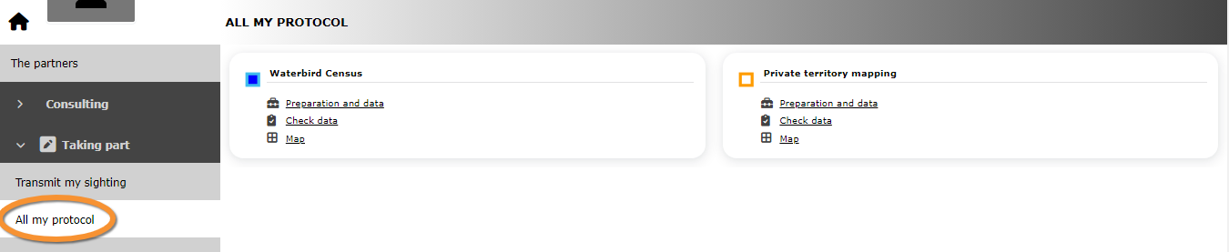


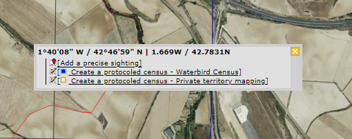
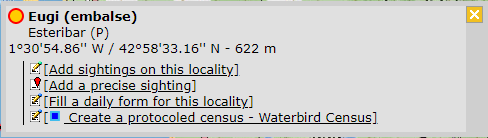


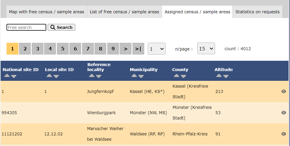


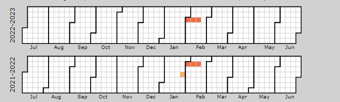
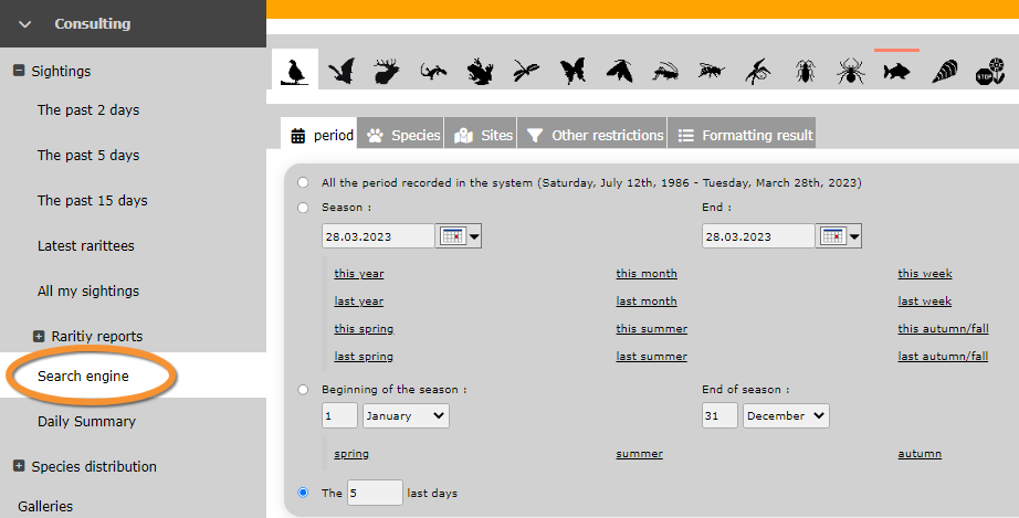


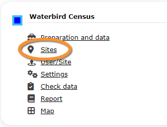


.png)